Martha’s Vineyard · the wreck mapPhoto by MV Vacation
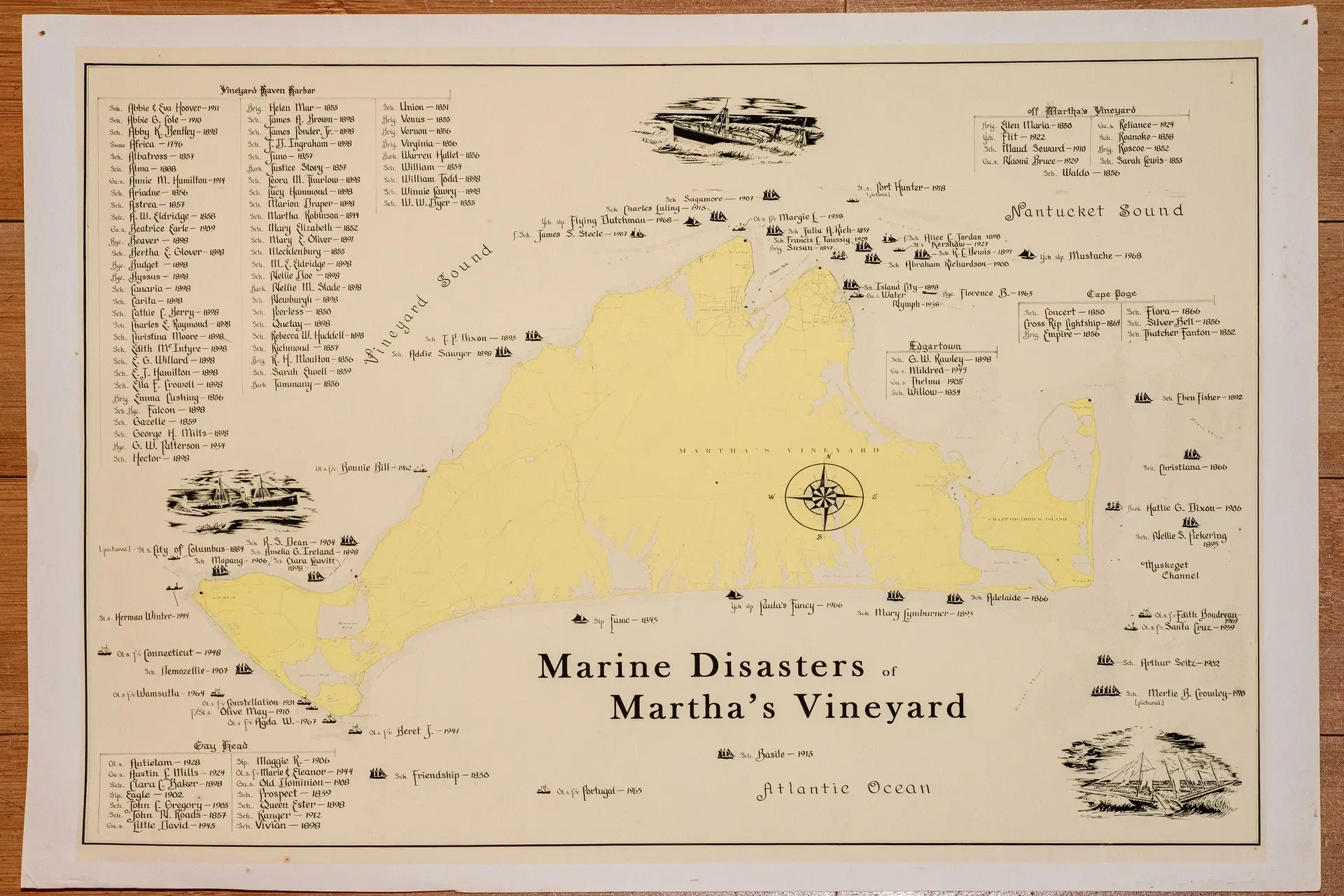
A vintage map of the wrecks around Martha’s Vineyard, each one marked with a little ship, a name and a year.
Analysis of a historic shipwreck map reveals dangerous waters around Martha's Vineyard. About 140 wrecks from 1746 to 1968 tell the story.
A vintage map titled Marine Disasters of Martha's Vineyard lists about 140 shipwrecks across more than two centuries, from 1746 to 1968. Below is everything it lists, area by area.
The map groups the wrecks by area around the island, and each entry gives the vessel's name, its type and the year it was lost.
Vineyard Haven Harbor
Schooner Abbie & Eva Hoover - 1911
Schooner Abbie G. Cole - 1910
Schooner Abby K. Bentley - 1898
Snow Africa - 1746
Schooner Albatross - 1857
Schooner Alma - 1888
Motor vessel Annie M. Hamilton - 1914
Schooner Ariadne - 1856
Schooner Astrea - 1857
Schooner A. W. Eldridge - 1858
Motor vessel Beatrice Earle - 1909
Barge Beaver - 1898
Schooner Bertha E. Glover - 1898
Barge Budget - 1898
Barge Byssus - 1898
Schooner Canaria - 1898
Schooner Carita - 1898
Schooner Cathie C. Berry - 1898
Schooner Charles E. Raymond - 1898
Schooner Christina Moore - 1898
Schooner Edith McIntyre - 1898
Schooner E. G. Willard - 1898
Schooner E. J. Hamilton - 1898
Schooner Ella F. Crowell - 1898
Brig Emma Cushing - 1856
Schooner barge Falcon - 1898
Schooner Gazelle - 1859
Schooner George H. Mills - 1898
Barge G. W. Patterson - 1934
Schooner Hector - 1898
Brig Helen Mar - 1855
Schooner James A. Brown - 1898
Schooner James Ponder Jr. - 1898
Schooner J. D. Ingraham - 1898
Schooner Juno - 1857
Bark Justice Story - 1857
Schooner Leora M. Thurlow - 1898
Schooner Lucy Hammond - 1898
Schooner Marion Draper - 1898
Schooner Martha Robinson - 1844
Schooner Mary Elizabeth - 1852
Schooner Mary E. Oliver - 1891
Schooner Mecklenburg - 1855
Schooner M. E. Eldridge - 1898
Schooner Nellie Doe - 1898
Bark Nellie M. Slade - 1898
Schooner Newburgh - 1898
Schooner Peerless - 1850
Schooner Quetay - 1898
Schooner Rebecca W. Huddell - 1898
Schooner Richmond - 1857
Brig R. H. Moulton - 1856
Schooner Sarah Elwell - 1859
Bark Tammany - 1856
Schooner Union - 1851
Brig Venus - 1855
Brig Vernon - 1856
Brig Virginia - 1856
Bark Warren Hallet - 1856
Schooner William - 1854
Schooner William Todd - 1898
Schooner Winnie Lawry - 1898
Schooner W. W. Dyer - 1853
Vineyard Sound, the Chops and Nantucket Sound
Schooner T. P. Dixon - 1895
Schooner Addie Sawyer - 1898
Fishing schooner James S. Steele - 1907
Yacht Flying Dutchman - 1968
Schooner Charles Luling - 1915
Schooner Sagamore - 1907
Fishing vessel Margie L. - 1958
Steamer Port Hunter - 1918
Schooner Julia A. Rich - 1857
Schooner Francis L. Taussig - 1929
Brig Susan - 1857
Fishing schooner Alice C. Jordan - 1898
Steamer Kershaw - 1927
Schooner R. L. Lewis - 1897
Schooner Abraham Richardson - 1900
Yacht Mustache - 1968
Schooner Island City - 1898
Motor vessel Water Nymph - 1938
Barge Florence B. - 1963
Off Martha's Vineyard
Brig Ellen Maria - 1850
Yacht Flit - 1922
Schooner Maud Seward - 1910
Motor vessel Naomi Bruce - 1929
Motor vessel Reliance - 1924
Schooner Roanoke - 1858
Brig Roscoe - 1852
Schooner Sarah Lewis - 1853
Schooner Waldo - 1856
Cape Poge
Schooner Concert - 1850
Cross Rip Lightship - 1864
Brig Empire - 1856
Schooner Flora - 1866
Schooner Silver Bell - 1856
Schooner Thatcher Fanton - 1852
Edgartown
Schooner G. W. Rawley - 1898
Motor vessel Mildred - 1944
Motor vessel Thelma - 1905
Schooner Willow - 1854
Off Chappaquiddick and Muskeget Channel
Schooner Eben Fisher - 1892
Schooner Christiana - 1866
Bark Hattie G. Dixon - 1906
Schooner Nellie S. Pickering - 1895
Fishing vessel Edith Boudreau - 1967
Fishing vessel Santa Cruz - 1959
Schooner Arthur Seitz - 1902
Schooner Mertie B. Crowley - 1910
The south shore and the Atlantic
Schooner Adelaide - 1866
Schooner Mary Lymburner - 1893
Yacht Paula's Fancy - 1966
Sloop Fame - 1845
Schooner Basile - 1913
Fishing vessel Portugal - 1965
Schooner Friendship - 1830
Off Aquinnah and Menemsha Bight
Fishing vessel Bonnie Bill - 1962
Schooner R. S. Dean - 1904
Schooner Amelia G. Ireland - 1898
Steamer City of Columbus - 1884
Schooner Mopang - 1906
Schooner Clara Leavitt - 1898
Steamer Herman Winter - 1944
Fishing vessel Connecticut - 1948
Schooner Nemozellie - 1907
Fishing vessel Wamsutta - 1964
Fishing vessel Constellation - 1931
Fishing steamer Olive May - 1910
Fishing vessel Agda W. - 1967
Fishing vessel Beret J. - 1941
Aquinnah (the map's boxed list)
Motor vessel Antietam - 1928
Motor vessel Austin L. Mills - 1924
Schooner Clara C. Baker - 1898
Sloop Eagle - 1902
Schooner John C. Gregory - 1905
Schooner John N. Roads - 1857
Motor vessel Little David - 1945
Sloop Maggie R. - 1906
Fishing vessel Marie & Eleanor - 1944
Motor vessel Old Dominion - 1908
Schooner Prospect - 1859
Schooner Queen Ester - 1898
Schooner Ranger - 1912
Schooner Vivian - 1898
What the map shows
The worst year
1898 has about 40 of the listed wrecks. Most of them went down in one storm, the Portland Gale of November 26–27, 1898, which drove a fleet of coasting schooners ashore in Vineyard Haven harbor.
Types of vessels
Schooners make up about 60 percent of the wrecks, since they did most of the coastal trading for much of this period. The rest is a mix of barks and brigs, barges, steamers, yachts and, in the 20th century, motor and fishing boats.
Seasons
Many wrecks came in the winter months, when storms were worst and visibility poorest. Rough seas, fog and poor weather forecasting made these waters dangerous to sail.
For a fall trip
The Vineyard in the Fall, free
The Derby, the beaches that open to everyone and what closes when, date by date. Free with the island letter, together with our other three island guides.
One-click unsubscribe, and we never share your email.
Notable wrecks
City of Columbus (1884)
When the SS City of Columbus struck Devil's Bridge reef, over 100 people died, one of the worst maritime disasters in Martha's Vineyard's waters. The loss led to better navigational aids and safety rules at sea.
The wider history
M.V. Museum · the Fresnel lensPhoto by MV Vacation
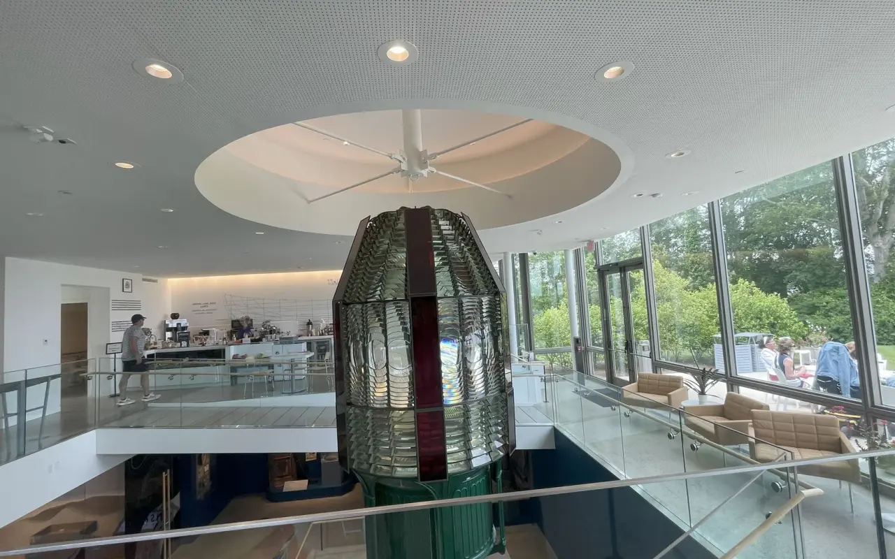
The first-order Fresnel lens that once lit the Gay Head Light now fills its own two-story pavilion at the Martha's Vineyard Museum.
These wrecks span the age of sail, the move to steam and the first decades of motor fishing boats, and the number of schooners on the list shows how much coastal trade passed the island.
Many vessels were caught by sudden changes in the weather, or by navigation errors in poorly charted water.
Losses like these pushed for better-placed lighthouses and stronger rescue services, including the Life-Saving Service stations around the island.
The wrecks today
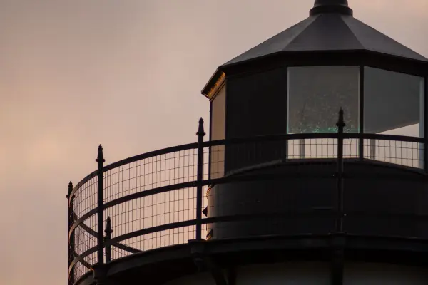
East Chop Light · duskPhoto by MV Vacation
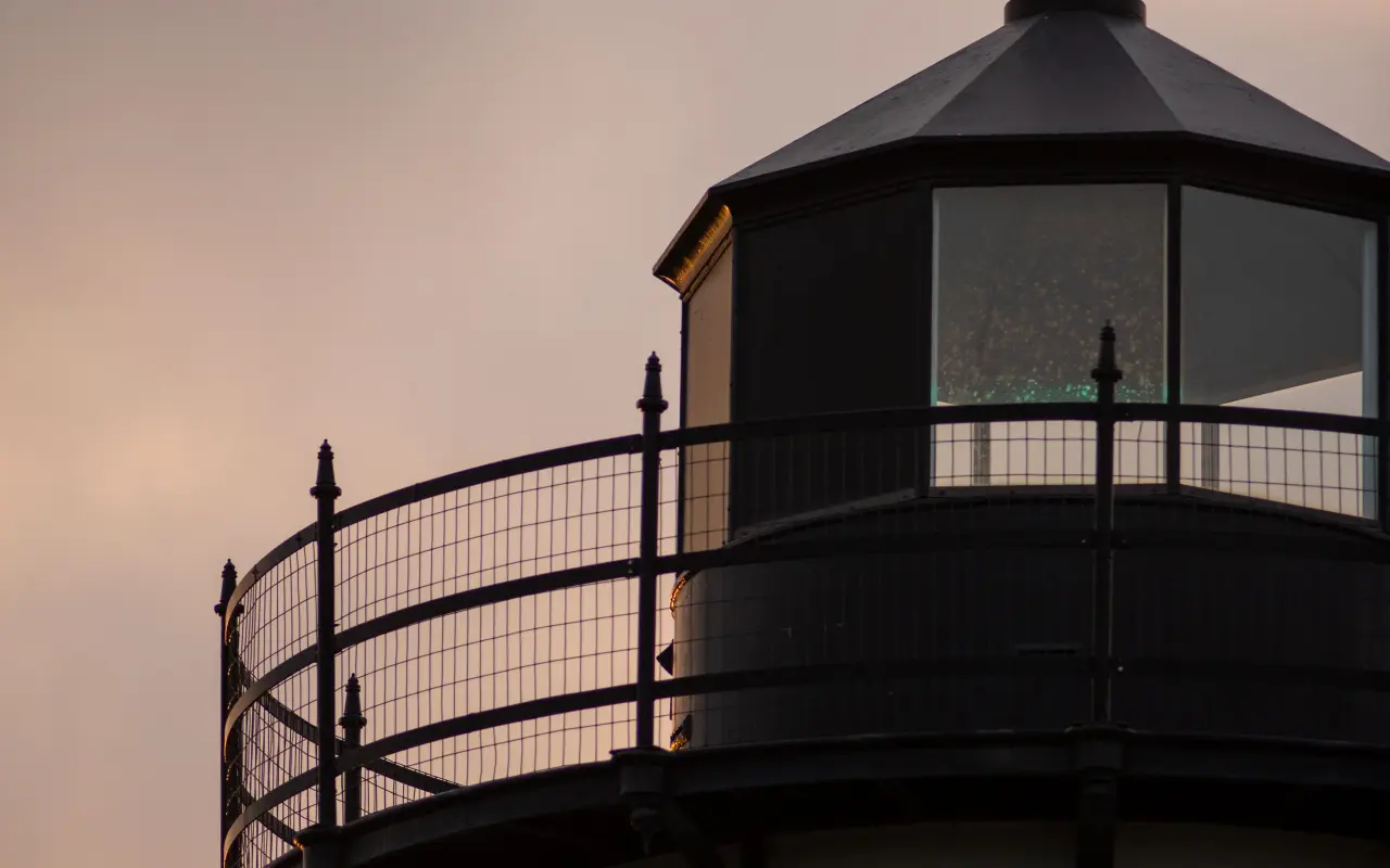
The lantern room of East Chop Light at dusk.
Today many of these wreck sites draw recreational divers and marine archaeologists.
Modern navigation has made wrecks like these rare, but the same shoals and the same weather are still out there.
Reading the map
The map is a plain record of how hard these waters were on sailing ships for more than a century: about 140 wrecks, most of them working schooners, and 1898 alone accounts for about 40 of them, most in the Portland Gale of late November.
The vintage map, titled Marine Disasters of Martha's Vineyard, lists about 140 wrecks between 1746 and 1968. It boxes them for Vineyard Haven Harbor, the waters off the island, Cape Poge, Edgartown and Aquinnah, and draws the rest where they went down around the coast.
Why did so many ships sink in 1898?
Most of the roughly 40 losses listed for that year came in one storm, the Portland Gale of November 26 and 27, 1898. It drove a fleet of coasting schooners ashore in Vineyard Haven harbor. Winter storms, fog and poor forecasting made these waters hard on sailing ships for a century.
What was the worst wreck around Martha's Vineyard?
The steamer City of Columbus in 1884. It struck Devil's Bridge reef and over 100 people died. Losses like this pushed improvements in navigation aids and rescue services, including the Life-Saving Service stations around the island.
Can I dive or see any of the wrecks today?
Many of the sites draw recreational divers and marine archaeologists, but the map is a historical record, not a dive guide. If you want to get on the water, our fishing guide covers charters and the fall Derby.
Where can I see the island's maritime history in person?
The lighthouses are the easiest stop, and they were built for exactly these waters. Our island lighthouses page lists each one with visiting details, from East Chop in Oak Bluffs to Gay Head Lighthouse in Aquinnah.
Do storms like that still hit the island?
Modern navigation has made wrecks rare, but the same shoals and the same weather are still out there. For a modern example, read our account of Hurricane Bob in 1991, a hurricane that hit the island hard.
The Beach Guide (all 20 beaches decoded), The Vineyard in the Fall, the season date by date, Where to Stay, every town and price band, and What It Really Costs, the 2026 budget line by line. All four PDFs free, plus a short island letter when there is something worth telling. No schedule, no spam.
No spam, unsubscribe in one click. Want a look first? See what you get.
First email ever from us? Give it a minute, and peek in spam once.
Disclaimer: The information in this article is provided for general guidance only and was accurate at the time of writing. Beach conditions, hours, prices, lifeguard schedules, ferry fares, and business operations change frequently and without notice. Ocean swimming carries inherent risks including rip currents, undertow, and cold water shock. Always verify current conditions with official local sources before your visit. MV Vacation assumes no responsibility for any loss, injury, or inconvenience resulting from the use of this information. Swim only where lifeguards are on duty, supervise children at all times near water, and follow all posted safety signs.
A guide to Martha's Vineyard, written on the island: beaches, dining, events and island living. We write down what we know about the island so your trip goes the way you hoped.
Joshua Slocum, first to sail alone around the world, spent his last years farming in West Tisbury and vanished from Vineyard Haven harbor in November 1909. The voyage, the farm called Fag End, the last departure, and what a visitor can actually see: the harbor, a marker stone by a country road, the museum's Slocum papers, and the book itself.
Who summered where on Martha's Vineyard, and what a visitor can actually see: Eisenstaedt's Menemsha, Benton's Chilmark, Cronkite's Edgartown harbor, Styron and Buchwald in Vineyard Haven, McCullough and Katharine Graham in West Tisbury, Belushi's grave at Abel's Hill, and the Onassis farm in Aquinnah that opened to the public in 2025. Public places named, private homes left alone.
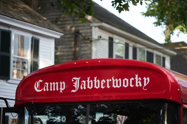
The red bus that gets the loudest cheer in the Edgartown Fourth of July parade belongs to Camp Jabberwocky, a tuition-free summer camp for people with disabilities that has run on the Vineyard since 1953. An islander's account of where it came from and what it is. For anything official, the camp's own site is the source.
The Feast of the Holy Ghost in Oak Bluffs, held every third full weekend of July since 1928: the Queen Isabel legend behind the free soup, the Sunday parade from the ferry up Circuit Avenue, the crown blessed at Our Lady Star of the Sea, the sopas at the Portuguese-American Club, the club the rest of the year, and how a visitor should behave at the island's Portuguese feast.
The words you will hear on Martha's Vineyard and what they mean: up-island and down-island, on-island and off, going to America, the boats, wash-ashore versus native, Five Corners, the Triangle, the Blinker, Chappy, OB, the Campground, the Derby, the Fair, island cars and the Vineyard shuffle, with pronunciations.
East Chop Lighthouse in Oak Bluffs: the 1878 cast-iron tower on Telegraph Hill, the Sunday sunset openings run by the Martha's Vineyard Museum, the semaphore and Chocolate Lighthouse history, and the bus stop and parking below the hill.
Island tip of the dayTimingNo. 61 of 79New tip at midnight, island time
Visit Edgartown on a Tuesday or Wednesday. Same beautiful town, maybe 30% of the weekend crowds. Most restaurants have availability without reservations.
Useful?
More on
Subscribe
The free island library · 2026
One short island letter, and all four guides to start
Beach reports, events worth a day, ferry heads-ups. Sent when there is something worth telling. The Beach Guide, The Vineyard in the Fall, Where to Stay and What It Really Costs arrive with your welcome email.
The Beach Guide, The Vineyard in the Fall, Where to Stay and What It Really Costs. No spam, one-click unsubscribe.
We use cookies for trip planning, site stats and ads, including ads based on your browsing. To opt out, turn on Global Privacy Control in your browser. Cookie policy
These cookies are essential for the website to function properly.
These cookies help us understand how visitors interact with the website.
These cookies are used to deliver personalized advertisements.