Travel advisorySteamship Authority travel advisory · Gale Warning on the ferry waters until Thu 8 AMGusty winds are forecast for Cape Cod and the Islands that will have the potential to cause cancellations on both the Hyannis-Nantucket and Woods Hole-Martha's Vineyard routes through Thursday. We are waiving change and cancellation fees for travel scheduled for Tuesday, October 20, through Thursday, October 22.Steamship Authority · checked 4:00 PM ET
By MV VacationUpdated 08 Oct, 20269 mins read 336 views
On August 19, 1991, Hurricane Bob hit Martha's Vineyard at the height of the season: 98 mph winds, 84 boats wrecked in Edgartown Harbor alone, a sloop in the Harborside Inn pool, and a false autumn by Labor Day. The story of the storm, told through an original Vineyard Gazette storm edition we found in an island thrift shop.
Thirty-five years ago, on Monday, August 19, 1991, the busiest week of the Martha's Vineyard summer stopped cold. Hurricane Bob came up the coast so fast that the island went from a gray, breezy morning to hurricane-force wind by early afternoon, and by dinner it was over: hundreds of boats ashore, the harbors unrecognizable, the trees stripped, and the lights out. Edgartown's harbormaster at the time, Charlie Blair, summed it up in a phrase islanders still repeat: "40 minutes of terror."
Bob remains, as of this writing, the most recent hurricane to make landfall in New England. Thirty-five years without another one is a long run of luck, and part of why the storm is worth remembering. This is what happened that day, told through the newspaper that covered it, from a copy we were lucky to find in a thrift shop on the island.
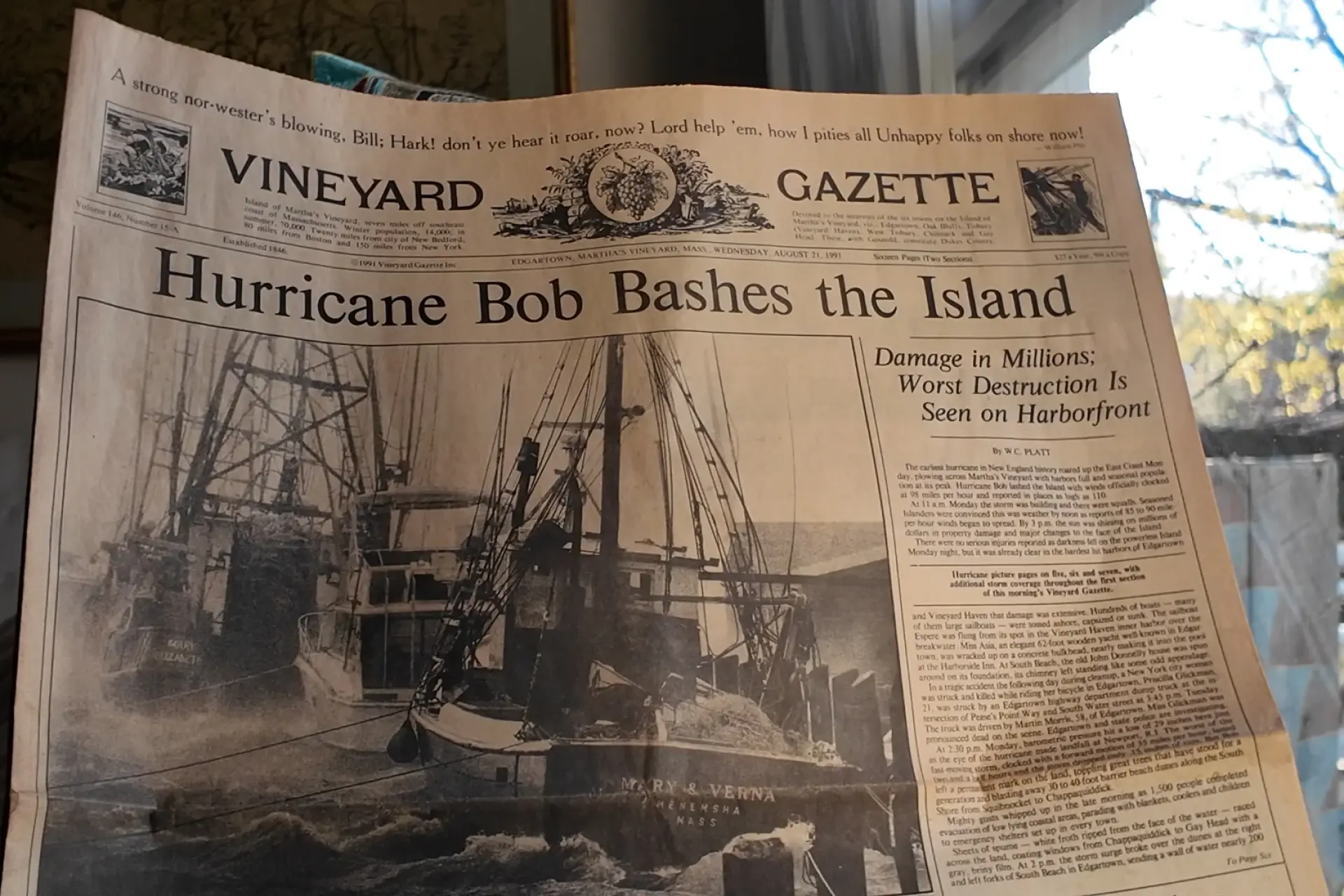
A while back we picked up an original Vineyard Gazette storm edition at the Chicken Alley thrift shop in Vineyard Haven: the morning-after paper, dated August 21, 1991, with a wrecked fishing boat filling the front page under the headline "Hurricane Bob Bashes the Island." The scans throughout this article come from that copy. Newsprint from that week is getting hard to find, and holding it makes the storm feel less like history and more like a Monday that could come around again.
A storm in a hurry
Bob formed east of the Bahamas on August 16 and was a hurricane by the 17th. At its peak early on August 19 it was a Category 3 with 115 mph winds off the Virginia coast. Then it did the thing New England storms do: it accelerated, racing northeast at around 25 mph and crossing the region before anyone had time to second-guess their preparations. The eye passed over Block Island around 1:30 PM and came ashore near Newport, Rhode Island just before 2 PM as a Category 2.
Vineyard Gazette · the trackPhoto by MV Vacation
The Gazette’s map of the track. The eye passed just west of the island, which put Martha’s Vineyard on the strong right-hand side of the storm.
That track mattered here. Martha's Vineyard sat just east of the eye, on the dangerous right-hand side where the storm's forward speed adds to its winds. The Gazette reported winds "officially clocked at 98 mph and reported in places as high as 110," and the Martha's Vineyard Times put gusts in Edgartown at 111 mph. Because Bob was moving at more than 30 mph, the worst of it was compressed into less than an hour, Blair's forty minutes. Oddly, it barely rained: Edgartown recorded only about 0.15 inches.
For a fall trip
The Vineyard in the Fall, free
The Derby, the beaches that open to everyone and what closes when, date by date. Free with the island letter, together with our other three island guides.
One-click unsubscribe, and we never share your email.
The harborfront took the worst of it
In Edgartown Harbor alone, 84 vessels were beached, sunk or capsized. A 6,000-pound mooring anchor dragged more than 300 yards across the bottom. And in the storm's most retold image, the sloop Claire ended up in the Harborside Inn's swimming pool, lifted clean out of the harbor and set down among the deck chairs. In Vineyard Haven, about 30 boats went ashore and two sank; one was thrown clear over the jetty and somehow came away with little more than scratches. Island-wide, the Gazette put it simply at "hundreds of boats."
Up-island fared better on the water. Menemsha's fishing fleet was fully secured by 9:30 that morning, and the harbor came through largely intact.
The island turned brown overnight
Edgartown · blocked roadsPhoto by MV Vacation
Fallen trees block main Edgartown roads, as the Gazette put it. Roughly a million board feet of timber came down in the state forest alone.
Away from the harbors, Bob's signature was trees. Roughly a million board feet of timber came down in Manuel Correllus State Forest, most of it white pine. About 2,400 power lines fell, four times the toll of Hurricane Gloria six years earlier, and some 15,000 customers lost power. West Tisbury had lights back in 23 hours; parts of Chilmark waited about eight days, with line crews arriving from as far away as Oklahoma.
Then came the "false autumn." Salt spray driven miles inland dried the leaves on every windward tree, and within days the north side of the island had turned, in the words of West Tisbury's Dan Waters, "brown as a grocery bag." In late August, the Vineyard looked like early November. The south-facing beaches lost up to 50 feet of shoreline, dunes from Squibnocket to Chappaquiddick were cut down, several great ponds were torn open to the sea, and along Gay Head the surf ran red from dissolving clay. At Five Corners in Vineyard Haven, the flood put two feet of water in the A&P.
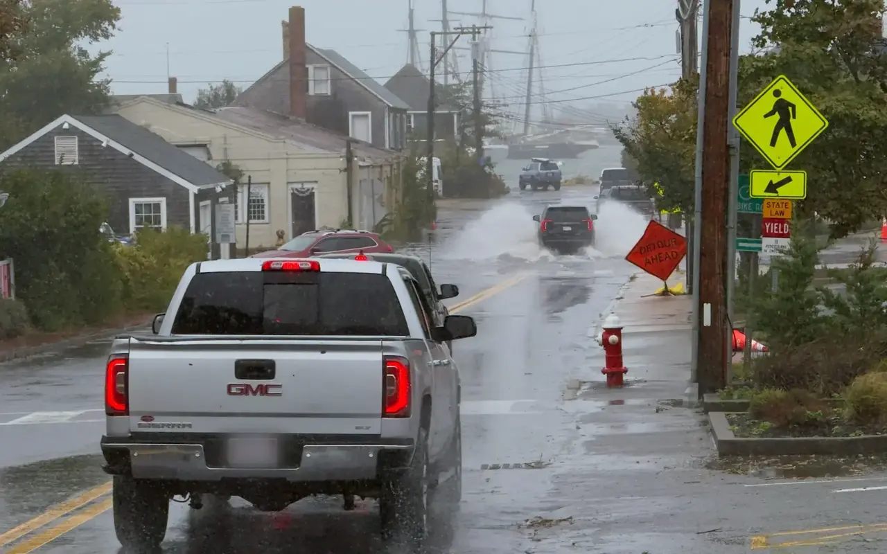
Vineyard Haven · September 26, 2026Photo by MV Vacation
Thirty-five years later the same corner still floods. Five Corners in a nor’easter with a Coastal Flood Warning: a Detour Ahead sign on the sidewalk and an SUV throwing spray on the road down to the harbor, tall ship masts in the rain behind.
No deaths here, and plenty of island humor
Vineyard Gazette · island humorPhoto by MV Vacation
Spray paint on a boarded-up storefront: Now Playing: 1. What About Bob? 2. Gone With the Wind. The Gazette captioned it a big and painful hit.
No one on Martha's Vineyard died in the storm, and there were no serious storm injuries. About 1,500 people rode it out in shelters, ferries were halted, and Edgartown banned driving from midday until the evening. The hospital's biggest post-storm problem was bee stings, ten of them by Wednesday, from yellow jackets whose nests had been torn up along with everything else.
Vineyard Haven · Kowabunga BobPhoto by MV Vacation
Kowabunga Bob, painted across the boarded windows of Crispin’s Landing on Main Street in Vineyard Haven.
Once the wind died, the graffiti showed the island's mood: "Kowabunga Bob" across a boarded storefront on Main Street in Vineyard Haven, and on another wall a mock movie marquee, Now Playing: 1. What About Bob? 2. Gone With the Wind.
With the island dark, the Gazette flew its production to Nantucket that week and printed the storm edition on the Inquirer and Mirror's press, keeping a press run then approaching a century and a half unbroken. The edition sold out all 16,000 copies and needed a reprint, and the Gazette's storm coverage went on to be named a Pulitzer Prize finalist in Spot News Reporting.
Bob across New England
Across the region, Bob caused about $1.47 billion in damage in 1991 dollars and was blamed for 18 deaths per the National Hurricane Center, with roughly 2.1 million customers losing power. The storm surge reached 12 to 15 feet at the head of Buzzards Bay, and Cape Cod took gusts up to 125 mph. On the island, the damage totaled about $5.5 million by the Gazette's accounting, a fraction of the regional bill, thanks in part to how little rain fell and how fast the storm moved. The name Bob was retired in the spring of 1992.
Vineyard Gazette · August 21, 1991Photo by MV Vacation
The Gazette’s storm edition: Hurricane Bob Bashes the Island. Damage in millions, worst destruction on the harborfront.
What Bob means for a visitor in 2026
For a late-summer trip, Bob is mostly a reminder to keep an eye on the calendar. New England's hurricane climatology peaks from late August through September, and Bob's real lesson is speed: the storm went from a weather note to a landfall in about three days. If you are here when a storm threatens, the rhythm is well practiced now: the Steamship Authority posts service changes early, harbors haul and secure boats, and the island hunkers down for an afternoon. During a late-summer visit it's worth watching the forecast and, if you can, leaving a flexible day around the ferry.
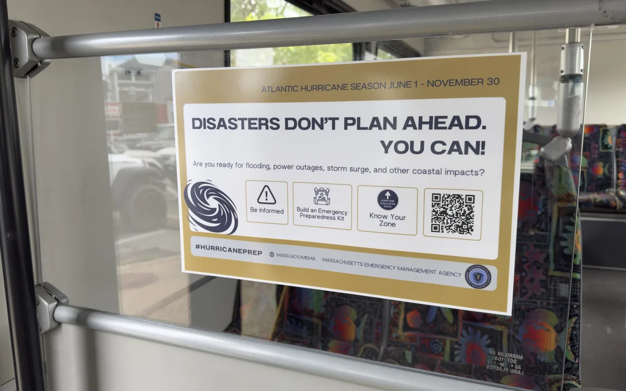
The season Bob belonged to still runs every year from June 1 to November 30, and the reminder now rides the buses. The Massachusetts Emergency Management Agency posts the same three asks on VTA buses each summer: stay informed, keep an emergency kit, and know your evacuation zone, with the details at mass.gov/mema. For a visitor the practical version is simpler: if a named storm is in the forecast for your dates, the ferries are the thing to watch, because the Steamship Authority stops sailing before the wind arrives and the island is on its own until it starts again.
Island-wide · on the busPhoto by MV Vacation
The state emergency agency rides the VTA: a MEMA poster on a Route 13 bus in September 2026, mid hurricane season, with the three things it asks of everyone on the coast.
Edgartown · after the stormPhoto by MV Vacation
From the Gazette’s coverage: a 45-foot ketch driven against the Edgartown waterfront. In that harbor alone, 84 vessels were beached, sunk or capsized.
Our September guide covers what the shoulder season looks like now, and our month-by-month weather guide has the climate numbers if you are picking dates. And if a 1991 Gazette ever turns up in an island thrift shop, it makes a better souvenir than a T-shirt.
Frequently Asked Questions
When did Hurricane Bob hit Martha’s Vineyard?
Monday, August 19, 1991, in the busiest week of the summer. The eye passed Block Island around 1:30 PM and came ashore near Newport as a Category 2 just before 2 PM; the island sat on the dangerous right-hand side of the track.
How strong was the wind?
The Vineyard Gazette reported winds officially clocked at 98 mph and as high as 110 in places; the Martha’s Vineyard Times put Edgartown gusts at 111 mph. Edgartown’s harbormaster called it “40 minutes of terror”.
Is Bob still the last New England hurricane?
As of this writing, yes: the most recent hurricane to make landfall in New England, thirty-five years and counting.
What did it do to the island?
Hundreds of boats ashore, the harbors unrecognizable, trees stripped and the lights out, all between a gray, breezy morning and dinner.
Where do the newspaper scans come from?
An original Vineyard Gazette storm edition dated August 21, 1991, found at the Chicken Alley thrift shop in Vineyard Haven, with a wrecked fishing boat on the front page under the headline “Hurricane Bob Bashes the Island”.
Island tip of the dayShoppingNo. 35 of 86New tip at midnight, island time
Single-use plastic checkout bags are banned in all six island towns (since 2017), so pack a reusable tote. Or buy one here: canvas bags from the Black Dog, Cronig's or Alley's General Store make souvenirs that keep working at home.
Useful?
More on
Four free downloads · 2026 editions
Four island guides, in your inbox
The Beach Guide (all 20 beaches decoded), The Vineyard in the Fall, the season date by date, Where to Stay, every town and price band, and What It Really Costs, the 2026 budget line by line. All four PDFs free, plus a short island letter when there is something worth telling. No schedule, no spam.
No spam, unsubscribe in one click. Want a look first? See what you get.
First email ever from us? Give it a minute, and peek in spam once.
Disclaimer: The information in this article is provided for general guidance only and was accurate at the time of writing. Beach conditions, hours, prices, lifeguard schedules, ferry fares, and business operations change frequently and without notice. Ocean swimming carries inherent risks including rip currents, undertow, and cold water shock. Always verify current conditions with official local sources before your visit. MV Vacation assumes no responsibility for any loss, injury, or inconvenience resulting from the use of this information. Swim only where lifeguards are on duty, supervise children at all times near water, and follow all posted safety signs.
A guide to Martha's Vineyard, written on the island: beaches, dining, events and island living. We write down what we know about the island so your trip goes the way you hoped.
Joshua Slocum, first to sail alone around the world, spent his last years farming in West Tisbury and vanished from Vineyard Haven harbor in November 1909. The voyage, the farm called Fag End, the last departure, and what a visitor can actually see: the harbor, a marker stone by a country road, the museum's Slocum papers, and the book itself.
Who summered where on Martha's Vineyard, and what a visitor can actually see: Eisenstaedt's Menemsha, Benton's Chilmark, Cronkite's Edgartown harbor, Styron and Buchwald in Vineyard Haven, McCullough and Katharine Graham in West Tisbury, Belushi's grave at Abel's Hill, and the Onassis farm in Aquinnah that opened to the public in 2025. Public places named, private homes left alone.
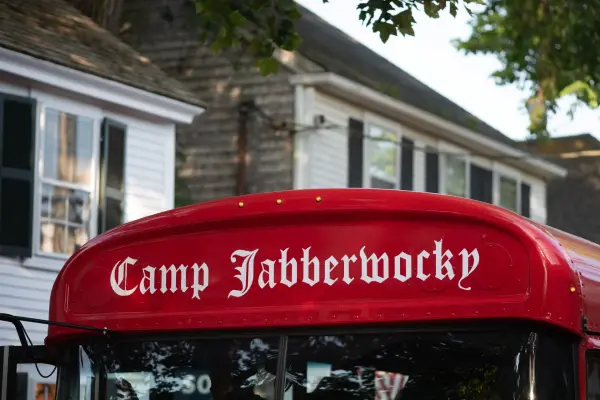
The red bus that gets the loudest cheer in the Edgartown Fourth of July parade belongs to Camp Jabberwocky, a tuition-free summer camp for people with disabilities that has run on the Vineyard since 1953. An islander's account of where it came from and what it is. For anything official, the camp's own site is the source.
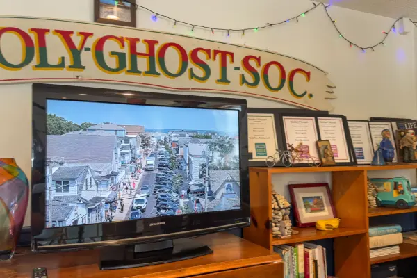
The Feast of the Holy Ghost in Oak Bluffs, held every third full weekend of July since 1928: the Queen Isabel legend behind the free soup, the Sunday parade from the ferry up Circuit Avenue, the crown blessed at Our Lady Star of the Sea, the sopas at the Portuguese-American Club, the club the rest of the year, and how a visitor should behave at the island's Portuguese feast.
The words you will hear on Martha's Vineyard and what they mean: up-island and down-island, on-island and off, going to America, the boats, wash-ashore versus native, Five Corners, the Triangle, the Blinker, Chappy, OB, the Campground, the Derby, the Fair, island cars and the Vineyard shuffle, with pronunciations.
East Chop Lighthouse in Oak Bluffs: the 1878 cast-iron tower on Telegraph Hill, the Sunday sunset openings run by the Martha's Vineyard Museum, the semaphore and Chocolate Lighthouse history, and the bus stop and parking below the hill.
Subscribe
The free island library · 2026
One short island letter, and all four guides to start
Beach reports, events worth a day, ferry heads-ups. Sent when there is something worth telling. The Beach Guide, The Vineyard in the Fall, Where to Stay and What It Really Costs arrive with your welcome email.
The Beach Guide, The Vineyard in the Fall, Where to Stay and What It Really Costs. No spam, one-click unsubscribe.
We use cookies for trip planning, site stats and ads, including ads based on your browsing. To opt out, turn on Global Privacy Control in your browser. Cookie policy
These cookies are essential for the website to function properly.
These cookies help us understand how visitors interact with the website.
These cookies are used to deliver personalized advertisements.