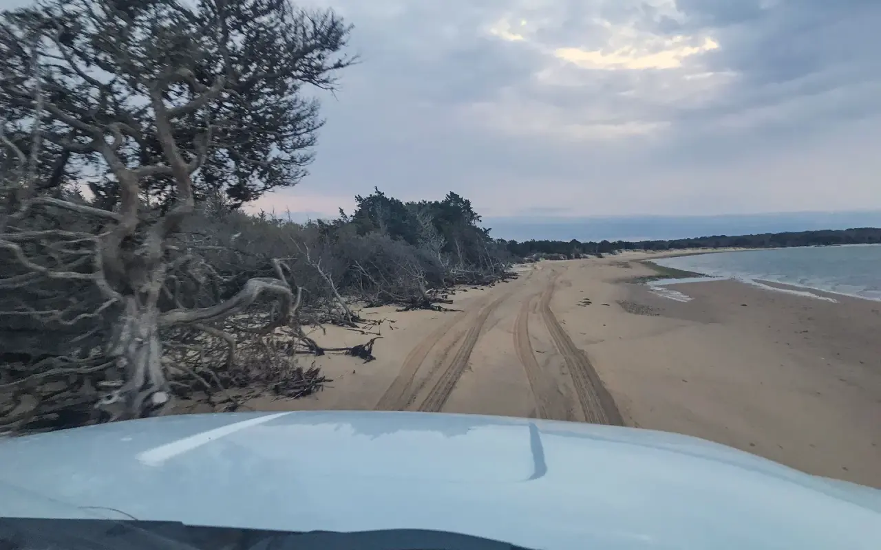
Two and a half miles of barrier beach running east from South Beach toward Chappaquiddick, with the Atlantic on one side, Katama Bay on the other, and a sand road down the middle for anyone with a permit and the right tires.
Plate 01
Norton Point Beach is the barrier strand that ties Katama to Chappaquiddick, or used to: it begins where South Beach ends at the Left Fork and runs east about two and a half miles toward Wasque, a ribbon of sand between the open Atlantic and the sheltered water of Katama Bay. It is the island’s over-sand beach, the one you drive onto, and on foot it is the emptiest sand within a bus ride of Edgartown.
This guide was written and photographed by MV Vacation, from over-sand days in a truck and a good many more walking out from the Left Fork.
The beach belongs to Dukes County and has been managed by the Town of Edgartown since April 2023, which is why the permits, the rules and the closure notices all come from the Edgartown Parks Department and not from the Trustees, who run the Chappaquiddick beaches next door. Since January 1, 2026 the two have not been connected: a winter storm broke through the barrier and the point is a point again.
Know Before You Go
Before you go in the water
None anywhere on Norton Point. The guarded stands are on the main stretch of South Beach in season; if you want to swim in surf, swim there, between the stands.
This is open Atlantic with a shorebreak and a drop-off past the bar. Big days mean rip currents. If one catches you, float, drift and swim parallel to the shore, then angle back in rather than fighting it.
Where the barrier broke through on January 1, 2026 the tide rips through the cut with real force. Swimming near the opening on a moving tide is dangerous, and children are safest well back from it.
On August 31, 2026 a swimmer off Norton Point was bitten on the lower leg, the first confirmed unprovoked shark bite in the island’s history; the state’s shark biologist put it down to a sandbar shark, and the injury was not life-threatening. Swimming was suspended for a few hours. The Sharktivity app and the flags at South Beach are worth a look before you go in.
Finding Norton Point
Getting there
How to reach the beach
04 WAYSFree. Take Katama Road south from Edgartown and keep left at the fork; the town lot at the end is free, no sticker, and Norton Point starts where the last lifeguard stand ends. Walk east as far as you like.
The Katama bus runs from Edgartown to the beach in season, and every VTA ride is fare-free through June 30, 2027. Get off at South Beach and walk east.
A flat, paved path runs from Edgartown out to Katama and the beach lots. Lock the bike at the lot; the beach is sand from there.
Four-wheel drive only, tires aired down to 15 psi, a 15 mph limit on the sand, and a shovel, tow rope and low-pressure gauge aboard. Season permits were last published at $90 for Edgartown residents and $140 for everyone else, with day permits at $30 and $60; the town sells them through its online portal and posts the current prices there. A Norton Point permit is not a Trustees permit, and the Trustees permit for Cape Poge and Wasque does not cover Norton Point.
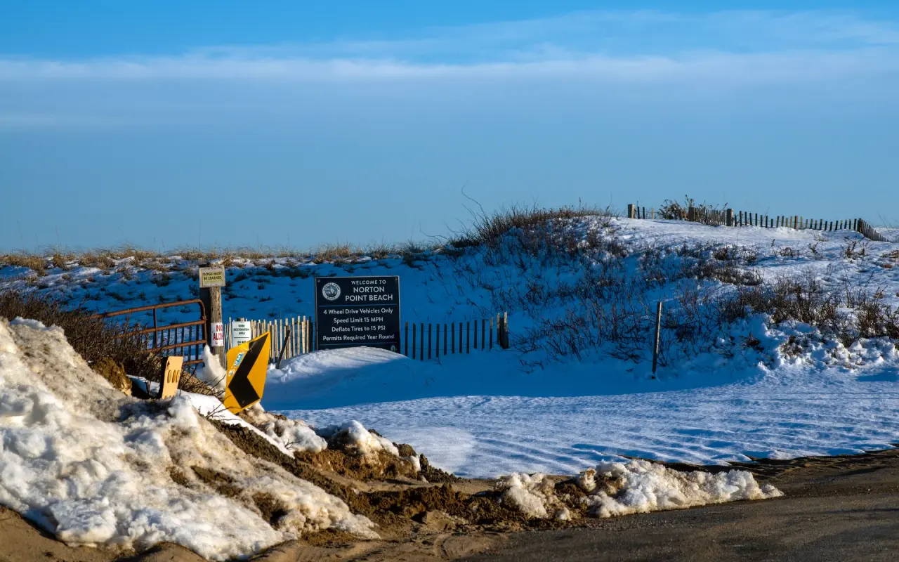
The Norton Point gate in February 2026, a month after the breach: snow on the dunes, the rules board still up, and the beach closed to vehicles for the winter.
Closures
When the beach shuts, as of September 2026
Nesting closures from spring into late summer can shut whole sections of the beach to vehicles, and sometimes to walkers near the nests. In 2025 the over-sand route stayed closed for nesting well into August. The Edgartown Parks Department posts the day’s status; check before you air down.
You cannot drive through to Chappaquiddick. The cut that opened on January 1, 2026 measured about 500 feet when it formed, and the last one, in 2007, took eight years to close. Wasque is reached only from the Chappy side now.
Over-sand access can close in winter and in bad weather; walkers can use the beach year-round.
The beach itself
Walk east from the Left Fork and the crowd thins within five minutes. The ocean side is the same golden sand and the same surf as South Beach, with a steeper shorebreak in places and a bar that drops off into deeper water; the bay side, a short walk across the barrier, is Katama Bay, shallow and calm, with the oyster farms and the moorings of Edgartown in the distance. In summer the over-sand traffic sets up along the ocean side in a long line of trucks with tailgates down and rods in the holders; on foot you simply keep walking past them until the last truck is behind you.
The point is one of the island’s classic surfcasting spots, and during the Derby in September and October the line of trucks runs from first light to well after dark. It is also one of the beaches where the Second World War still surfaces: South Beach, Norton Point and Wasque were a military machine-gun and bombing range, and ordnance still works its way out of the sand after storms. If you see something metal and old, leave it, back away, and call 911.
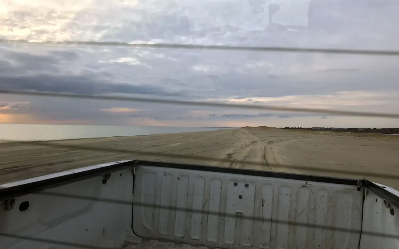
Looking back over the pickup bed at the tire tracks, with the water off to one side and a low, cloudy sky over the sand.
On the sand
What the beach is good for
04 WAYSTwo and a half miles of Atlantic beach with almost nobody on it once the trucks are behind you. Bring water; there is nothing out there.
Bass and bluefish work the bar and the cut, and the Derby regulars know every foot of it. The fishing guide covers seasons and licenses.
Park on the sand, set up beside the truck, move along when you like. You will need aired-down tires and recovery gear.
Katama Bay is shallow, warm and calm, the opposite of the ocean side a hundred yards away. Good for small children and for watching the working boats.
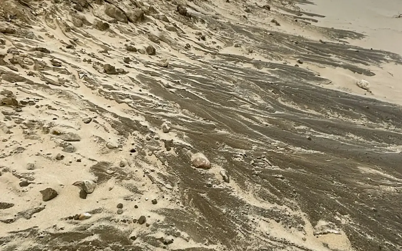
The eroding dune face at the east end of South Beach, where the lifeguard stands stop and Norton Point starts.
Field notes
Tips for visiting Norton Point
Nesting closures, the state of the breach and the over-sand route all change week to week. The Edgartown Parks Department posts updates; look before you drive out.
The Left Fork lot fills early on July and August weekends. Arriving early helps, or come by bike (or by bus to the main South Beach stop) and walk east.
No food, water, shade or restrooms on Norton Point itself; the facilities are back at South Beach. Carry in, carry out.
Under the posted beach rules dogs are banned April 1 through August 31, banned from 9 to 5 in the first half of September, and allowed on a leash the rest of the year. South Beach proper bans dogs entirely.
No alcohol and no camping. A charcoal grill is allowed under the posted rules if it is fully extinguished and the coals are buried; open fires are not. Littering carries a fine.
Questions
Questions about Norton Point Beach
Do you need a permit to go to Norton Point?
Only to drive on it. Walking in from the South Beach lots is free, and the lots are free too, with no sticker required.
Can I drive across to Chappaquiddick?
Not since January 1, 2026. The barrier beach breached that day and the cut is still open; Wasque and Cape Poge are reached only from the Chappy side, on the On Time ferry.
Where do I buy the over-sand permit?
From the Town of Edgartown, which has managed the beach for Dukes County since 2023, through the town’s online permit portal. It is a separate permit from the Trustees over-sand permit for the Chappaquiddick beaches.
Are there lifeguards?
No. The nearest guarded water is the main stretch of South Beach, from mid-June to Labor Day. Norton Point is swim-at-your-own-risk, and the shorebreak and drop-off are real.
Can I swim on the bay side?
Yes, and it is the calm option: Katama Bay is shallow and sheltered. Stay well away from the breach, where the tide runs hard through the cut.
The Record
Fun facts about Norton Point
Katama and Edgartown on film
-
 4th of July Parade Edgartown, Martha's Vineyard
 -
 Edgartown Martha's Vineyard Walking Tour
 -
 Vineyard Haven to Edgartown Bus Ride, Martha's Vineyard
 -
 Exploring Martha's Vineyard Bike Trails, Edgartown Bike Ride
 -
 Edgartown Lighthouse Martha's Vineyard
 -
 Bicycle Ride Edgartown to Vineyard Haven Martha's Vineyard
Free download · 2026 edition
The Martha’s Vineyard Beach Guide
Every one of the island’s 20 beaches (parking, stickers, dog rules, lifeguards and safety) in a ten-page guide you can keep on your phone, with a printable cheat sheet and a phone field card inside. Checked for the 2026 season.
It lands in your inbox too, with one useful island letter now and then. Unsubscribe in one click.