Travel advisorySteamship Authority travel advisory · Gale Warning on the ferry waters until Fri 2 PMGusty winds are forecast for Cape Cod and the Islands that will have the potential to cause cancellations on both the Hyannis-Nantucket and Woods Hole-Martha's Vineyard routes through Thursday. We are waiving change and cancellation fees for travel scheduled for Tuesday, October 20, through Thursday, October 22.Steamship Authority · checked 12:00 AM ET
By MV VacationUpdated 21 Oct, 2026Facts checked Aug 28, 202612 mins read 1,840 views
Aquinnah · the cliff facePhoto by MV Vacation
A hundred million years of clay, sand and lignite in one wall. The colors shift with the light and the season.
Aquinnah Cliffs: 100-million-year-old clay formations, Gay Head Lighthouse, Moshup Beach, and Wampanoag heritage on MV.
The Aquinnah Cliffs rise about 100 feet above the Atlantic at Martha's Vineyard's western tip, a mile-long wall of multicolored clay. They have been sacred to the Wampanoag people for at least 10,000 years, became a National Natural Landmark in 1965, and have Gay Head Light, the island's first lighthouse, on the crest. For a broader look at the town itself, see our Aquinnah town guide.
Filmed January 2025The island moves on: shops, signs and prices may differ from what you see here. The text of this guide was checked October 2026.
Filmed March 2022The island moves on: shops, signs and prices may differ from what you see here. The text of this guide was checked October 2026.
The cliffs formed in two stages. The first came in the Late Cretaceous period, roughly 100 to 65 million years ago, when this area was a subtropical river delta emptying into the young Atlantic. Layer upon layer of clay, sand, and gravel accumulated in coastal-plain environments: beaches, estuaries, marshes, and lagoons. Miocene greensand layers (5–23 million years old) settled on top later, in a shallow sea.
The second stage came with the Wisconsinan glaciation about 21,000 years ago. The Laurentide ice sheet advanced to its southernmost extent along what is now Martha's Vineyard and Nantucket, pushing the buried Cretaceous sediments forward and upward. Some layers now stand nearly vertical, tilted about 80 degrees. The cliffs sit on the island's terminal moraine, the ridge left at the glacier's farthest reach. The same geological system runs along the south shore to the cliffs at Lucy Vincent Beach in Chilmark.
Each color comes from a mineral. Red and maroon are iron oxide (hematite), orange and brown are limonite and goethite, and the white bands are kaolin clay. The black streaks are lignite, a low-grade coal that holds 90-million-year-old charcoal from ancient conifer forests. The green layers are glauconite, an iron potassium mineral that makes up the Miocene greensand, and the purple likely comes from iron oxide mixtures in different oxidation states. Fossils found here include camel teeth, megalodon shark teeth, and whale bones.
Waves and groundwater seepage wear the cliffs back about 1.8 to 2 feet a year. Climbing the cliffs or taking clay is illegal, and Wampanoag Conservation Rangers enforce the ban.
The clay was an economy before it was a view. Nineteenth-century New England potters wanted Vineyard clay for its stoneware-grade clay, and Gay Head families dug it and carried it by boat to the mainland kilns; in 1893 the town, incorporated in 1870, leased the cliffs to the Gay Head Clay Company for 500 dollars a year to feed brickworks. Tourists did the rest. Alfred Eisenstaedt, who photographed the cliffs every August from 1937, wrote in 1980 that most of the red clay he had known in the 1960s had either fallen into the sea or grassed over, and that a good part of the damage was people climbing and digging; he was known to shout at children with shovels. The ban on climbing and taking clay that the Tribe and the town enforce today grew out of that damage.
Aquinnah · the overlookPhoto by MV Vacation
The panel at the overlook: the cliffs are a National Natural Landmark, and the sign explains the layers you are looking at.
The legend of Moshup
In Wampanoag tradition, the cliffs belong to the story of Moshup (also spelled Maushop), the giant who is the central figure of the Tribe's oldest stories. The Tribe's own telling describes Moshup as "a benevolent being of gigantic frame and supernatural power" who created Martha's Vineyard itself. Weary from a journey across the mainland, Moshup dragged his foot heavily through the mud, and the ocean slowly widened the track until it separated the island from the mainland.
From a den near the Aquinnah Cliffs, Moshup would wade into the ocean, seize a whale, and fling it against the cliffs to kill it before cooking it over a perpetual fire. "The blood from these whales stained the clay banks of the Cliffs dark red," the Tribe recounts. To reach whales in deeper water, Moshup threw stones into the sea, and those stones became the underwater reef known as Devil's Bridge, where many ships have wrecked. He also created Nantucket by emptying his pipe ashes into the ocean. Moshup Beach, at the base of the cliffs, is named for him. The Tribe has staged the Legends of Moshup pageant on tribal land in recent summers; check the Tribe's calendar for the current year.
For beach days
The Beach Guide, free
All 20 beaches with parking, stickers, lifeguards and dog rules, plus a one-page card for the beach bag. Free with the island letter, together with three more island guides.
One-click unsubscribe, and we never share your email.
From Gay Head to Aquinnah
The town changed its name from Gay Head to Aquinnah at the annual town meeting in May 1997, by a vote of 79 to 76. (An earlier attempt in 1991 had failed 89-36.) The Massachusetts legislature passed enabling legislation, and Acting Governor Paul Cellucci signed it into law in May 1998. Wampanoag leader Carl Widdiss led the effort and cited "the importance of retaining the town's Native American heritage."
"Aquinnah" is the original Wampanoag name. It is often translated as "land under the hill", the hill believed to be Peaked Hill in Chilmark; the Tribe's own list of place names gives "the shore or end of the island". "Gay Head" was the name English colonists gave the headland in the 1600s for the bright ("gay") colors of the cliffs. The lighthouse is still officially "Gay Head Light" on the National Register of Historic Places, and the Tribe's federal name is the Wampanoag Tribe of Gay Head (Aquinnah), federally recognized in 1987, one of only two federally recognized Wampanoag tribes. Today the Tribe cares for 477 acres of its ancestral lands, including the cliffs. The Tribe has about 1,570 members (2025); in its 2019 count, 319 of its then 1,364 enrolled citizens lived on the island.
Gay Head Lighthouse
The lighthouse goes back to 1799, when an octagonal wooden tower went up under a contract approved by President John Adams. It was the first lighthouse on Martha's Vineyard. The current 51-foot brick tower was finished in 1856 by contractor Caleb King, with brick made from local clay, from the cliffs or the nearby Chilmark brickworks. A First-Order Fresnel lens from France was installed with 1,008 hand-made crystal prisms. The lens came out in 1952 and is now at the Martha's Vineyard Museum in Vineyard Haven.
In May 2015 the lighthouse was moved about 130 feet inland over three days, after erosion brought the cliff edge too close. The $3–3.5 million project was managed by International Chimney Corporation. The Town of Aquinnah took ownership of the lighthouse from the federal government in February 2015.
A $1.4 million restoration, paid for mostly by offshore wind company Ørsted (~$1 million), a state tourism grant, and Community Preservation Act funds, ran from November 2024 to June 2025. A new LED beacon was installed, bringing back the historic flash pattern of three whites followed by a red (set in 1874). The tower opened for the 2026 season on Memorial Day weekend, with four-day weekends until June 29 and then daily through Labor Day weekend, 10 AM–4 PM. After Labor Day it stayed open on Friday-to-Monday weekends through Indigenous Peoples' Day, October 12, and it is now closed until the 2027 season. Admission is $6 (ages 13+), free for children 12 and under, veterans and Aquinnah residents.
Offshore · horizonPhoto by MV Vacation
Offshore wind turbines on the horizon at sunset, in the waters south of the island.
Moshup Beach and practical tips
Aquinnah · at the overlookPhoto by MV Vacation
The Gay Head Clay Cliffs sign on the path at dusk. The beach below is a walk down from Moshup Trail.
A 10-minute walk down a sandy dune path from the parking lot brings you to Moshup Beach, which runs along the shore beneath the cliffs. There are no lifeguards, and the beach faces southwest into strong surf and currents, so it suits confident ocean swimmers. Portable restrooms sit at the beach entrance. Our photo spots guide covers the light at the cliffs and the rules on the face.
The section closer to the cliffs (to the right when facing the water) has a longstanding clothing-optional tradition. A posted sign reads "Beyond this point you may encounter nude sunbathing." Aquinnah's town bylaws ban public nudity (a fine of up to $50), even though nude sunbathing at that end has been tolerated for decades.
The short-term parking spaces at Aquinnah Circle, by the overlook and the shops, are free with a 90-minute limit, enforced in season. For the beach, the Moshup Beach lot charges about $35 a day (credit card only, no cash). It's small and fills early on summer weekends. Aquinnah residents can buy seasonal permits, and the town can confirm current rates at (508) 645-2300.
To see the whole multicolored face from below, you have to walk down to the beach; the clifftop overlook shows the cliffs from a distance. Near sunset the west-facing cliffs turn gold.
Aquinnah · Moshup BeachPhoto by MV Vacation
From the sand below, the whole face of the cliffs is in front of you, boulders at the tide line and Gay Head Light on the crest.
Clifftop shops, food and the cultural center
The 10–15 businesses at Aquinnah Circle are almost all Wampanoag family-owned and sit on town-leased land. Cliffhangers is the main food spot, serving lobster rolls, clam chowder and ice cream. The gift shops include Stony Creek Gifts (85+ years, wampum jewelry), Hatmarcha Gifts (handmade beadwork), and several others selling Native crafts. Shops open in May and many stay open through October, usually closing between 4 and 5 PM.
The Aquinnah Shop Restaurant, on the clifftop since 1948, has been closed since about 2022. In 2023, the Native Land Conservancy purchased the property for $2 million to return it to Wampanoag ownership. No confirmed reopening as of 2026.
On the way to the cliffs you will pass the old Orange Peel Bakery ClosedClosed for good in September 2026 (22 State Road), which Wampanoag baker Juli Vanderhoop ran for twenty years, with its wood-fired oven, Thursday pizza nights and honor-system shelves. It closed for good in late September 2026; she has said she hopes to come back with something new.
The Aquinnah Cultural Center at the Edwin D. Vanderhoop Homestead (35 Aquinnah Circle, built in the 1890s) has exhibits on Wampanoag history, guided walking tours and art installations. Open for the 2026 season June 16 to October 11, Tuesday through Sunday 11 AM–4 PM; admission $10 adults, $8 seniors and students, $6 ages 7–17, free under 7 and for tribal members. Closed September 12 and 13 for the Powwow. When it's closed, the Heritage Exhibit Kiosk outside has information.
Getting to Aquinnah
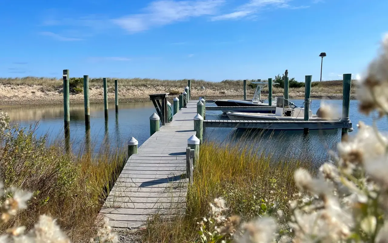
Aquinnah · a small dockPhoto by MV Vacation
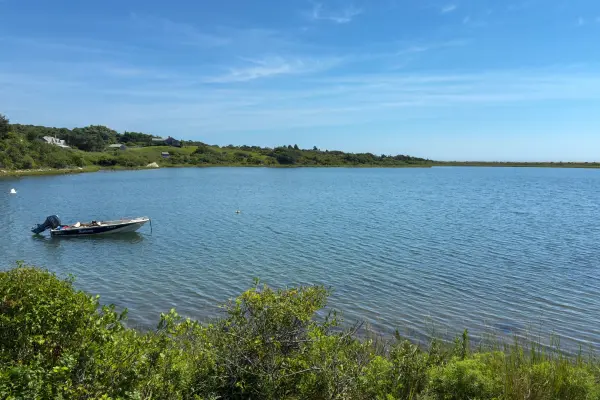
A small wooden dock in Aquinnah, two skiffs tied up by the marsh with the dunes behind.
VTA Bus Route #5 (via South Road through West Tisbury and Chilmark) reaches the cliffs about once an hour in summer and every two hours from October 4 to April 15, and it's free to ride through June 30, 2027 under the fare-free initiative. From Vineyard Haven the trip takes about an hour: in summer you change buses at West Tisbury, and off-season the Route 3 bus carries straight on as Route 5. Check the VTA schedule for current times.
By car it's about 18 miles (35 to 40 minutes) from Vineyard Haven, about 20 miles (35–40 minutes) from Oak Bluffs and about 19 miles (30–40 minutes) from Edgartown. Moshup Trail runs along the coast near Aquinnah.
Biking there is hard work: 17 hilly miles from Vineyard Haven on narrow roads with no bike path, so it's a ride for fit cyclists. Many people take the bus up and bike back, which is mostly downhill. See our bike routes guide for details.
Most visitors spend 1–2 hours at the cliffs for the overlook, shops and lighthouse, or half a day with time on the beach. See our complete Jaws filming locations guide.
ABC
Gay Head Light · three more viewsPlate 05
A: the light at dusk from the road below; B: the brick tower up close in low sun; C: the light on its rise above the road and the houses below it.
The short-term spaces at Aquinnah Circle, by the overlook, are free with a 90-minute limit in season, enough for the view, the shops and a snack. The Moshup Beach lot charges $35 a day by card only, no cash, and fills early on summer weekends.
Can I get there by bus?
Yes. VTA Route 5 reaches the cliffs about once an hour in summer and every two hours from October 4 to April 15, and it is fare-free through June 30, 2027. From Vineyard Haven the trip takes about an hour, with a change at West Tisbury in summer (off-season the same bus carries on). On the off-season timetable the last bus off the cliffs leaves at 6:05 PM, so check the current timetable before you linger. Our VTA schedule has the times.
Can I climb the cliffs or take some clay?
No. The cliffs are a National Natural Landmark on tribal land, and climbing or removing clay is illegal, enforced by Wampanoag Conservation Rangers. They already lose about 2 feet a year to erosion. The best close-up view is from Moshup Beach, a 10-minute walk down the dune path from the lot.
Can I go inside the Gay Head Lighthouse?
Yes, in season. The tower opened for the 2026 season on Memorial Day weekend, after a restoration finished in June 2025. It was open 10 AM to 4 PM, on four-day weekends until June 29, daily through Labor Day weekend, and then on Friday-to-Monday weekends until Indigenous Peoples' Day, October 12. It is now closed until the 2027 season. Admission is $6 for ages 13 and up, free for kids 12 and under, veterans and Aquinnah residents.
How long should I plan for, and when is the best time?
Most visitors spend 1 to 2 hours on the overlook, shops and lighthouse, or a half day with beach time. Many people come for sunset, when the west-facing cliffs glow. Shops at Aquinnah Circle open in May, many stay open through October, and most close between 4 and 5 PM, so eat early.
Is Moshup Beach safe for swimming?
For confident ocean swimmers. There are no lifeguards, and the beach faces southwest into strong surf and currents. The stretch nearer the cliffs has a longstanding clothing-optional tradition, marked by a sign, so families may want to stay to the left. Our beach guide lists calmer options.
Book Martha’s Vineyard Experiences
See the clay cliffs and beyond on a guided up-island sightseeing tour. Browse all tours →
If you book through this link we may earn a small commission, at no extra cost to you. It helps keep our guides free.
Island tip of the dayTimingNo. 58 of 79New tip at midnight, island time
Oak Bluffs restaurants are packed 6–8 PM. Eat at 5 PM or after 8:30 PM: same food, half the wait, easier parking.
Useful?
More on
Four free downloads · 2026 editions
Four island guides, in your inbox
The Beach Guide (all 20 beaches decoded), The Vineyard in the Fall, the season date by date, Where to Stay, every town and price band, and What It Really Costs, the 2026 budget line by line. All four PDFs free, plus a short island letter when there is something worth telling. No schedule, no spam.
No spam, unsubscribe in one click. Want a look first? See what you get.
First email ever from us? Give it a minute, and peek in spam once.
Disclaimer: The information in this article is provided for general guidance only and was accurate at the time of writing. Beach conditions, hours, prices, lifeguard schedules, ferry fares, and business operations change frequently and without notice. Ocean swimming carries inherent risks including rip currents, undertow, and cold water shock. Always verify current conditions with official local sources before your visit. MV Vacation assumes no responsibility for any loss, injury, or inconvenience resulting from the use of this information. Swim only where lifeguards are on duty, supervise children at all times near water, and follow all posted safety signs.
A guide to Martha's Vineyard, written on the island: beaches, dining, events and island living. We write down what we know about the island so your trip goes the way you hoped.
Shellfishing on Martha's Vineyard town by town: what each of the six towns charges a visitor for a permit and what it covers, where to buy it, weekly limits and sizes, the 2026 to 2027 bay scallop dates published so far, how to check storm and rain closures, and keeping the catch safe to eat.
Martha's Vineyard's ponds explained: the great ponds sealed behind the south-shore beach and cut open to the sea by an excavator, the salt ponds with tides and scallops, the freshwater kettle ponds, why cyanobacteria blooms turn some of them green in August and what MV Cyano's colors mean, the nitrogen under the houses, and where a visitor can swim, paddle and watch the cut.
Where Martha's Vineyard's oysters, bay scallops and quahogs come from: the public solar hatchery on Lagoon Pond that turned fifty in 2026, the dozen oyster farms in Katama Bay, Menemsha Pond and Vineyard Sound, the wild beds in the great ponds, the autumn scallop season and its limits, visitor shellfish permits by town, why rain closes a pond, and where to eat them.
Mytoi, the Japanese garden on Chappaquiddick: how to get there on the Chappy ferry, the 15-car lot, hours and admission by season, the pond and bridge, birch walk and camellia dell, the story of Hugh Jones, Mary Wakeman and the rebuild after Hurricane Bob, rules, accessibility and when to go.
Felix Neck Wildlife Sanctuary in Edgartown: the four easy trails and what each passes, the ospreys, the butterfly garden, hours and admission, Mass Audubon's kayak tours and prices, accessibility, the Wampanoag and Smith-farm history, and when to go.
The Gay Head Cliffs are sacred Wampanoag land, not just a viewpoint. What visitors are welcome to in Aquinnah, what the rules protect, and how to be a good guest.
Subscribe
The free island library · 2026
One short island letter, and all four guides to start
Beach reports, events worth a day, ferry heads-ups. Sent when there is something worth telling. The Beach Guide, The Vineyard in the Fall, Where to Stay and What It Really Costs arrive with your welcome email.
The Beach Guide, The Vineyard in the Fall, Where to Stay and What It Really Costs. No spam, one-click unsubscribe.
We use cookies for trip planning, site stats and ads, including ads based on your browsing. To opt out, turn on Global Privacy Control in your browser. Cookie policy
These cookies are essential for the website to function properly.
These cookies help us understand how visitors interact with the website.
These cookies are used to deliver personalized advertisements.