By MV VacationUpdated 13 Oct, 20269 mins read 1,487 views
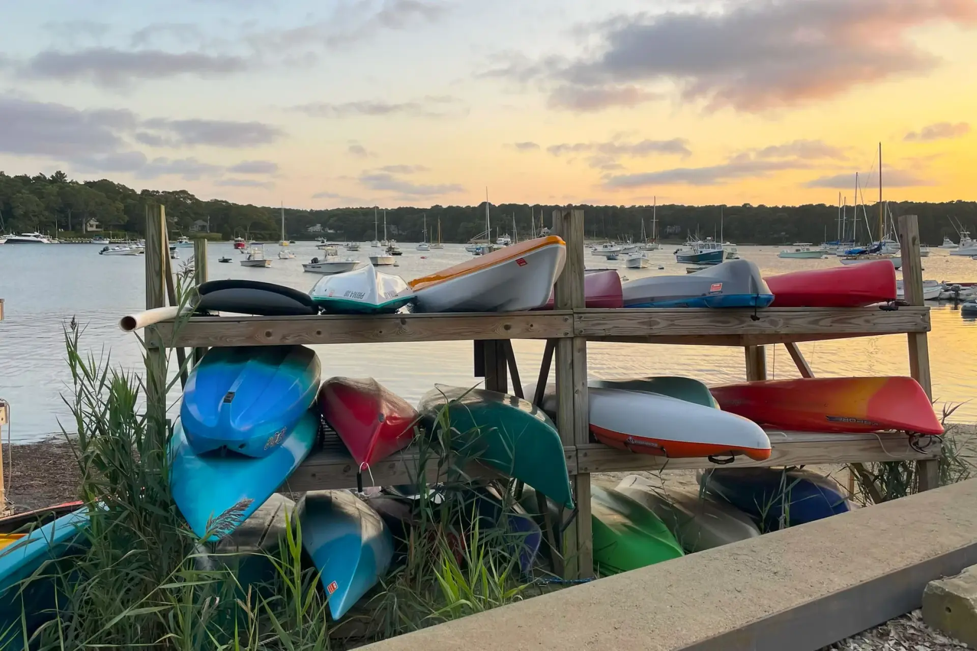
Lake Tashmoo · the kayak rackPhoto by MV Vacation
Kayaks stacked by Lake Tashmoo at golden hour, with moored boats scattered across the lake behind them.
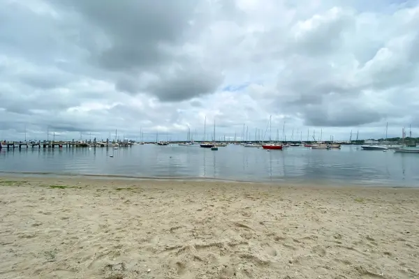
Lake Tashmoo Town Beach in Vineyard Haven sits where a tidal saltwater lake meets Vineyard Sound. Warm shallows on one side, the Sound on the other, free parking and sunsets.
Lake Tashmoo Town Beach is a small, white-sand barrier beach at the northern tip of Vineyard Haven where the brackish waters of Lake Tashmoo flow through a jetty-lined channel into Vineyard Sound, so you can swim on either side of the channel: warm, shallow pond water that suits small children on one, cooler and clearer Sound water with small waves on the other. Parking is free with no permit in a small town lot that fills early, and the rough dirt access road keeps most visitors away. Fodor's, the Vineyard Gazette and the MV Chamber of Commerce all list it among the island's best sunset spots.
Filmed April 2024The island moves on: shops, signs and prices may differ from what you see here. The text of this guide was checked October 2026.
Despite the name, Lake Tashmoo is a 269-acre tidal saltwater estuary. It was fresh until 1938, when the Great New England Hurricane tore open the barrier beach and let the sea in. In the early 1940s the inlet was dredged and the stone jetties built (the town dates the work to 1942), creating the permanent channel that exists today; it silts in constantly and was dredged again in the winter of 2025 to 2026. The name "Tashmoo" comes from the Wampanoag word Kuttashimmoo, meaning "great spring," referring to Tashmoo Spring at the lake's southern head, which fed Martha's Vineyard's first public water supply (1887 pumping station, now on the National Register of Historic Places). Tisbury’s beach regulations prohibit swimming or diving in the channel: the tide runs hard between the jetties, and the county’s own beach list calls the currents there “quite strong.” The beach on either side of the cut is the place to swim.
Fishing at Tashmoo Inlet
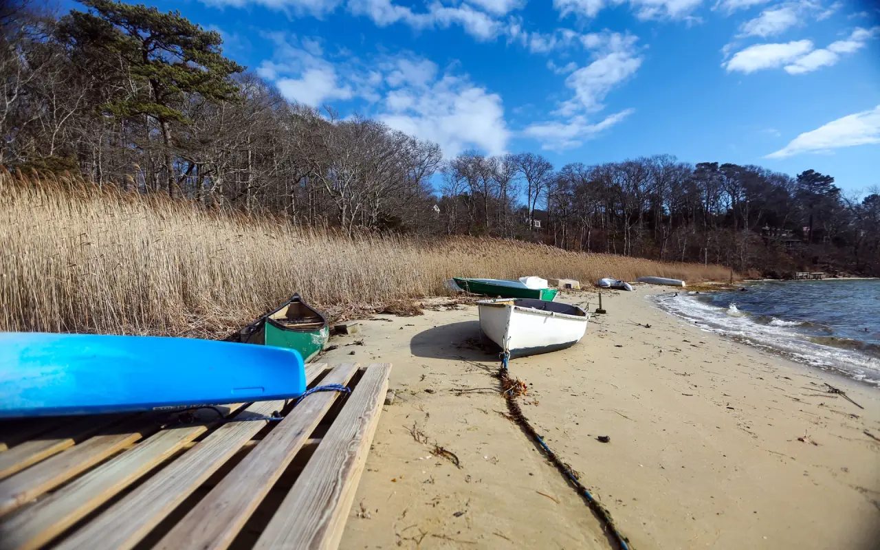
Tashmoo · out on the waterPhoto by MV Vacation
Dinghies and a kayak pulled up on the shore of Lake Tashmoo out of season, with the reeds gone tan and the trees bare.
The Wampanoag name for the channel area, Ashappaquonsett, means "where the nets are spread", and it still fits. The inlet is a well-known shore-fishing spot: striped bass spring through fall (ask about the mid-May "worm hatch"), bluefish in summer, Atlantic bonito from late July and false albacore from mid-September. The jetty fills with anglers during the annual Martha's Vineyard Striped Bass and Bluefish Derby (five weeks, mid-September through mid-October). A herring run fish ladder (installed 2001) gives the fish passage April through June, though taking river herring has been prohibited under a Massachusetts moratorium since 2005. A MA saltwater fishing permit ($10/year, ages 16+) is required.
For beach days
The Beach Guide, free
All 20 beaches with parking, stickers, lifeguards and dog rules, plus a one-page card for the beach bag. Free with the island letter, together with three more island guides.
One-click unsubscribe, and we never share your email.
Boats, kayaks and Lake Street Landing
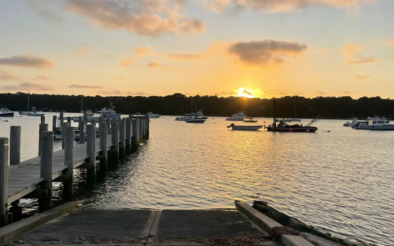
Lake Tashmoo · Lake Street LandingPhoto by MV Vacation
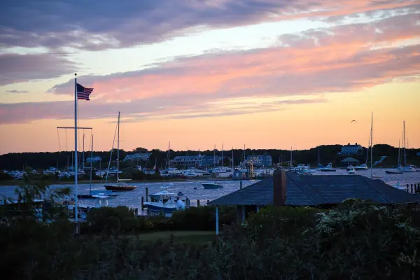
The town boat ramp and dock at the foot of Lake Street at sunset, with the mooring field beyond. Boats go in here rather than at the beach.
Most of the boats you see on the water launched at Lake Street Landing, the town’s ramp, dock and parking area at the foot of Lake Street on the lake’s east shore, about a mile from downtown Vineyard Haven. Tisbury runs it for power and sailboaters, kayakers, shellfishermen, commercial fishers and charter boats, and rebuilt it in 2018 with a new ramp, a steel bulkhead and a pier raised a foot for sea level. The 2026 town fee schedule lists no launch fee. The dock rules keep boats moving: 20 minutes on the ramp side for active launching, 15-minute tie-ups, no fuel, no launch service, porta-potties on shore. The town keeps a few public rowing dinghies at the floating docks, and kayaks left on the three-tier rack need a Natural Resources Department sticker ($25 a season if you do not hold a mooring). Harbormaster: (508) 696-4249.
The whole lake is no-wake. Anchoring has been banned everywhere in Lake Tashmoo since March 2023 to protect the eelgrass, so it is moorings only; the town sells a handful of transient moorings at $70 a night through Dockwa, and there is a long waiting list for private ones. Windsurfing and kiteboarding are prohibited on the lake. The entrance channel shifts and carries about five feet of water; anything drawing more should come and go near high tide.
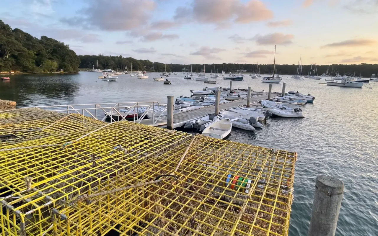
Lake Tashmoo · the dinghy docksPhoto by MV Vacation
Lobster pots stacked on the pier and the floating dinghy docks, with the mooring field filling the lake behind. Working boats and pleasure boats share the same landing.
The lake is good kayak and paddleboard water. You can launch at Lake Street Landing or carry in from the town beach lot at the end of Herring Creek Road (boats may sit on the bare sand for the day, nothing stays overnight); you can also land at the spillway below the Tashmoo Overlook. The 269 acres take about two hours to circle at an easy pace, the water is sheltered and rarely rough, and local paddlers stay well south of the jetties, because the tide through the cut is the one real hazard on the pond. Wind’s Up in Vineyard Haven rents kayaks and boards. This is boat water more than swimming water: the shore is mostly marsh and mooring field, and on a July afternoon you will see far more hulls than bathers.
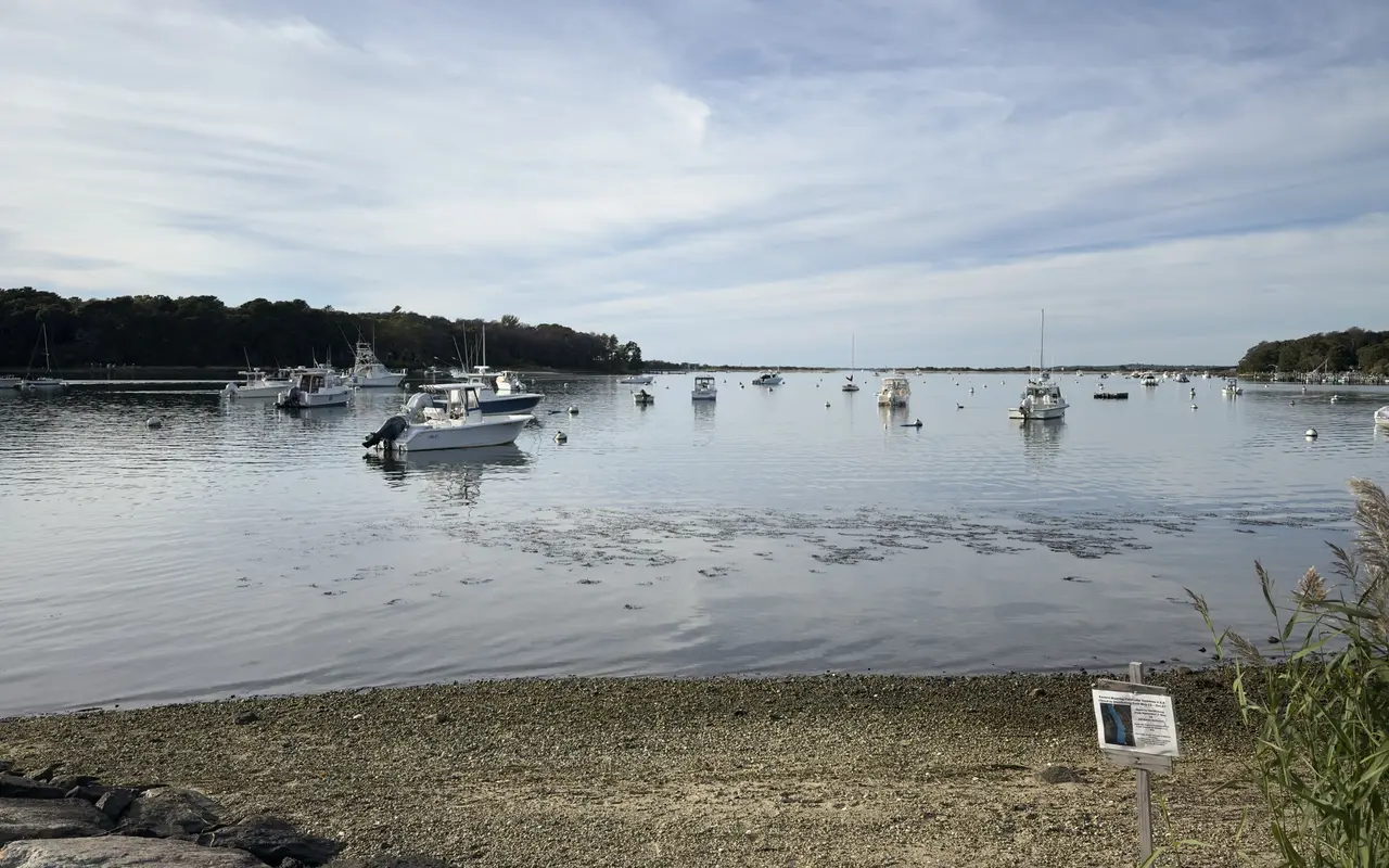
Tashmoo is also a working shellfish pond. A Tisbury recreational permit costs residents $40 a year; visitors can buy one for a week ($25), two weeks ($50) or a month ($75), good for quahogs and steamers only, from the Natural Resources office at Owen Park or online. Hand digging and raking only, no dredging anywhere in Tashmoo. The mooring field at the south end, off the Lake Street landing, is closed to shellfishing every year from May 15 to October 31 and open from November 1 to May 14, and the town posts a map of the closed area on the beach there. In the eelgrass, watch for the small invasive clinging jellyfish first confirmed here in 2018; water shoes help, and the grass beds are best left unwaded.
Lake Tashmoo · the mooring fieldPhoto by MV Vacation
The mooring field off the Lake Street landing on a still afternoon. The notice on the beach marks the part of the lake closed to shellfishing from May 15 to October 31.
Getting there and parking
From the Vineyard Haven ferry terminal: roughly 2 miles, 5–10 minutes by car via Franklin Street to Daggett Avenue to Herring Creek Road. That last mile is a narrow, one-lane dirt road, so take it slowly and pull over for oncoming cars; a bike or an SUV handles it better than a sedan. The free town lot is small and fills by mid-morning in July and August, and the Land Bank counts illegal parking along Herring Creek Road among the town’s complaints, so the lot is the only good option. In July 2026 the town chained the lot shut for two weeks while a piping plover chick fledged in it. There is no other parking; Herring Creek Road is a dead end. Biking from downtown is flat and under 2 miles, though the dirt surface favors hybrids over road bikes. VTA Route 10A stops at Daggett Avenue but that still leaves a one-mile walk.
The Tashmoo Overlook
A separate destination on State Road toward West Tisbury, the Tashmoo Overlook is a formal pull-off looking across a broad meadow to boats on the lake, through to Vineyard Sound, with the mainland as a backdrop. Next to it are the restored Tashmoo Spring Building (rented for events, $300–$850), an outdoor amphitheater with summer performances, and trails down to the dam. A former Tisbury selectman called it one of "three great views on the Island."
Before you go
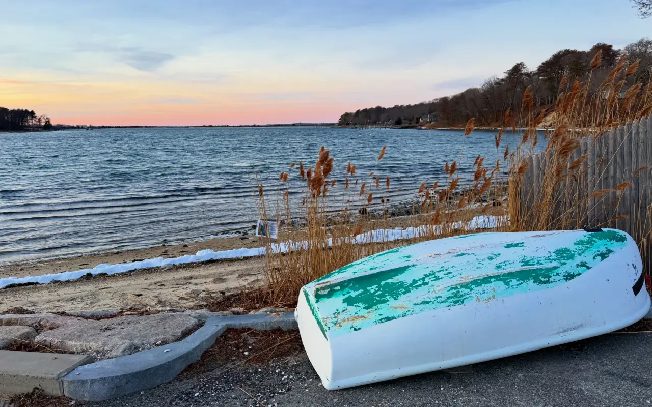
Lake Tashmoo · off-seasonPhoto by MV Vacation
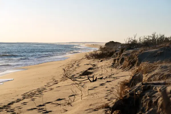
The Lake Tashmoo shore in winter: an overturned dinghy, beach grass and not another soul around.
Facilities are minimal: a lifeguard in the summer months (the town does not publish dates), no restrooms at the beach itself (the porta-potties are at Lake Street Landing), no showers or concessions. Dogs are not permitted on Tisbury beaches during posted hours in season, and the Land Bank preserves either side of the beach ban them from April through September. After heavy rain the state’s weekly bacteria tests can close the beach and the cut for a day or two, as they did twice in August 2026; the state beach dashboard has the live status. The beach faces north-northwest, but in summer the sun sets far enough north that you get the sunset from the sand. Vineyard Sound water runs about 68–76°F in July and August and is still mild in September, and the shallow lake side is usually warmer. Nearby: Cedar Tree Neck Sanctuary (10–15 min), kayaking on the lake (see the landing section above), the Land Bank’s Tashmoo Preserve next to the beach and Wilfrid’s Pond Preserve a few hundred yards up Herring Creek Road (670 feet of Sound beach, a handful of parking spaces, no dogs April to September), and farm stands along State Road including North Tisbury Farm and Bakehouse Farm. Back in town: the Black Dog Tavern is a short drive away, about 2.5 miles by road.
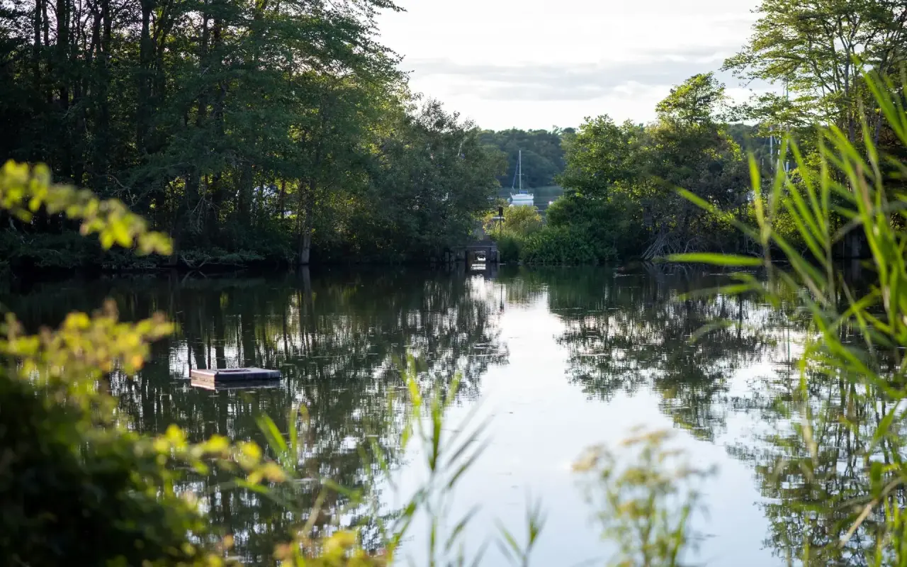
Vineyard Haven · Lake TashmooPhoto by MV Vacation
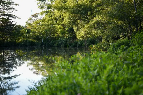
The reedy head of the lake: still water, a small float and the trees reflected from bank to bank.
No, a 269-acre tidal saltwater estuary. It was fresh until the 1938 hurricane tore open the barrier beach; the inlet was dredged and the stone jetties built in the early 1940s, and the channel silts in constantly (dredged again in the winter of 2025 to 2026).
Can I swim in the channel?
No. Tisbury’s beach regulations prohibit swimming or diving in the channel, and the tide runs hard between the jetties. The beach on either side is for swimming: warm shallow lake water on one side, cooler, clearer Sound water with minimal waves on the other.
Does parking cost anything?
No. The small town lot is free with no permit, but it fills early, and the rough dirt access road keeps most visitors away.
What does Tashmoo mean?
From the Wampanoag Kuttashimmoo, “great spring”, for Tashmoo Spring at the lake’s southern head, which fed the island’s first public water supply through an 1887 pumping station now on the National Register.
Is the fishing good?
The inlet is a well-known shore spot: striped bass from spring to fall (ask about the mid-May worm hatch), bluefish in summer and Atlantic bonito. The Wampanoag name for the channel meant “where the nets are spread”.
Island tip of the dayBeachesNo. 30 of 86New tip at midnight, island time
Owen Park Beach in Vineyard Haven is 2 minutes from the SSA ferry: calm harbor water, playground, dock. Perfect for a last-morning swim before departure.
Useful?
More on
Four free downloads · 2026 editions
Four island guides, in your inbox
The Beach Guide (all 20 beaches decoded), The Vineyard in the Fall, the season date by date, Where to Stay, every town and price band, and What It Really Costs, the 2026 budget line by line. All four PDFs free, plus a short island letter when there is something worth telling. No schedule, no spam.
No spam, unsubscribe in one click. Want a look first? See what you get.
First email ever from us? Give it a minute, and peek in spam once.
Disclaimer: The information in this article is provided for general guidance only and was accurate at the time of writing. Beach conditions, hours, prices, lifeguard schedules, ferry fares, and business operations change frequently and without notice. Ocean swimming carries inherent risks including rip currents, undertow, and cold water shock. Always verify current conditions with official local sources before your visit. MV Vacation assumes no responsibility for any loss, injury, or inconvenience resulting from the use of this information. Swim only where lifeguards are on duty, supervise children at all times near water, and follow all posted safety signs.
A guide to Martha's Vineyard, written on the island: beaches, dining, events and island living. We write down what we know about the island so your trip goes the way you hoped.
Joshua Slocum, first to sail alone around the world, spent his last years farming in West Tisbury and vanished from Vineyard Haven harbor in November 1909. The voyage, the farm called Fag End, the last departure, and what a visitor can actually see: the harbor, a marker stone by a country road, the museum's Slocum papers, and the book itself.
The red bus that gets the loudest cheer in the Edgartown Fourth of July parade belongs to Camp Jabberwocky, a tuition-free summer camp for people with disabilities that has run on the Vineyard since 1953. An islander's account of where it came from and what it is. For anything official, the camp's own site is the source.
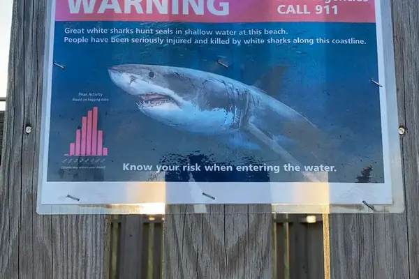
Rip currents, tidal channels, sharks, bacteria closures, wartime ordnance and cold water: the Martha's Vineyard beach safety guide, with the 2026 incidents (the Long Point drowning, the Norton Point possible shark bite, the Lucy Vincent sighting), which beaches have lifeguards and when they leave, how to escape a rip, and where the hospital is.
Lake Tashmoo in Vineyard Haven hides a century of stories: the 1887 waterworks that watered the town, a golf course where a bull was a hazard, town baseball and the frozen winters when islanders raced ice boats.
Complete guide to all 20 Martha's Vineyard beaches: parking costs, lifeguard schedules, dog rules, swimming safety, sticker requirements, and ADA access.
Subscribe
The free island library · 2026
One short island letter, and all four guides to start
Beach reports, events worth a day, ferry heads-ups. Sent when there is something worth telling. The Beach Guide, The Vineyard in the Fall, Where to Stay and What It Really Costs arrive with your welcome email.
The Beach Guide, The Vineyard in the Fall, Where to Stay and What It Really Costs. No spam, one-click unsubscribe.
We use cookies for trip planning, site stats and ads, including ads based on your browsing. To opt out, turn on Global Privacy Control in your browser. Cookie policy
These cookies are essential for the website to function properly.
These cookies help us understand how visitors interact with the website.
These cookies are used to deliver personalized advertisements.