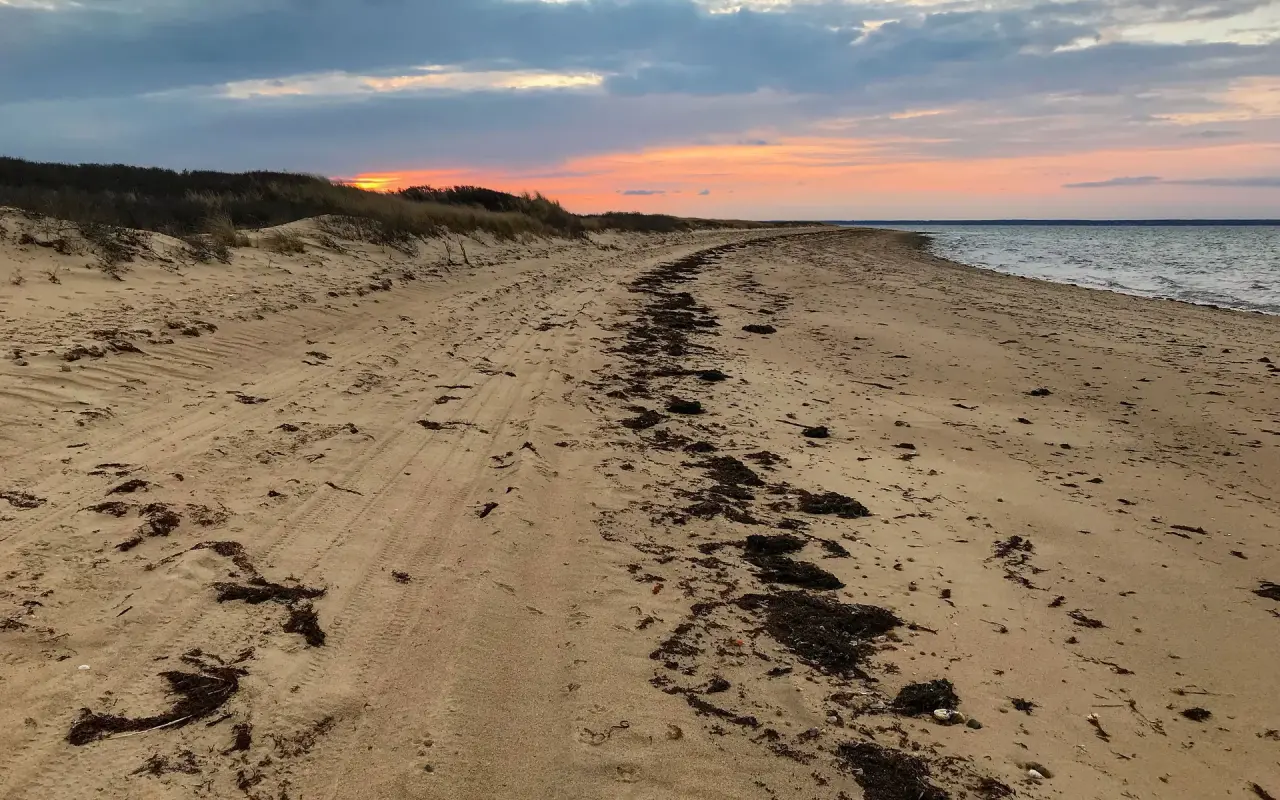
The far end of Chappaquiddick, reached by the three-car ferry and a wooden bridge, or over the sand with a permit. Seven miles of barrier beach, usually with very few people on it.
Plate 01
Wasque (say WAY-skwee) and Cape Poge are the two Trustees of Reservations properties that between them hold most of the shoreline of Chappaquiddick: Wasque Point at the southeastern corner, where strong, shifting currents run off the point, and the long barrier strand of East Beach running north from Dike Bridge to the Cape Poge lighthouse. Together they are the wildest stretch of sand on Martha’s Vineyard, and the emptiest.
This guide was written and photographed by MV Vacation, from years of Chappy ferry crossings, a few over-sand days and many more on foot.
Getting here takes some effort. You cross Edgartown Harbor on the On Time ferry, drive or ride the length of Chappy, and then either park at a Trustees gate and walk, or air down a four-wheel-drive and take the sand with a permit.
Know Before You Go
Before you go in the water
Strong, shifting currents run off the point, and the Trustees warn against swimming there. Fishing and walking the point are fine; swimming there is not.
None anywhere on the Trustees beaches. East Beach is open Atlantic with a shorebreak; it is safest to swim near other people and to stay out on big days.
Sections of beach close from spring into summer for nesting plovers and terns, and the over-sand route closes with them. Erosion has already closed the over-sand route to Wasque Point itself. The Trustees site is worth a look the morning you go.
Finding Wasque and Cape Poge
Getting there
How to reach the beaches
05 WAYSThree cars at a time, a couple of minutes across, running continuously in season. On foot or by bike you usually go straight on; cars wait in July and August.
Chappaquiddick Road to School Road to Wasque Road, roughly four miles from the ferry. A Trustees gatehouse and a small lot at the end. Day parking is $25 for non-members and $15 for Trustees household members, charged from Memorial Day weekend through Indigenous Peoples’ Day weekend between 9 and 5; Contributing members and library day-pass holders park free.
Dike Road runs to Dike Bridge, the wooden bridge over to the barrier beach. A Trustees gate stands at the bridge, and East Beach starts on the other side. There is no parking fee here: a free town lot of about twenty cars sits on the town side of the bridge, with a second small lot at Mytoi on Dike Road.
Walk or cycle in and there is no charge at either gate. Bikes stay at the gate; the beaches are sand from there.
Four-wheel-drive only, tires aired down, recovery gear aboard, and a Trustees over-sand permit for the season. Season permits ran $250 for Cape Poge and Wasque and $380 for the all-over permit for the 2025 to 2026 permit year, a Trustees membership included in the price; there is no day permit, and the current prices are on the Trustees site. Over-sand access to Wasque Point itself is closed because of erosion.
 A
A  B
B 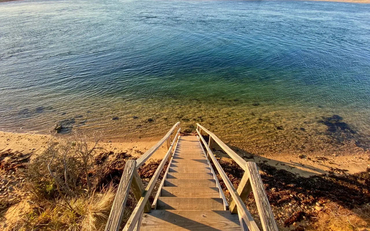 C
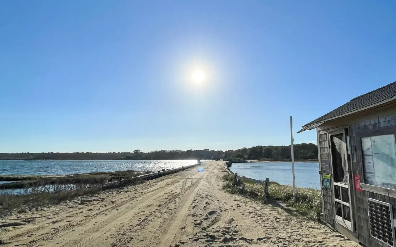
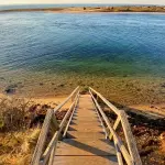
C A: the track past the Trustees gatehouse, Dike Bridge a sliver ahead; B: the Army Corps board at Cape Poge warning about old munitions from the Little Neck bomb target site; C: the steps down to the water on the bay side.
Permits
The over-sand permits, as of September 2026
In August 2026 the Massachusetts Land Court ruled that the Trustees’ sale of public over-sand permits goes beyond the 1891 easement they hold on Chappy. On September 28, 2026 the judge added a preliminary injunction: permit holders can no longer drive the trails north of Division Lot 1, the stretch through private land toward the Cape Poge Light, while the case goes on. That stretch can still be reached on foot or by boat. The trial is set for March 2027, so if you plan on buying a season permit, check the Trustees site first for where things stand.
The two properties
Wasque is the corner. About two hundred acres of heath and bluff end at Wasque Point, where the beach faces south into open Atlantic and the rip off the point makes it a well-known surfcasting spot and a dangerous place to swim. The beach here has come and gone dramatically in living memory: after Norton Point breached in 2007 the point eroded by hundreds of feet, then rebuilt itself when the breach closed in 2015 and Chappy joined Katama again. Another breach opened in December 2022, and on January 1, 2026 Norton Point broke through once more. A short trail loops the bluff; the parking lot sits at the top of it.
Cape Poge Wildlife Refuge is the long thin arm north of Dike Bridge: more than five hundred acres of barrier beach, dunes, cedar and salt marsh wrapping around Cape Poge Bay to the lighthouse at the tip. East Beach is its ocean side, the sand most people mean when they say they went to the beach on Chappy. The Cape Poge Light, a wooden tower built in 1893, the fourth on the site since 1801 and moved back from the eroding bluff four times since, the last time by helicopter in 1987, stands at the far end; the Trustees run guided tours to it in season by over-sand vehicle, and it is a long walk otherwise. Ospreys nest on the platforms, and the refuge is one of the island’s most important shorebird grounds, which is why parts of it close each spring.
On the sand
What the beaches are good for
04 WAYSAfter twenty minutes of walking on East Beach you often have the Atlantic to yourself. Water is worth bringing; there is nothing out there.
Bass and bluefish in the rip off the point, and the Derby crowd knows it. The fishing guide covers seasons and licenses.
Park on the sand, set up beside the truck, move on when you like. This is why people buy the permit.
The only way most people see Cape Poge Light up close is the Trustees’ over-sand tour from the Mytoi lot; check their ticket calendar in season.
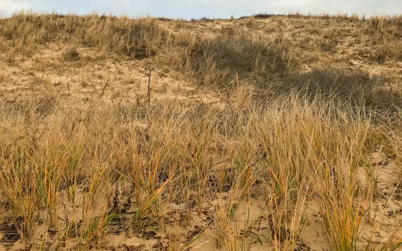
Beach grass on the East Beach dunes, holding the sand between the bay and the Atlantic.
Field notes
Tips for visiting Wasque and Cape Poge
Nesting closures and erosion change the open sections and the over-sand route week to week. The Trustees post the day’s status; look before you cross on the ferry.
The Edgartown, Vineyard Haven, West Tisbury and Chilmark libraries lend Trustees day-parking passes to cardholders; ask at the desk and reserve ahead in summer.
The ferry line builds mid-morning in July and August, so early or by bike is easier.
No food, no water and no shade on the beaches; accessible restrooms at both gates. Carry in, carry out.
Wasque: no dogs on the beach April 1 to September 30, leashed on the upland trails year-round. Cape Poge: leashed dogs October through April, and off the nesting areas at all times. Check the current rule at the gate.
Questions
Questions about Wasque and Cape Poge
Do you have to pay to get onto the beach?
Only to park. Walkers and cyclists enter the Trustees beaches free; cars pay at the gate in season, and driving on the sand needs a separate over-sand permit.
Can you swim at Wasque Point?
No. The currents off the point are strong and shifting, the Trustees warn against swimming there, and there are no lifeguards. East Beach north of Dike Bridge is the swimming side, with care.
Is Dike Bridge the bridge from the 1969 accident?
Yes. The wooden bridge over Poucha Pond is the one from the Chappaquiddick incident; it was rebuilt in 1995 and now carries walkers, cyclists and permitted vehicles to East Beach.
How do I get there without a car?
Take the On Time ferry on foot or with a bike from Dock Street in Edgartown. It is roughly three miles on quiet roads to Dike Bridge and a little more to Wasque, flat all the way.
Can I see the Cape Poge lighthouse?
Only from the beach unless you drive the sand with a permit or join a Trustees tour, which run in season by over-sand vehicle.
The Record
Fun facts about Wasque and Cape Poge


 +36
+36 Chappaquiddick and Edgartown on film
-
 4th of July Parade Edgartown, Martha's Vineyard
 -
 Edgartown Martha's Vineyard Walking Tour
 -
 Vineyard Haven to Edgartown Bus Ride, Martha's Vineyard
 -
 Exploring Martha's Vineyard Bike Trails, Edgartown Bike Ride
 -
 Edgartown Lighthouse Martha's Vineyard
 -
 Bicycle Ride Edgartown to Vineyard Haven Martha's Vineyard
Free download · 2026 edition
The Martha’s Vineyard Beach Guide
Every one of the island’s 20 beaches (parking, stickers, dog rules, lifeguards and safety) in a ten-page guide you can keep on your phone, with a printable cheat sheet and a phone field card inside. Checked for the 2026 season.
It lands in your inbox too, with one useful island letter now and then. Unsubscribe in one click.