By MV VacationUpdated 08 Oct, 202615 mins read 244 views
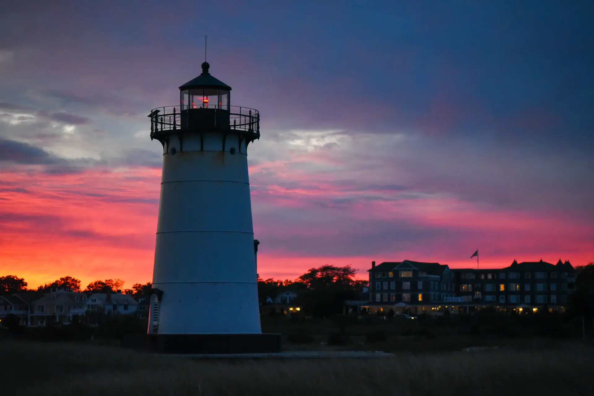
Edgartown · Lighthouse Beach, duskPhoto by MV Vacation
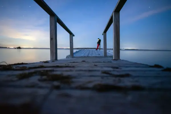
Edgartown Light after sundown, with the Harbor View Hotel lit behind it. The tower faces east across the harbor, so dawn puts the sun behind the lighthouse and dusk puts the color behind the hotel; both work, and the beach is free and a ten-minute walk from Main Street.
Where to photograph Martha's Vineyard, by subject and by light: the five lighthouses and their best hours, the working harbors, the ferries, the gingerbread cottages, the Aquinnah cliffs and the rules that protect them, the up-island stone walls, the Jaws bridge, Mytoi and Menemsha Hills, seasons and weather, and the drone, cliff and private-beach rules, illustrated with our own photographs.
Every photograph on this site was taken by us, on the island, over many years and in every month, and the questions readers send about them are always the same: where is that, when did you take it, and could I stand there too. We go by subject here instead of by town, because the light decides the order of a photography day here more than the map does. The lighthouses want dawn or dusk; the gingerbread cottages want the flat light of a cloudy noon; the stone walls of West Tisbury want the low sun of October; the ferries want whatever weather is doing something. For sunsets specifically, our sunset guide ranks the seven spots and lists the times by month. Everything else is below, including the handful of places with rules worth knowing before you set up.
The easiest to reach, at the end of a short causeway from North Water Street. It faces east across the harbor mouth, so sunrise is its hour: the sun comes up over Chappaquiddick behind the tower and the harbor is glass. In summer that means being on the beach by 5:15. Dusk works the other way, with the town and the hotel lit behind you and the sky over the harbor going pink. Free, no parking at the beach; walk from town.
The red-brick tower above the cliffs, best from the overlook path at the top of the shops with the clay cliffs below and the sun setting into Vineyard Sound past the Elizabeth Islands. The tower itself opens for climbing in season; check hours before promising anyone the view from the top. Sunset crowds are big from July to September, and arriving an hour early helps with parking.
A small cast-iron tower on Telegraph Hill above Vineyard Haven harbor, facing west, with the ferries crossing below it at golden hour. The Martha's Vineyard Museum opens it around sunset on summer Sundays; our East Chop guide has the details. Park on the loop road, respectfully: it is a residential street.
A Coast Guard tower behind a fence at the end of Main Street, so the picture is the beach below it: rocks, the light on the bluff, and the sunset over the Elizabeth Islands. The West Chop beach is the classic Vineyard Haven evening walk, and the light comes on before the sky goes dark.
The remote one, reached by the Trustees' guided tour, an over-sand permit, or a long walk up the barrier beach from the Dike Bridge. Wooden, weathered and alone on a bluff; the reward is that nobody else is in the frame. Trustees property, where drones are not allowed.
Working harbors and the boats in them
Menemsha is the island's best-known working waterfront: the gray fish shacks on Dutcher Dock, the lobster boats tied up three deep, the Coast Guard station across the basin, and the sun setting into the Sound from the beach beside the jetty. The harbor is at its best in the morning, when the boats come in and the light is on the shacks, and the beach in the evening, along with everyone else; our Menemsha guide has the parking, which is a small lot that fills an hour or two before sunset in summer. Vineyard Haven harbor gives you the tall ships at their moorings, the ferry arriving under the West Chop bluff, and the boatyard on Beach Road; the walk from the Steamship terminal along the harbor to Owen Park covers all of it. Edgartown harbor is yachts, the Chappy ferry and the row of white captains' houses on North Water Street, best from Memorial Wharf at the end of Main Street. And Oak Bluffs harbor is the loudest and the most colorful, with the fishing charters unloading in the late afternoon and the Ritz's neon coming on across the road.
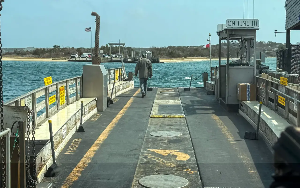
Edgartown · aboard the On Time IIIPhoto by MV Vacation
On board the On Time III for the 527-foot crossing to Chappaquiddick, the car deck empty this trip. From Memorial Wharf at the end of Main Street you get the ferry, the yachts and the North Water Street houses in one frame, and the crossing repeats every few minutes all day.
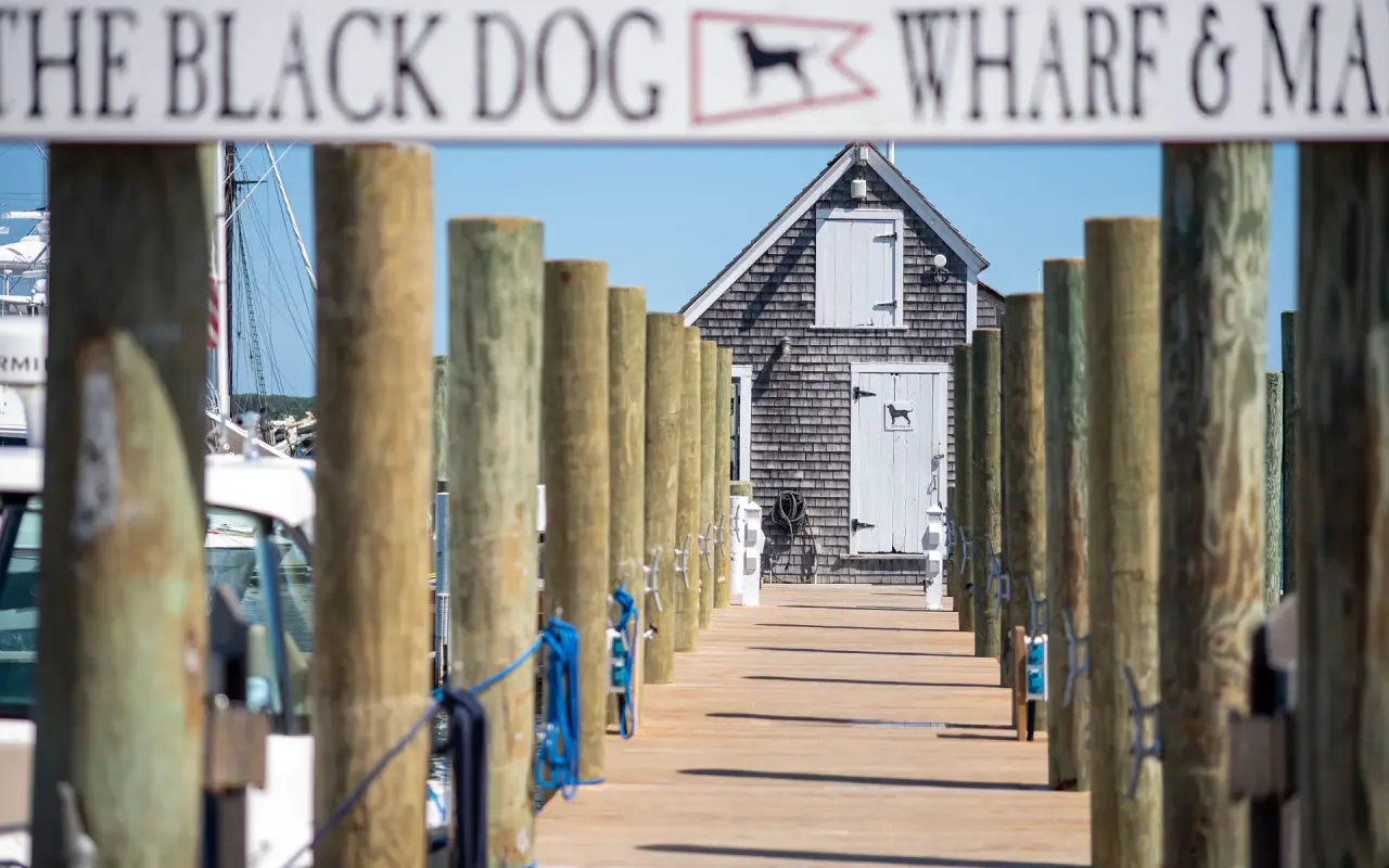
Vineyard Haven · Black Dog WharfPhoto by MV Vacation
Down the Black Dog Wharf: the sign overhead, the pilings and the shingled shed at the end.
For beach days
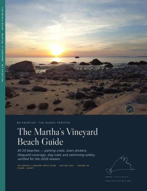
The Beach Guide, free
All 20 beaches with parking, stickers, lifeguards and dog rules, plus a one-page card for the beach bag. Free with the island letter, together with three more island guides.
One-click unsubscribe, and we never share your email.
The ferries themselves
The single most reliable photo subject on the island is the boat you arrived on. From the top deck of a Steamship Authority ferry the whole approach is a picture: West Chop and East Chop on either side of Vineyard Haven harbor, the schooners at anchor, the Black Dog wharf, and in Oak Bluffs the gingerbread cottages of the East Chop bluff and the Steamship pier with the town behind it. The first boat of the morning, 6:00 from Woods Hole, crosses into sunrise; the evening boats cross into sunset behind Woods Hole. From the land, the Oak Bluffs pier and the Vineyard Haven breakwater both give you the ferry arriving broadside, and the Chappy ferry in Edgartown, which our Chappaquiddick guide covers, runs every few minutes past Memorial Wharf, which is where everybody stands.
Gingerbread cottages, the Tabernacle and Ocean Park
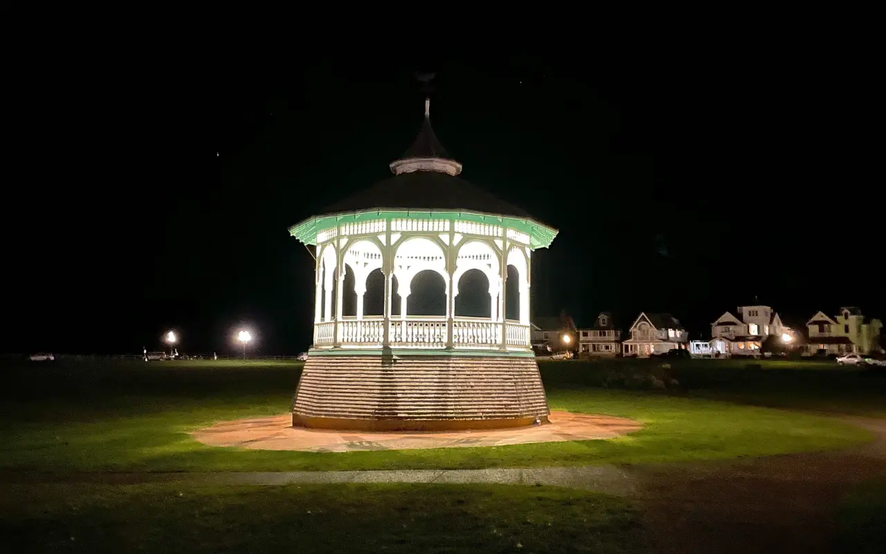
The Martha's Vineyard Camp Meeting Association's 300-odd cottages behind Circuit Avenue are the most concentrated subject on the island: filigree porches, candy colors, the iron Tabernacle at the center of the ring. They look best on an overcast day or in open shade, since full summer sun blows out the whites and buries the trim in shadow. Early on a weekday morning, before the walking tours, the lanes are empty. Every cottage is somebody's home and the porches are their living rooms in August, so the lanes are the vantage point and the houses are the picture. On Grand Illumination night, when the lanterns are lit, the same picture comes with far more people in the lanes; our Illumination guide explains the evening. Ocean Park, across the road, has the bandstand and the Victorian houses along the curve, and at night the bandstand lit against the dark, a calm picture a block from the busiest street in town.
Oak Bluffs · Ocean Park after darkPhoto by MV Vacation
The Ocean Park bandstand lit at night, with the Victorian houses along the park’s edge behind it, a few steps from Circuit Avenue and usually empty.
The Aquinnah cliffs and their rules
The Aquinnah Cliffs are 150 feet of banded clay in red, white, gray and ochre, facing west over the Sound, with Gay Head Light on top. The picture everyone wants is from the overlook at the top of the path from the shops, an hour before sunset, when the low sun lights the clay face; the second picture is from Moshup Beach below, a 10-minute walk down from the parking lot (a fee in season), looking back up at the cliffs. The cliffs are a National Natural Landmark on the land of the Wampanoag Tribe of Gay Head (Aquinnah), and climbing on them, digging into them or taking clay is prohibited by town bylaw and tribal law. The beach and the path are the places to be, and our guide to visiting Aquinnah respectfully explains why the tribe asks what it asks. Lucy Vincent's smaller clay cliffs in Chilmark are the same geology and the beach is residents and Chilmark renters only in season; from mid-September it opens to everyone, and the October light on those cliffs is lovely.
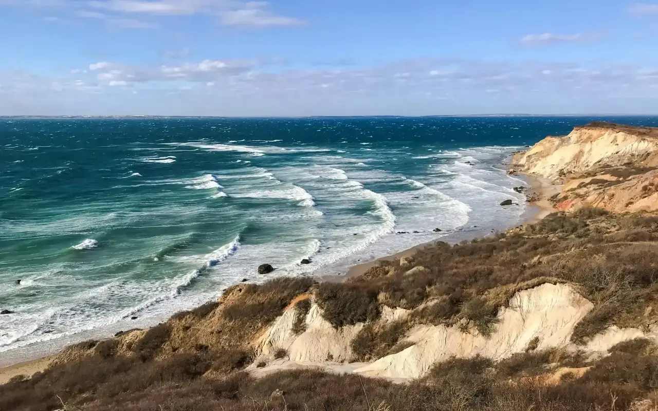
Aquinnah · the cliffs from abovePhoto by MV Vacation
The clay cliffs and Moshup Beach from above on a windy day, whitecaps out to the horizon. The cliff face itself is off limits.
Stone walls, farms and the up-island road
The other Vineyard, the one without a harbor, is West Tisbury and Chilmark: sheep behind stone walls, hay barns, the Grange Hall and Alley's General Store porch, the Agricultural Hall, the winding State Road and South Road with their stone walls running off into the scrub oak. It photographs best in the low light of early morning and late afternoon, and in October, when the walls are lit sideways and the fields turn gold. Almost every wall is on private land, and the picture is from the road shoulder anyway. Alley's porch and the post office next door are a favorite up-island doorstep, and the owners are used to cameras; Beetlebung Corner in Chilmark, the crossroads with the church and the store, is the other. The hiking guide lists the Land Bank and Sheriff's Meadow properties, which are public and where the walls, meadows and pond views are yours to walk into.
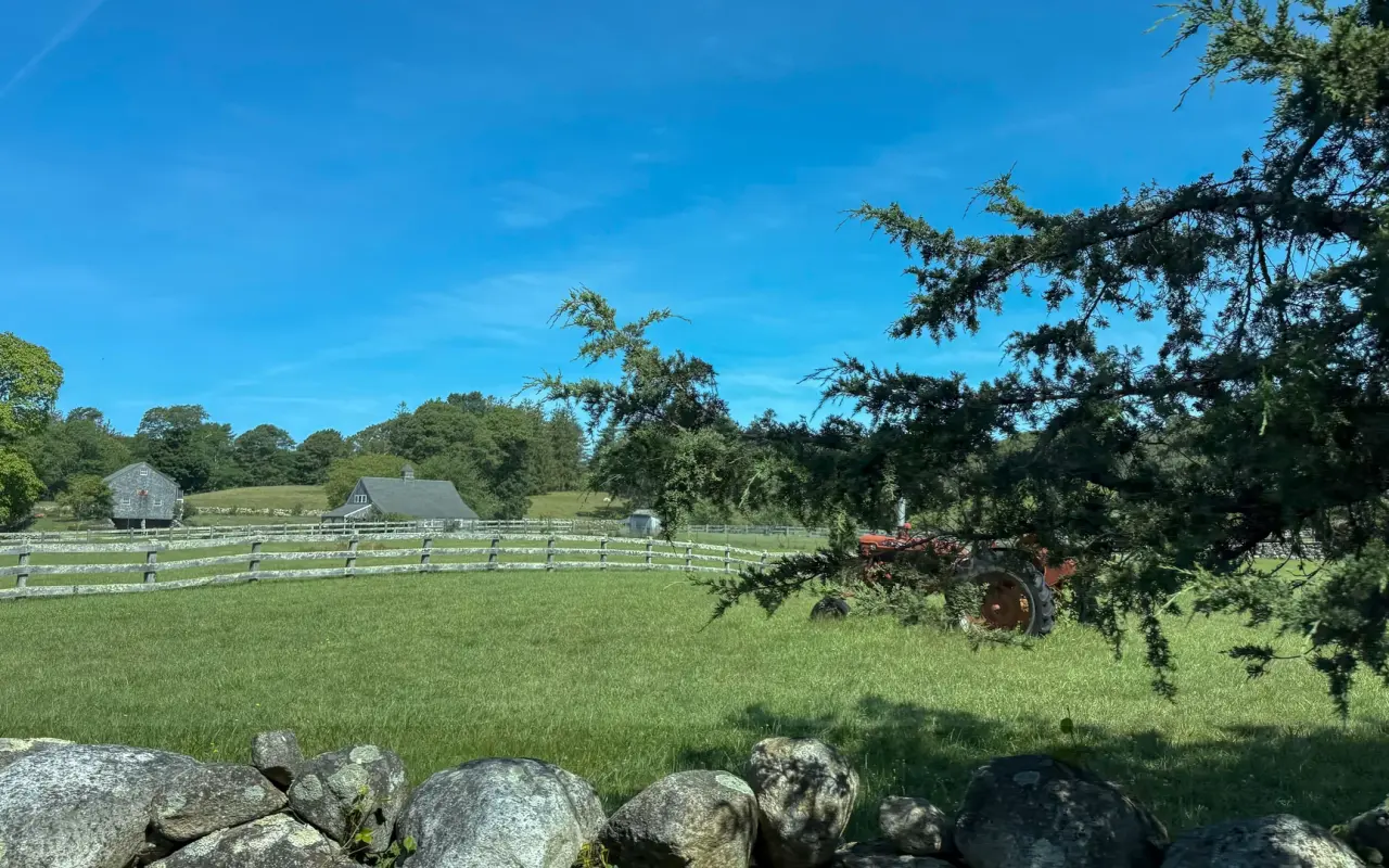
A farm off the roadPhoto by MV Vacation
A red tractor, a split-rail fence, a barn and a stone wall in one frame, from the road shoulder. Stone walls like this one usually mark a property line.
The bridge, the carousel and the film
The bridge on State Beach (the Jaws bridge) gets photographed constantly, and the picture that works is the beach and the bridge together from the sand on the Oak Bluffs side, or the bridge from the water's edge on the pond side, with the tide moving through. Posted signs prohibit jumping and diving and the channel current is strong, so the picture here is the bridge itself, taken from the sand, as our Jaws tour explains. The Flying Horses Carousel in Oak Bluffs is indoors and moving, which makes it a slow-shutter picture from the rail; ask at the ticket booth before using a tripod. Edgartown's Main Street and North Water Street, with the Old Whaling Church columns and the white picket fences, are the film's Amity and the island's best architectural walk, and they are prettiest an hour after sunrise before the shops open, when there are no cars on the street.
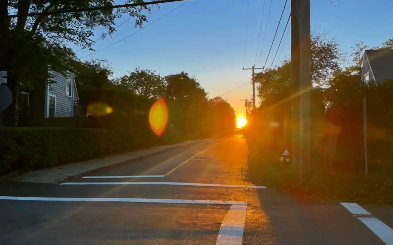
Vineyard Haven · a side street at dawnPhoto by MV Vacation
Sunrise straight down a Vineyard Haven side street, the town still asleep. The east-facing streets of all three down-island towns line up with the sunrise for a few weeks each spring and autumn.
Mytoi, Cedar Tree Neck, Menemsha Hills
Mytoi on Chappaquiddick is a Japanese garden with a weathered wooden bridge over a goldfish pond, best in spring bloom and in autumn color, and best in soft light; it is small, so go early before the tour vans. Cedar Tree Neck on the north shore of West Tisbury walks through beech woods to a stony beach with a view across the Sound, and the boulders at the water's edge photograph well at any hour. Menemsha Hills, the Trustees' property above Menemsha, climbs to the second-highest point on the island and drops to a beach below the Chilmark clay bluffs; the golden-hour picture from the bluff, sun on the water and the boulders on the beach, is the one to plan a late afternoon around.
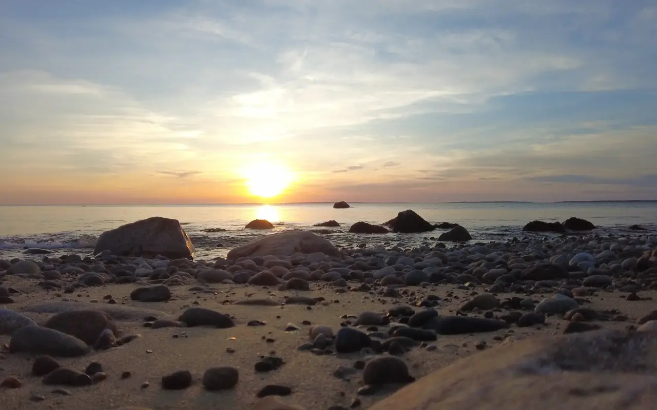
A boulder beach · golden hourPhoto by MV Vacation
Golden hour on a boulder beach, the sun dropping over the water. Below Menemsha Hills the trail down from the bluff is steep and the tide can cover the beach, so the walk back takes a little planning.
Seasons and weather
Fog comes on June mornings and any warm day after a cold night. It turns the lighthouses and harbors monochrome and usually burns off by ten; the climate guide has the months.
October brings low light, quiet beaches, gold up-island fields, Derby boats along the shore, and the cliffs and Lucy Vincent open to everyone.
December has Edgartown's lights and the harbor Christmas tree, Oak Bluffs' gazebo, the Chappy ferry with bulbs on the wheelhouse; our Christmas in Edgartown guide and the winter calendar give the dates.
Snow is rare and gone in a day, so when it falls, the same morning is the time: Five Corners, the Campground cottages, Katama with the fences half buried. Our winter gallery has examples.
The Agricultural Fair runs four days in August at the Agricultural Hall, full of people and animals to photograph; the Fair guide has the schedule.
Rules worth knowing
Drones are prohibited on all Trustees of Reservations properties (Cape Poge, Wasque, Long Point, Menemsha Hills, Mytoi) without written permission, banned on Martha's Vineyard Land Bank land, and restricted near the airport by federal rules. The beaches and cliffs of Aquinnah are tribal and town land where you should assume the same. We do not fly one, and we do not publish drone pictures.
At the Aquinnah and Lucy Vincent cliffs, climbing, digging and taking clay are all off limits.
Lucy Vincent, Squibnocket and the Chilmark and West Tisbury town beaches are closed to non-residents in season; they open to photographers from mid-September, or in season with a lease in the town. Our Lambert's Cove guide explains the sticker system.
Street and parade photography here works the way it does anywhere: public places are public, and a long lens from the sidewalk is how we shoot the Fourth of July ourselves. For a close portrait of a fisherman on Dutcher Dock or a shopkeeper at the cliffs, a hello first gets a better picture.
Parking is tight at every one of these places in July and August, and the towns ticket; the parking guide covers Menemsha, Aquinnah and the lighthouses.
Rocks at West Chop and Menemsha Hills are slippery, the channels under the bridges run fast, and the south shore has rip currents; the beach safety guide is worth the five minutes.
At a glance
Sunrise
Edgartown Light, Lighthouse Beach; the first ferry from Woods Hole; down-island side streets in spring and autumn
Sunset
Menemsha Beach, Aquinnah overlook, East Chop Light, West Chop beach, Menemsha Hills (full list in the sunset guide)
Overcast days
Gingerbread cottages, Mytoi, Edgartown's white streets, harbors in fog
Low autumn light
West Tisbury and Chilmark stone walls and fields, Lucy Vincent cliffs from mid-September
Night
Ocean Park bandstand, Edgartown Light with the hotel behind, Christmas lights in December, Grand Illumination in August
Off limits
Cliff faces, Campground porches, private beaches in season, drones on Trustees, Land Bank and tribal land
Where Eisenstaedt stood
The most famous photographer to work these beaches was Alfred Eisenstaedt of Life magazine, who came every August from 1937 until his death in 1995 and stayed at the Menemsha Inn from 1950 on. He took his island pictures for himself, outside his assignments, and his own list of favorites makes a usable shot list: the Menemsha jetty at sunset with a single boat in the glare; Dutcher Dock at half past five in the morning, before anyone else is up; the Aquinnah cliffs from the overlook after a clearing front, when the clouds do the composing; the foam line of a receding wave on South Beach, shot low against the white dunes with a yellow filter and no footprints in the frame; and the black skate egg cases the tide leaves on the sand, which he once stood up in a line because they looked like dancers. He was known for waiting: a sailboat took hours to reach the right place off the cliffs, and the wave on South Beach was one of many. The book of that work, Martha’s Vineyard by Eisenstaedt with text by Polly Burroughs (1980), is in the island libraries.
How we checked this
The locations, light and timings are our own, from years of photographing the island in every season; every image here is ours and was taken where the caption says. The cliff rules are the Town of Aquinnah's and the Wampanoag Tribe's as posted at the overlook and described in our Aquinnah guides; the drone rules are from the Trustees of Reservations' published photo and drone policy and the Land Bank's 2015 no-fly rule as reported by the Vineyard Gazette. Beach access rules are in our beach permits guide and change by town vote; lighthouse opening hours change by season and are in each lighthouse guide.
Frequently Asked Questions
When should I photograph the lighthouses?
Dawn or dusk. Edgartown Light faces east across the harbor mouth, so sunrise is its hour, on the beach by 5:15 in summer; Gay Head Light is best at dusk from the overlook above the cliffs; East Chop faces west over Vineyard Haven harbor for sunset.
What light do the gingerbread cottages want?
The flat light of a cloudy noon. The stone walls of West Tisbury want the low sun of October, and the ferries want whatever the weather is doing.
Are all the photos on this site yours?
Yes, every one, taken on the island over many years and in every month; this page answers where and when.
Which spots have rules?
A handful. At the Aquinnah cliffs, on Wampanoag tribal and town land, climbing, digging and taking clay are prohibited; drones are banned on Trustees and Land Bank properties; the up-island town beaches are residents only in season; and the Campground porches are people’s homes.
Where are the sunset spots?
In our sunset guide, which ranks seven spots and lists the times by month; this page is about everything else.
Island tip of the dayShoppingNo. 31 of 86New tip at midnight, island time
The Chappy Ferry costs $5/person round-trip and $17 for a car with driver. Cards work at the Edgartown-side kiosk; bring cash for the boat itself.
Useful?
More on
Four free downloads · 2026 editions
Four island guides, in your inbox
The Beach Guide (all 20 beaches decoded), The Vineyard in the Fall, the season date by date, Where to Stay, every town and price band, and What It Really Costs, the 2026 budget line by line. All four PDFs free, plus a short island letter when there is something worth telling. No schedule, no spam.
No spam, unsubscribe in one click. Want a look first? See what you get.
First email ever from us? Give it a minute, and peek in spam once.
Disclaimer: The information in this article is provided for general guidance only and was accurate at the time of writing. Beach conditions, hours, prices, lifeguard schedules, ferry fares, and business operations change frequently and without notice. Ocean swimming carries inherent risks including rip currents, undertow, and cold water shock. Always verify current conditions with official local sources before your visit. MV Vacation assumes no responsibility for any loss, injury, or inconvenience resulting from the use of this information. Swim only where lifeguards are on duty, supervise children at all times near water, and follow all posted safety signs.
A guide to Martha's Vineyard, written on the island: beaches, dining, events and island living. We write down what we know about the island so your trip goes the way you hoped.
Martha's Vineyard after dark: where the full moon rises out of the ocean, the darkest spots for stars (Aquinnah, Lobsterville, South Beach), full-moon and meteor dates through 2027, the honest word on bioluminescence in the ponds, the three towns after the shops close, and the practical side of deer, dark roads, parking lots and night swimming.
Sunset from West Chop in Vineyard Haven, Martha's Vineyard: the view over Vineyard Sound and the harbor from a quiet spot at the point.
Subscribe
The free island library · 2026
One short island letter, and all four guides to start
Beach reports, events worth a day, ferry heads-ups. Sent when there is something worth telling. The Beach Guide, The Vineyard in the Fall, Where to Stay and What It Really Costs arrive with your welcome email.
The Beach Guide, The Vineyard in the Fall, Where to Stay and What It Really Costs. No spam, one-click unsubscribe.
We use cookies for trip planning, site stats and ads, including ads based on your browsing. To opt out, turn on Global Privacy Control in your browser. Cookie policy
These cookies are essential for the website to function properly.
These cookies help us understand how visitors interact with the website.
These cookies are used to deliver personalized advertisements.