Travel advisorySteamship Authority travel advisory · Gale Warning on the ferry waters until Fri 2 PMGusty winds are forecast for Cape Cod and the Islands that will have the potential to cause cancellations on both the Hyannis-Nantucket and Woods Hole-Martha's Vineyard routes through Thursday. We are waiving change and cancellation fees for travel scheduled for Tuesday, October 20, through Thursday, October 22.Steamship Authority · checked 1:30 AM ET
Poison ivy on Martha's Vineyard: how to spot it and what to do
January 25, 2025 MV Vacation Team8 min read
Poison ivy grows almost everywhere on the island. If you plan to hike in Manuel F. Correllus State Forest, walk to a quiet beach or follow a nature trail, it helps to know what it looks like and how to steer around it.
All 20 beaches with parking, stickers, lifeguards and dog rules, plus a one-page card for the beach bag. Free with the island letter, together with three more island guides.
One-click unsubscribe, and we never share your email.
What poison ivy is
Poison ivy (Toxicodendron radicans) is a native North American plant. It contains urushiol, an oily resin that gives about 85% of people an allergic rash (contact dermatitis). The American Skin Association calls it the most common allergic reaction in the U.S.
The basics
Every part of the plant carries urushiol oil
The oil stays active on dead stems and leaves
Reactions can happen in any season
It grows all over the island, in every town
How to identify poison ivy
The old rule, leaves of three, let it be, gets you most of the way, but the plant changes its look a lot, so a few more details help.
What to look for
Leaf pattern
Three leaflets per stem (trifoliate)
Middle leaflet has its own stem (petiolule)
The two side leaflets attach directly to the main stem
Leaflets are usually 2-4 inches long
Leaf shape and edges
Can be smooth-edged or have teeth/lobes
Often described as mitten-shaped
May have notches or be deeply lobed
Surface can be shiny or dull
How it grows
As a climbing vine on trees and fences
As a shrub in open areas
As ground cover in shaded woods
Climbing stems have hairy aerial rootlets
Don’t burn it
The CDC warns against burning poison ivy: breathing the smoke can cause severe respiratory reactions and lung inflammation.
Poison ivy in the fall
Autumn is when poison ivy is easiest to spot. Its leaflets turn bright orange, red and yellow, according to UMass Extension, so a vine up a tree trunk or a patch along a stone wall can stand out from a long way off. The rash is just as likely as in summer: the American Academy of Dermatology says these plants are poisonous year-round.
Look for the berries too. UMass Extension describes small green berries that turn light gray to white, which birds and other animals eat and spread, and the CDC’s NIOSH page describes them as white to green-yellow or amber. Pale berries on a red-leaved vine are a good clue.
Poison ivy in winter
Once the leaves drop, the plant is harder to see and can still give you a rash. The American Academy of Dermatology says touching any part of it, including the roots, can cause one even in winter, and UMass Extension says the oil persists in dormant and dead plants. On trees the vine holds on with aerial roots that make it look like a fuzzy rope. If you gather wood for a fire pit, leave any log with one still wrapped around it, since UMass notes the smoke can carry the oil.
The oil also lasts on things. The AAD says it can stay on surfaces for months or years until it is washed off, and NIOSH puts it at up to five years on objects. Gloves, boot laces, a leash or a dog that ran through bare brush can bring it home, and NIOSH suggests washing exposed clothes separately in hot water with detergent.
Island land trusts keep it in mind on winter walks. When Sheriff’s Meadow Foundation hides glass floats on its trails for the Treasure on the Trails hunt (one round ran in December 2025), it asks seekers to watch out for poison ivy and ticks, and its tick page notes that adult black-legged ticks may look for a host any time winter temperatures are above freezing.
Where poison ivy grows on Martha's Vineyard
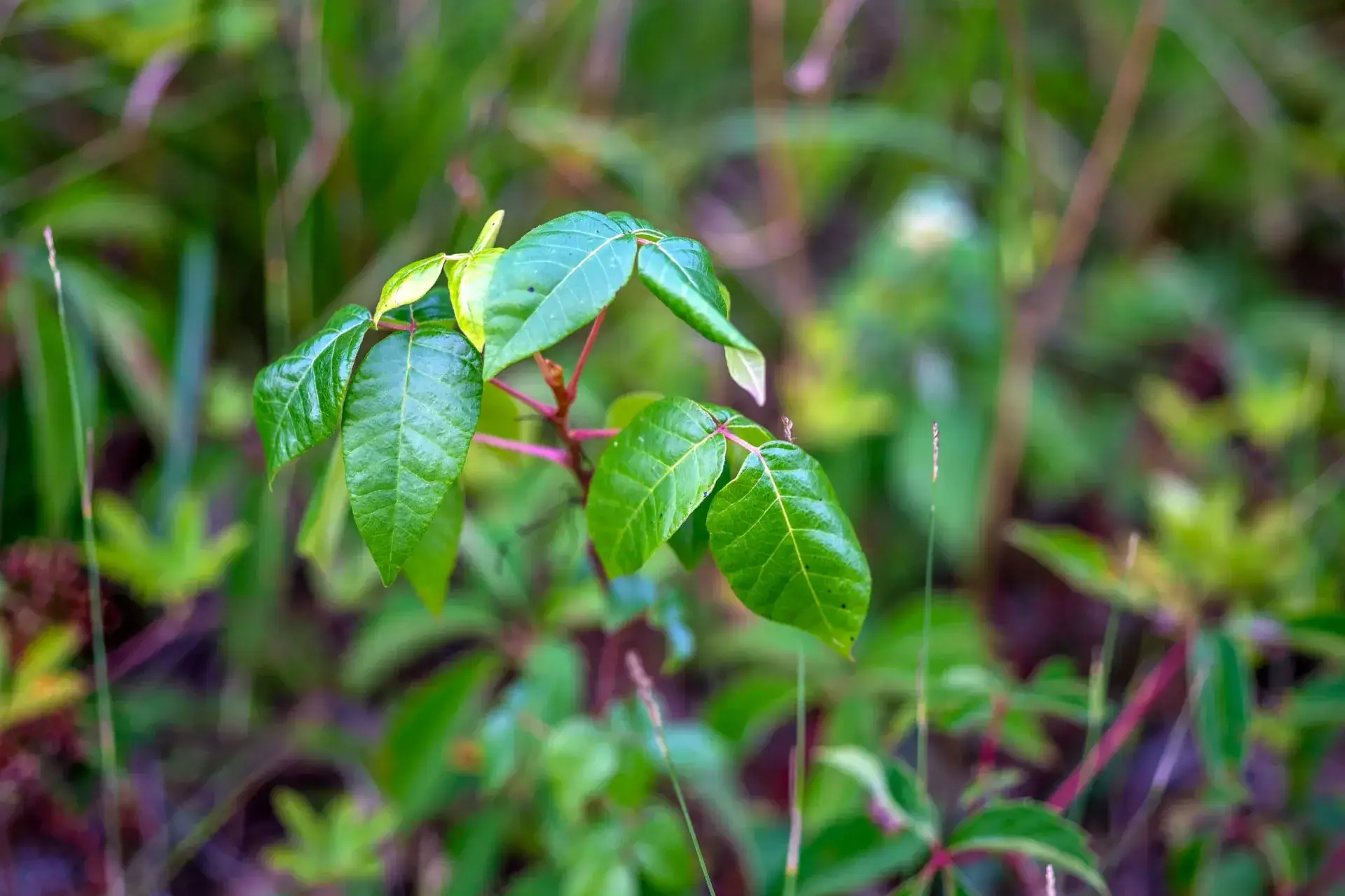
Island brush · the real thingPhoto by MV Vacation
Young poison ivy in the undergrowth. Note the reddish stems and glossy leaflets in groups of three.
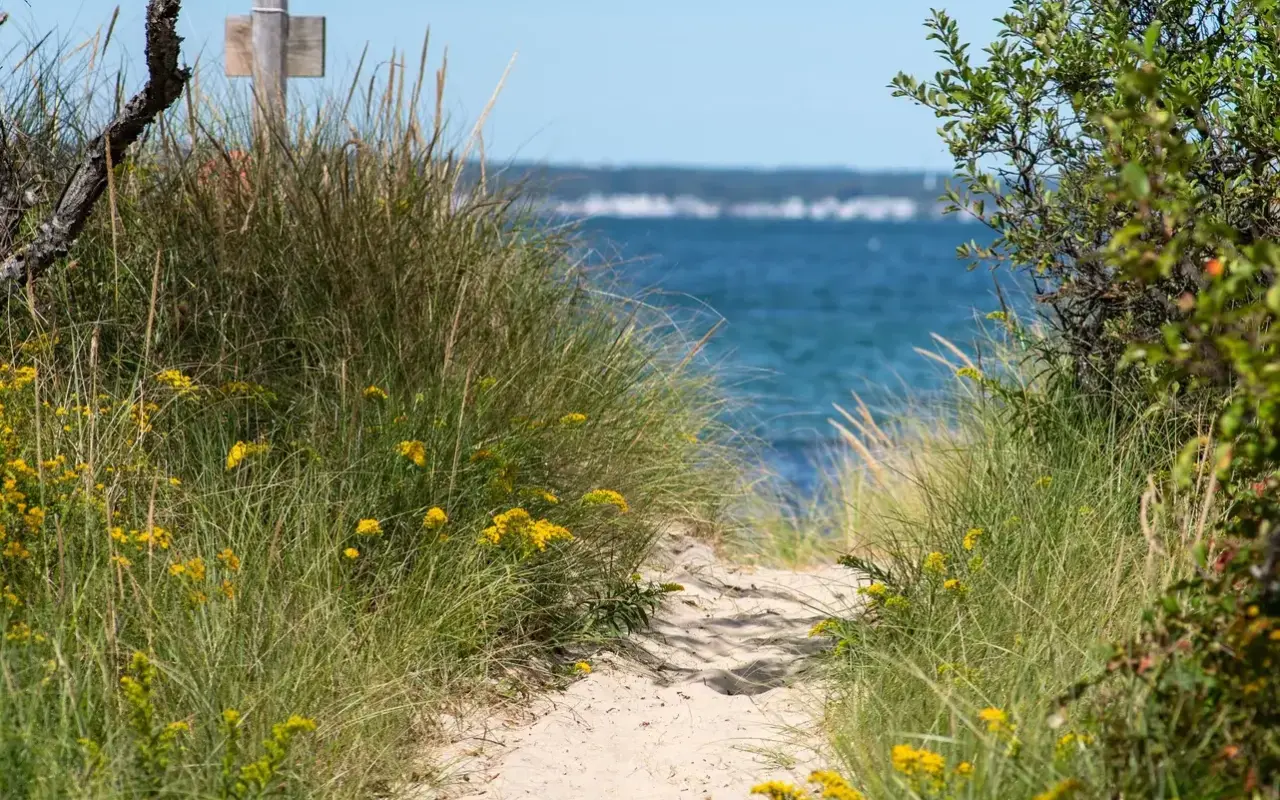
Dunes and trail edgesPhoto by MV Vacation
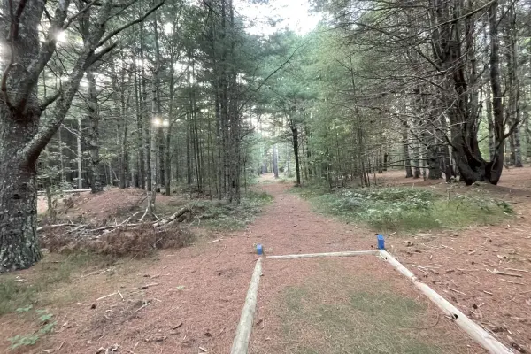
It grows along dune paths, trail edges and old stone walls all over the island, so the borders of a beach path are worth a look before you cut through.
Poison ivy does well in the island’s coastal climate and turns up in all six towns: Edgartown, Oak Bluffs, Tisbury (Vineyard Haven), West Tisbury, Chilmark, and Aquinnah.
Where you are likely to meet it
Conservation land
Manuel F. Correllus State Forest: trails and woodland edges
Felix Neck Wildlife Sanctuary: nature trails
Cedar Tree Neck Sanctuary: forest paths
Wasque Reservation: dune edges and paths
Beaches and the shore
Beach access paths and parking areas
Dune vegetation and transition zones
Coastal bluff trails
Areas behind primary dunes
Trails and everywhere else
All the main hiking and biking trails
Cemetery areas with overgrown sections
Abandoned or overgrown properties
Roadside areas and fence lines
How to avoid poison ivy on the island
Avoiding it in the first place is far easier than treating the rash. What works:
An ID sign · leaves of threePhoto by MV Vacation
An identification sign breaks down the trifoliate leaf: pointed tips, coarsely toothed margins and those clusters of hard white berries.
Clothes and gear
What to wear
Long pants for hikes and walks in the brush
Closed-toe shoes with high socks
Long sleeves where the growth is thick
Gloves for gardening or pulling plants
Other ways to stay clear
An ivy-blocker barrier lotion before you go
Marked trails and paths
Hands off the plants along the edges
A leash, so the dog doesn’t run through a patch and bring the oil home
If you think you touched it
According to the CDC’s NIOSH and the Mayo Clinic, if you suspect poison ivy contact:
Wash right away with dishwashing soap or a poison ivy wash
Clean any clothing and gear that may have touched the plant
Wash pets that may have been in it, with gloves on
Wipe tools and equipment with rubbing alcohol
Treatment and first aid
If you get the rash while you are on the island, treating it early makes it milder and shorter.
The first 24-48 hours
Step 1: Wash
Rinse the area with plenty of cool water and soap, and wash gently, since scrubbing can rub the oil into the skin. Done within 10 to 20 minutes of touching the plant, a good wash can sometimes stop the rash altogether, according to the American Academy of Dermatology.
Step 2: Calm the itch
Cool compresses, calamine lotion or an over-the-counter hydrocortisone cream can take the edge off. Try not to scratch, since broken skin can get infected. Island pharmacies stock all of these.
When to see a doctor
Get checked if the rash is on your face, near your eyes or on your genitals, if it covers a large part of your body, or if blisters ooze pus or you run a fever. Trouble breathing or swallowing, especially after being near burning brush, is a reason to get emergency care right away. Our hospital, urgent care and pharmacy guide lists where to go on the island.
Is poison ivy really that common on Martha's Vineyard?
Yes. It grows in all six towns and thrives in the coastal climate. You will find it along trail edges in the State Forest, at Felix Neck and Cedar Tree Neck, on beach access paths, behind the dunes and along roadsides and fence lines. Staying on marked trails avoids most of it.
How do I recognize it quickly?
Three leaflets per stem, with the middle leaflet on its own short stalk. Edges can be smooth or toothed, the surface shiny or dull, and it grows as a vine, a shrub or ground cover. When in doubt, leaves of three, let it be.
What should I do if I touch it?
Wash the skin right away with cool water and soap (not hot), and clean any clothing, gear and tools that touched the plant. The sooner you wash, the milder the rash. If it spreads or you are worried, see a doctor.
Can my dog carry poison ivy?
The oil can ride on fur, which is one more reason for a leash on the trails. If the dog ran through brush, a bath with gloves on takes care of it. For where dogs are welcome on the island, see our dog-friendly guide.
Is it a problem in fall and winter too?
It can be. The oil stays active on dead stems and bare vines, so reactions happen in every season. Long pants and closed shoes still make sense on off-season walks, and brush that might contain it should never be burned.
What does poison ivy look like in October?
The leaves turn orange, red and yellow, and the vines often carry small berries that go from green to grayish white. It keeps its three leaflets until they drop, and the rash is the same as in summer.
How long can the oil stay on gloves, boots or tools?
A long time. The American Academy of Dermatology says months or years until it is washed off, and NIOSH says up to five years on objects. A wash after a walk or yard work takes care of it.
What about ticks on the same trails?
Ticks are the other reason to stay on the path and wear long pants. Our tick safety guide covers how to check yourself and what to watch for after a hike anywhere on the island.
LIVELive webcamsWatch Martha's Vineyard in real time.→
Island tip of the dayTimingNo. 58 of 79New tip at midnight, island time
Oak Bluffs restaurants are packed 6–8 PM. Eat at 5 PM or after 8:30 PM: same food, half the wait, easier parking.
Useful?
More on
Four free downloads · 2026 editions
Four island guides, in your inbox
The Beach Guide (all 20 beaches decoded), The Vineyard in the Fall, the season date by date, Where to Stay, every town and price band, and What It Really Costs, the 2026 budget line by line. All four PDFs free, plus a short island letter when there is something worth telling. No schedule, no spam.
No spam, unsubscribe in one click. Want a look first? See what you get.
First email ever from us? Give it a minute, and peek in spam once.
Disclaimer: The information in this article is provided for general guidance only and was accurate at the time of writing. Beach conditions, hours, prices, lifeguard schedules, ferry fares, and business operations change frequently and without notice. Ocean swimming carries inherent risks including rip currents, undertow, and cold water shock. Always verify current conditions with official local sources before your visit. MV Vacation assumes no responsibility for any loss, injury, or inconvenience resulting from the use of this information. Swim only where lifeguards are on duty, supervise children at all times near water, and follow all posted safety signs.
A guide to Martha's Vineyard, written on the island: beaches, dining, events and island living. We write down what we know about the island so your trip goes the way you hoped.
Shellfishing on Martha's Vineyard town by town: what each of the six towns charges a visitor for a permit and what it covers, where to buy it, weekly limits and sizes, the 2026 to 2027 bay scallop dates published so far, how to check storm and rain closures, and keeping the catch safe to eat.
Martha's Vineyard's ponds explained: the great ponds sealed behind the south-shore beach and cut open to the sea by an excavator, the salt ponds with tides and scallops, the freshwater kettle ponds, why cyanobacteria blooms turn some of them green in August and what MV Cyano's colors mean, the nitrogen under the houses, and where a visitor can swim, paddle and watch the cut.
Where Martha's Vineyard's oysters, bay scallops and quahogs come from: the public solar hatchery on Lagoon Pond that turned fifty in 2026, the dozen oyster farms in Katama Bay, Menemsha Pond and Vineyard Sound, the wild beds in the great ponds, the autumn scallop season and its limits, visitor shellfish permits by town, why rain closes a pond, and where to eat them.
Mytoi, the Japanese garden on Chappaquiddick: how to get there on the Chappy ferry, the 15-car lot, hours and admission by season, the pond and bridge, birch walk and camellia dell, the story of Hugh Jones, Mary Wakeman and the rebuild after Hurricane Bob, rules, accessibility and when to go.
Felix Neck Wildlife Sanctuary in Edgartown: the four easy trails and what each passes, the ospreys, the butterfly garden, hours and admission, Mass Audubon's kayak tours and prices, accessibility, the Wampanoag and Smith-farm history, and when to go.
Every hiking trail on Martha's Vineyard: 220+ miles on more than 100 properties. Menemsha Hills, Cedar Tree Neck, Felix Neck, Aquinnah, and tick safety tips.
Subscribe
The free island library · 2026
One short island letter, and all four guides to start
Beach reports, events worth a day, ferry heads-ups. Sent when there is something worth telling. The Beach Guide, The Vineyard in the Fall, Where to Stay and What It Really Costs arrive with your welcome email.
The Beach Guide, The Vineyard in the Fall, Where to Stay and What It Really Costs. No spam, one-click unsubscribe.
We use cookies for trip planning, site stats and ads, including ads based on your browsing. To opt out, turn on Global Privacy Control in your browser. Cookie policy
These cookies are essential for the website to function properly.
These cookies help us understand how visitors interact with the website.
These cookies are used to deliver personalized advertisements.