Travel advisorySteamship Authority travel advisory · Gale Warning on the ferry waters until Fri 2 PMGusty winds are forecast for Cape Cod and the Islands that will have the potential to cause cancellations on both the Hyannis-Nantucket and Woods Hole-Martha's Vineyard routes through Thursday. We are waiving change and cancellation fees for travel scheduled for Tuesday, October 20, through Thursday, October 22.Steamship Authority · checked 12:45 AM ET
By MV VacationUpdated 21 Oct, 2026Facts checked Aug 28, 202610 mins read 1,628 views
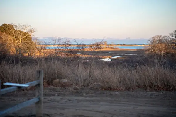
A stony beach · the view acrossPhoto by MV Vacation
A sandy path through the dune grass to a stony beach, low land along the far horizon. At Cedar Tree Neck swimming is not allowed; people come for the walk and the view.
Cedar Tree Neck Sanctuary: about 400 acres of bluffs, forest trails, and rocky shoreline in West Tisbury. Free admission, open year-round.
Cedar Tree Neck is one of Martha's Vineyard's most varied sanctuaries: about 400 acres of glacial bluffs, freshwater ponds, wind-sculpted forest and rocky Vineyard Sound shoreline, all free and open to the public year-round. This north-shore preserve in West Tisbury owes its existence to Henry Beetle Hough, the longtime editor of the Vineyard Gazette, who as a boy explored these woods and later spent decades fighting to protect them. Today, managed by Sheriff's Meadow Foundation, it has one of the island's best short hikes: a 1.4-mile loop through oak-beech forest, cranberry bogs, a turtle pond, wind-sheared coastal heath, and bluffs overlooking the Elizabeth Islands.
Filmed April 2024The island moves on: shops, signs and prices may differ from what you see here. The text of this guide was checked October 2026.
Cedar Tree Neck is, true to its name, a "neck": a narrow peninsula of high ground jutting north into Vineyard Sound. The promontory was created roughly 23,000 years ago when the Buzzards Bay Lobe of the Laurentide ice sheet deposited its terminal moraine, leaving behind the hilly terrain and the huge glacial erratic boulders you see there today. Henry Beetle Hough described it as "almost islanded itself by a large pond just to the west and a smaller pond and marsh in front and the deep bend of the sound on both sides."
The sanctuary spans about 400 acres; the same Sheriff's Meadow Foundation page puts the current total at 436 acres, built up from many gifts of land. According to island historian Charles E. Banks, the Wampanoag name for this place is Squemmechchue, which refers to cranberries, not cedars. The English name "Cedar Tree Neck" dates to at least 1718, when it appears in a deposition of Jonathan Luce. The cedars in question are Eastern red cedars (Juniperus virginiana), technically junipers, which colonized former pastureland and remain prominent throughout the property.
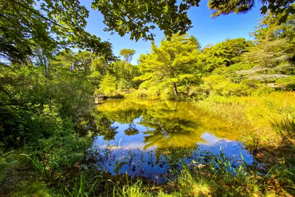
Three bodies of water shape the sanctuary. Vineyard Sound breaks against the rocky northern shoreline, Cedar Tree Neck Pond (also called Daggett Pond) sits behind the beach, and Ames Pond, a smaller woodland pond deeper in the property, is where visitors find painted turtles sunning on logs. Several streams, a small waterfall and cranberry bogs fill out the freshwater side, and close by, off the Ephraim Allen Road, is the one-acre Pond Lot that Hough gave Sheriff’s Meadow, with a vernal pool he named Lake Elizabeth after his wife.
The trails
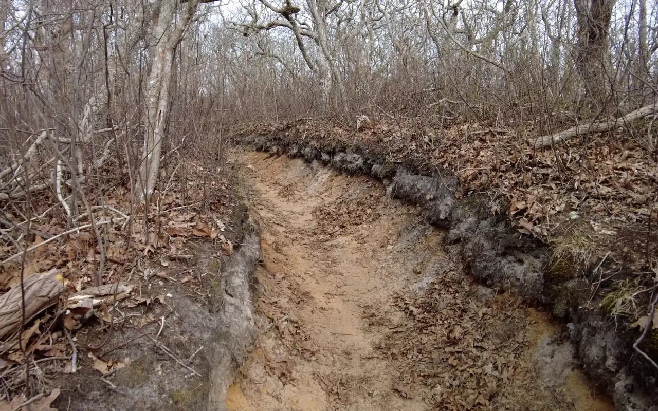
The trails · a sunken stretchPhoto by MV Vacation
A sunken, sandy stretch of trail, worn down between banks of fallen oak leaves.
The sanctuary's trails are color-coded and well marked, and several are named for the families and conservationists who donated the land. The most popular route (1.4 miles as a true loop on AllTrails, with 121 feet of elevation gain, rated "Easy," averaging 30–60 minutes) combines the White, Yellow-Blue, Neighborhood, Blue, and Maria Daggett Trails from the main Daggett Trailhead.
The named trails are:
Bruce Irons Trail: an educational trail from the main parking area with a downloadable habitat commentary guide
Obed Sherman Daggett Trail: loops around the elevated neck, with Vineyard Sound on one side and Cedar Tree Neck Pond on the other
Maria Daggett Trail: follows the shores of Cedar Tree Neck Pond
Bill Bridwell Trail: traverses the bluff area with water views through the trees
Elinor Moore Irvin Trail (Green Trail): a 2-mile connector from Indian Hill Road through undulating woodlands
Orange Trail: from the Taylor Gate trailhead, descending past old cranberry bogs, stone walls, and a small waterfall (~1.5 miles to the beach)
Underfoot it changes a lot: packed dirt with exposed roots and rocks in the forest, boardwalks over the wet sections, heavy sand near the beach and tumbled boulders along the shore. The route is broadly family-friendly (AllTrails reviewers call it "good for kids"), but it is not stroller-accessible, and the footing is uneven for anyone unsteady on roots and rocks.
GPS coordinates for the Daggett Trailhead parking lot: 41.4327°N, 70.6962°W.
For beach days
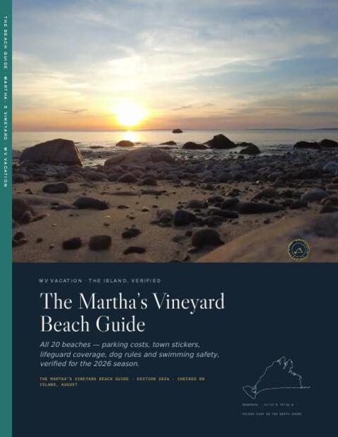
The Beach Guide, free
All 20 beaches with parking, stickers, lifeguards and dog rules, plus a one-page card for the beach bag. Free with the island letter, together with three more island guides.
One-click unsubscribe, and we never share your email.
Bluffs, beach and the view to the Elizabeth Islands
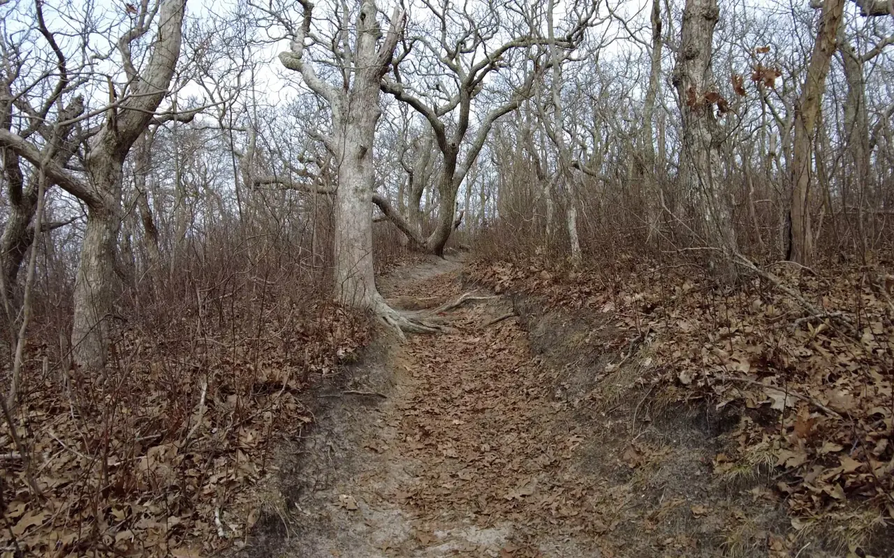
The trails · bare oaksPhoto by MV Vacation
Cedar Tree Neck is a tangle of glacial hills and ponds on the north shore, threaded with trails that the Sheriff’s Meadow Foundation keeps wild and free to walk.
The neck itself is a wind-battered glacial bluff with a different character on each side. The inland side has what MV Times writer Jonathan Burke called "a magical canopy of bent and crooked trees," dense and sheltered. The seaward face is exposed, with grasses and stunted American beeches shaped by the wind. The trail gains about 120 feet over the loop.
Under the bluffs · washed upPhoto by MV Vacation
A driftwood log and a broken paddleboard washed up under the bluffs. The beach here is all stones, better for walking than swimming.
From the bluff, Vineyard Sound stretches north, with the low Elizabeth Islands, Naushon in particular, clearly visible across the water. Cedar Tree Neck Pond gleams below to the west.
A rocky beach, often empty, sits at the base of the bluffs. Swimming is not permitted there: terns and piping plover (a federally threatened species) nest on it, and the Vineyard Sound currents along the rocks are strong.
Henry Beetle Hough, the editor who saved the land
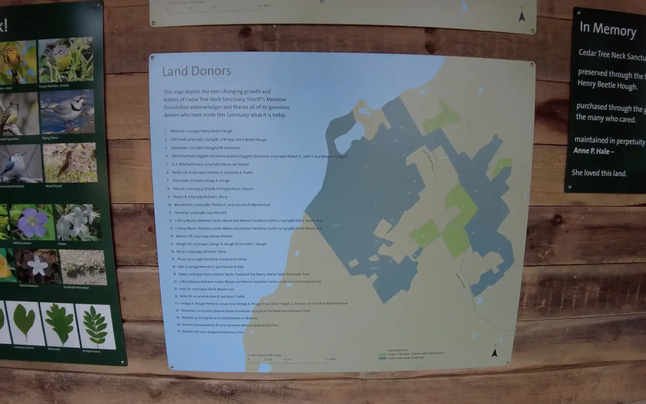
Cedar Tree Neck · the donorsPhoto by MV Vacation
The land donors remembered at the sanctuary entrance. The preserve was put together from gifts of land.
Henry Beetle Hough (1896–1985) is the central figure in Cedar Tree Neck's history. Born in New Bedford, he grew up visiting the Vineyard, where his family owned a property called "Fish Hook" on the north shore near Cedar Tree Neck. He graduated from Columbia University's Graduate School of Journalism in 1918, winning the Pulitzer Prize for Newspaper History at age 21.
At Columbia he met Elizabeth Bowie, and their 1920 marriage came with an unusual wedding gift: Hough's father bought them the Vineyard Gazette. Henry and Betty ran the paper together for 45 years, until her death in 1965, and built it into one of the country's most respected community papers; Henry sold it to James and Sally Reston in 1968.
In the mid-1960s, Hough worked with Allen H. Morgan of Massachusetts Audubon on a public campaign to buy 100 acres from the Daggett family. The Hough family donated 60 acres of their adjacent Fish Hook property. He also founded Sheriff's Meadow Foundation, which now protects over 3,500 acres across 75 preserves on the island.
Wildlife
The mix of habitats draws a long list of species. Osprey nest at the sanctuary and soar above the grassy dunes, and piping plover, a federally threatened species, have been seen along the beach. The forest has downy woodpeckers, chestnut-sided warblers, cedar waxwings and possibly the worm-eating warbler, which doesn't nest anywhere else on the Vineyard.
Ames Pond is the place for painted turtles, which sun on floating logs in spring and summer alongside snapping turtles and peeping tree frogs. The canopy is oak, American beech, maple, sassafras and black gum (locally called "Beetlebung" trees), and the wildflowers include starflower (a small white woodland flower), wild sarsaparilla and jack-in-the-pulpit.
Ticks are worth taking seriously on Martha's Vineyard. Three species are present, including the Lone Star tick, and positive alpha-gal tests at Martha's Vineyard Hospital went from 2 in 2020 to 742 in 2025. Permethrin-treated clothing and a thorough tick check after every visit go a long way. Poison ivy is also widespread along the trails.
Before you go
Hours: 8:30 AM to 5:30 PM daily. Admission: Free. Dogs: Allowed on a leash. Restrooms: None listed by Sheriff’s Meadow, so plan ahead. Swimming is not permitted at the sanctuary.
Parking at the main Daggett Trailhead is an unpaved lot with about 11 spaces, and it can fill on peak summer days.
West Tisbury · Daggett trailheadPhoto by MV Vacation
The trail map at the trailhead, posted by Sheriff’s Meadow Foundation.
Driving from the Vineyard Havenferry terminal takes about 10–15 minutes over roughly 5 miles. Take State Road west, veer right onto Indian Hill Road for 1.75 miles, then turn right onto Obed Daggett Road and follow "Sanctuary" signs for 1 mile to the parking area. Indian Hill Road is paved; Obed Daggett Road is a narrow dirt road and slow going.
Public transit does not reach the sanctuary directly. VTA Route #3 runs from the Vineyard Haven terminal to West Tisbury, but the closest stop leaves you roughly 2.75 miles from the trailhead. The VTA is fare-free through June 30, 2027.
When to go
Spring (May–June) brings migratory warblers, wildflowers, and active painted turtles at Ames Pond. Summer has the most going on (osprey, nesting shorebirds, full canopy), though the sanctuary stays much less crowded than the island's popular beaches. Fall brings good color from the oak, maple, beech and cedar mix. Winter means empty trails, woodpecker calls, and a bare, wind-scoured shore.
Seasonal beach closures for nesting terns and piping plover typically run April through August, with fenced-off nesting areas. The trails themselves remain open year-round.
Nearby
Lake Tashmoo Town Beach is roughly 3–4 miles east, with swimming on the Vineyard Sound side; Tisbury bans swimming and diving in the channel into the lake, where the current can be strong, and in summer 2026 the town lot at the end of Herring Creek Road was closed to cars for nesting birds. West Tisbury village center, home to Alley's General Store (operating since 1858), is about 3 miles south. Long Point Wildlife Refuge, The Trustees' 632-acre south-shore preserve with a swimmable beach, is roughly 8–10 miles away. Menemsha, the fishing village, is a similar distance west.
Cronig's Market (Up-Island location) sits at the State Road/Indian Hill Road junction, at the turnoff to the sanctuary. Polly Hill Arboretum, a 72-acre public garden on the National Register of Historic Places, is just 2–3 miles from the Cedar Tree Neck turnoff.
The short version: about 400 acres, free, open year-round (8:30 AM–5:30 PM), dogs on leash, no swimming, 5 miles from the Vineyard Haven ferry.
Drive about 5 miles from the Vineyard Haven ferry, 10 to 15 minutes: State Road west, right onto Indian Hill Road for 1.75 miles, then right onto Obed Daggett Road and follow the Sanctuary signs for a mile. The last stretch is a narrow dirt road. No bus reaches the trailhead; the nearest VTA stop in West Tisbury is about 2.75 miles away.
Is there parking, and does it cost anything?
Admission is free. The Daggett Trailhead lot is unpaved with roughly 11 spaces, and it can fill on peak summer days, so early or late is easier. The sanctuary is open 8:30 AM to 5:30 PM daily, year-round; Sheriff’s Meadow lists no restrooms, so plan ahead.
Are dogs allowed?
Yes, on a leash. The leash matters most on the beach, because terns and piping plover nest there and parts of the shore are fenced off from April through August. More dog-friendly spots are in our pet-friendly guide.
Can I swim at the beach?
No. Swimming is not permitted on the rocky Vineyard Sound shore, both for the nesting birds and because the currents are strong. For a swim afterward, Lake Tashmoo Town Beach is about 10 minutes east (Sound side only, since the town bans swimming in the channel, and its lot was closed to cars in summer 2026); see our Lake Tashmoo guide.
How long is the hike, and is it OK for kids?
The main loop is 1.4 miles with about 120 feet of climbing, rated easy and taking 30 to 60 minutes. Kids do fine on it, but it is not stroller-friendly: expect roots, rocks, boardwalks and deep sand, so real shoes help.
What should I bring?
Closed shoes, water and bug protection. Ticks are a real problem on the island, so permethrin-treated clothing, staying on the trail and a full tick check afterward are all worth it; poison ivy lines the paths too. Our tick safety guide has the details.
AUDIOIsland soundscapesEight field recordings: summer nights, crickets and birdsong, about ninety minutes. It keeps playing while you read on.→
Island tip of the dayTimingNo. 58 of 79New tip at midnight, island time
Oak Bluffs restaurants are packed 6–8 PM. Eat at 5 PM or after 8:30 PM: same food, half the wait, easier parking.
Useful?
More on
Four free downloads · 2026 editions
Four island guides, in your inbox
The Beach Guide (all 20 beaches decoded), The Vineyard in the Fall, the season date by date, Where to Stay, every town and price band, and What It Really Costs, the 2026 budget line by line. All four PDFs free, plus a short island letter when there is something worth telling. No schedule, no spam.
No spam, unsubscribe in one click. Want a look first? See what you get.
First email ever from us? Give it a minute, and peek in spam once.
Disclaimer: The information in this article is provided for general guidance only and was accurate at the time of writing. Beach conditions, hours, prices, lifeguard schedules, ferry fares, and business operations change frequently and without notice. Ocean swimming carries inherent risks including rip currents, undertow, and cold water shock. Always verify current conditions with official local sources before your visit. MV Vacation assumes no responsibility for any loss, injury, or inconvenience resulting from the use of this information. Swim only where lifeguards are on duty, supervise children at all times near water, and follow all posted safety signs.
A guide to Martha's Vineyard, written on the island: beaches, dining, events and island living. We write down what we know about the island so your trip goes the way you hoped.
The island's farmers markets, checked October 2026: the West Tisbury Farmers Market at the Agricultural Hall (Saturdays to October 31, 9 AM to noon), the Harvest Festival on October 24, the indoor winter market, Edgartown's summer Tuesday market, and the farm stands that stay open all year.
Shellfishing on Martha's Vineyard town by town: what each of the six towns charges a visitor for a permit and what it covers, where to buy it, weekly limits and sizes, the 2026 to 2027 bay scallop dates published so far, how to check storm and rain closures, and keeping the catch safe to eat.
Joshua Slocum, first to sail alone around the world, spent his last years farming in West Tisbury and vanished from Vineyard Haven harbor in November 1909. The voyage, the farm called Fag End, the last departure, and what a visitor can actually see: the harbor, a marker stone by a country road, the museum's Slocum papers, and the book itself.
Martha's Vineyard's ponds explained: the great ponds sealed behind the south-shore beach and cut open to the sea by an excavator, the salt ponds with tides and scallops, the freshwater kettle ponds, why cyanobacteria blooms turn some of them green in August and what MV Cyano's colors mean, the nitrogen under the houses, and where a visitor can swim, paddle and watch the cut.
Where Martha's Vineyard's oysters, bay scallops and quahogs come from: the public solar hatchery on Lagoon Pond that turned fifty in 2026, the dozen oyster farms in Katama Bay, Menemsha Pond and Vineyard Sound, the wild beds in the great ponds, the autumn scallop season and its limits, visitor shellfish permits by town, why rain closes a pond, and where to eat them.
Mytoi, the Japanese garden on Chappaquiddick: how to get there on the Chappy ferry, the 15-car lot, hours and admission by season, the pond and bridge, birch walk and camellia dell, the story of Hugh Jones, Mary Wakeman and the rebuild after Hurricane Bob, rules, accessibility and when to go.
Subscribe
The free island library · 2026
One short island letter, and all four guides to start
Beach reports, events worth a day, ferry heads-ups. Sent when there is something worth telling. The Beach Guide, The Vineyard in the Fall, Where to Stay and What It Really Costs arrive with your welcome email.
The Beach Guide, The Vineyard in the Fall, Where to Stay and What It Really Costs. No spam, one-click unsubscribe.
We use cookies for trip planning, site stats and ads, including ads based on your browsing. To opt out, turn on Global Privacy Control in your browser. Cookie policy
These cookies are essential for the website to function properly.
These cookies help us understand how visitors interact with the website.
These cookies are used to deliver personalized advertisements.