Southern New England · the islandsMap by MV Vacation
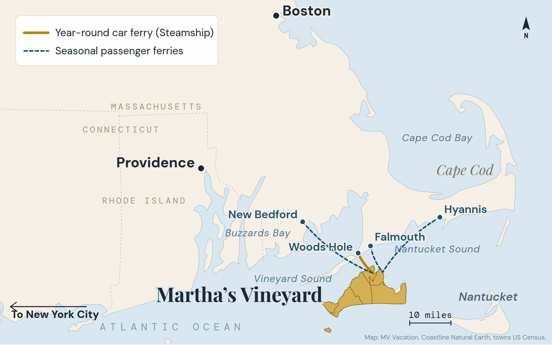
Martha’s Vineyard sits south of Cape Cod, with Nantucket to the east. The gold line is the year-round Steamship Authority ferry from Woods Hole; the dashed lines are the summer passenger boats.
Where Martha's Vineyard is, with our own maps: an island in Dukes County, Massachusetts, under four miles across Vineyard Sound from Woods Hole on Cape Cod, 75 miles from Boston and 70 from Providence by road. How big it is, the six towns, up-island and down-island, every way to get there and where the name comes from.
Martha’s Vineyard is an island off the south coast of Cape Cod, in Massachusetts. Less than four miles of Vineyard Sound separate it from Woods Hole, at the southwest corner of the Cape, and the Steamship Authority ferry makes that crossing in about 45 minutes, all year. Woods Hole is about 75 miles from Boston and 70 from Providence. Here is where the island sits, how big it is, which town is where, and every way to get there.
Martha’s Vineyard is part of Dukes County, Massachusetts, which is made up of the island’s six towns plus Gosnold, the small town on the Elizabeth Islands. It is not part of Cape Cod, which is Barnstable County; the two face each other across Vineyard Sound.
North: Cape Cod and Woods Hole. NOAA puts the island’s northern tip about three nautical miles southeast of the western end of the Cape. The lighthouses at Nobska Point in Woods Hole and West Chop on the island are a little under four miles apart.
Northwest: the Elizabeth Islands, a chain running about 16 miles west-southwest from the Cape, with Buzzards Bay beyond them.
East: Nantucket, across Nantucket Sound. The gap between Chappaquiddick and the little island of Muskeget, on Nantucket’s side, is about seven miles.
South: the open Atlantic.
On the U.S. Geological Survey’s map the island is listed at 41°25′ north, 70°37′ west.
How big it is
The island is a little over 20 miles long, from the cliffs at Aquinnah to the far shore of Chappaquiddick; NOAA’s Coast Pilot gives the two together a combined length of 18 nautical miles. Guidebooks usually say about 96 square miles, and the 2020 Census counts 90 square miles of land in the six towns, about twice Nantucket’s. Our guide to the island’s size has the town-by-town numbers.
About 20,500 people lived on the island year-round in the 2020 Census, and the Census estimate for 2025 is about 21,150. In summer the number climbs: the Martha’s Vineyard Commission’s 2024 study put the likely maximum on a peak August day at about 94,650.
Before you book
What Martha’s Vineyard really costs, free
Ferry fares by the day of the week, the room tax every town charges and four whole trips added up. Free with the island letter, together with our Beach, Fall and Where to Stay guides.
One-click unsubscribe, and we never share your email.
The six towns, and up-island and down-island
Martha’s Vineyard · the six townsMap by MV Vacation
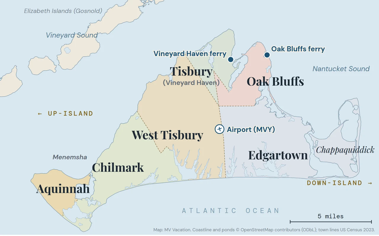
The six towns, the two ferry terminals and the airport. Up-island is the rural west end; down-island is the three port towns in the east.
The clay cliffs and the ancestral land of the Wampanoag Tribe of Gay Head (Aquinnah). The smallest town, about 440 people in 2020.
Islanders split the map in two. Down-island is the three port towns, Vineyard Haven, Oak Bluffs and Edgartown; up-island is West Tisbury, Chilmark and Aquinnah. It looks backward on a map, since up-island is to the west. The usual explanation is longitude, which counts up as you go west, though some islanders put it down to the old sailing routes and the wind. Nobody has settled it.
How to get there
There is no bridge, so everyone arrives by boat or plane. The short version, from the three cities most visitors come from:
From Boston: about 75 miles by road to Woods Hole, usually 75 to 90 minutes without traffic and a lot longer on a summer Friday. Peter Pan buses run from South Station and Logan Airport right to the Woods Hole ferry, in about an hour and a half to two hours. Cape Air flies from Logan all year, about 40 minutes. Our Boston guide compares them.
From Providence: about 70 miles to Woods Hole. In summer two boats run closer to Providence, Seastreak from New Bedford and the Vineyard Fast Ferry from Quonset Point, but both have finished for 2026. More in our Providence guide.
From New York: roughly five hours by car to Woods Hole. In season JetBlue and Delta fly from the New York airports and Cape Air from JFK and White Plains, and Seastreak runs a boat from Manhattan on select summer weekends (done for 2026). Our New York guide covers the car-free routes.
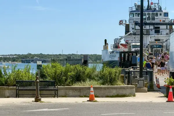
The ferries. The Steamship Authority runs from Woods Hole all year and is the only ferry that takes cars; a car needs a reservation. In summer, passenger boats also run from Falmouth, Hyannis, New Bedford and Rhode Island. After October 25 the Steamship is the only boat until spring. Our ferry guide has every route, and its ferry board shows the next sailing.
Flying. Martha’s Vineyard Airport (MVY) is in the middle of the island, in West Tisbury. Cape Air flies all year, and JetBlue, Delta, American and Tradewind add seasonal flights. See our airport guide for routes.
Getting around once you’re here
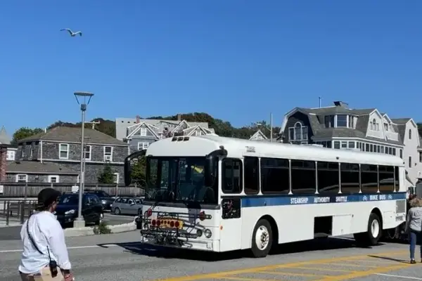
You don’t need a car. The VTA buses run all year, except on Thanksgiving and Christmas Day, meet the boats and stop at the airport, and they are fare-free through June 30, 2027. Our bus guide and the car-free guide have the routes.
Where the name comes from
The Wampanoag, who have lived here for thousands of years, call the island Noepe, which the Tribe’s own glossary translates as “dry land.” The English name goes back to Bartholomew Gosnold’s voyage in 1602. Which Martha he meant is not known; as the Martha’s Vineyard Museum puts it, no one really knows why, and through the 1600s the island was more often called Martin’s Vineyard. The apostrophe is official: the U.S. Board on Geographic Names settled on “Martha’s Vineyard” in 1933. For a respectful visit to Aquinnah, see our Aquinnah guide.
Frequently Asked Questions
Is Martha’s Vineyard part of Cape Cod?
No. It is its own county, Dukes County, across Vineyard Sound from Cape Cod, which is Barnstable County. Most people still reach it through the Cape, from the ferry at Woods Hole.
How far is Martha’s Vineyard from Boston?
About 75 miles by road to the Woods Hole ferry, then a 45-minute crossing. The flight from Logan takes about 40 minutes.
Can you drive to Martha’s Vineyard?
Not across a bridge, because there isn’t one. You can bring a car on the Steamship Authority ferry from Woods Hole with a reservation, or leave it on the mainland and ride the island’s buses.
Is Martha’s Vineyard bigger than Nantucket?
Yes, about twice as big by land: the six Vineyard towns have 90 square miles of land, Nantucket County 46.
Which town should I stay in?
For a first trip without a car, one of the three down-island towns, Vineyard Haven, Oak Bluffs or Edgartown, where the ferries, most restaurants are. Up-island is quieter and better with a car or a bike. Our where-to-stay guide compares them.
Island tip of the dayShoppingNo. 32 of 86New tip at midnight, island time
No standalone McDonald's, Starbucks, or Dunkin' on MV, but Edgartown Meat and Fish Market has a licensed Starbucks counter inside. The only spot for Starbucks coffee on the island.
Useful?
More on
Four free downloads · 2026 editions
Four island guides, in your inbox
The Beach Guide (all 20 beaches decoded), The Vineyard in the Fall, the season date by date, Where to Stay, every town and price band, and What It Really Costs, the 2026 budget line by line. All four PDFs free, plus a short island letter when there is something worth telling. No schedule, no spam.
No spam, unsubscribe in one click. Want a look first? See what you get.
First email ever from us? Give it a minute, and peek in spam once.
Disclaimer: The information in this article is provided for general guidance only and was accurate at the time of writing. Beach conditions, hours, prices, lifeguard schedules, ferry fares, and business operations change frequently and without notice. Ocean swimming carries inherent risks including rip currents, undertow, and cold water shock. Always verify current conditions with official local sources before your visit. MV Vacation assumes no responsibility for any loss, injury, or inconvenience resulting from the use of this information. Swim only where lifeguards are on duty, supervise children at all times near water, and follow all posted safety signs.
A guide to Martha's Vineyard, written on the island: beaches, dining, events and island living. We write down what we know about the island so your trip goes the way you hoped.
Martha's Vineyard in December 2026: First Friday on December 4, Light Up Oak Bluffs on December 5, Christmas in Edgartown December 10 to 13, 4:15 sunsets, one ferry into Vineyard Haven, and what stays open through Christmas.
All six town libraries on Martha's Vineyard, checked October 2026: hours and addresses, how visitors get a library card, free Wi-Fi, the concerts, art shows and programs, the Libraries of Things with beach chairs and stargazing kits, museum and beach parking passes, and a short history of each building.
Cell service on Martha's Vineyard town by town: towers down-island, no tower in Chilmark or Aquinnah and the named dead spots, what each carrier reports to the FCC, free Wi-Fi at all six libraries and on the ferry, the $10 xfinitywifi pass, prepaid plans and 911 when you have no bars.
The twelve things that catch first-timers on Martha's Vineyard, from car reservations and the two ferry terminals to resident-only beaches, the last bus from Aquinnah and cash for the Chappy Ferry, each with an easy fix, plus the fall and winter dates.
EV charging on Martha's Vineyard: about 34 public stations, nearly all Level 2, listed town by town with ports and prices (the Edgartown Park and Ride, town halls, libraries, the airport, the Aquinnah cliffs), two fast-charging ports at the VTA, the Chilmark plans, no Supercharger, the ferry's EV rules, and how to run an electric week on a 20-mile island.
Parking for the Woods Hole ferry: there is none at the terminal, so here are the three Steamship Authority lots (Palmer Avenue, Thomas B. Landers, Cataumet), the 2026 rates ($25 a day April to October, $20 otherwise), the free shuttle timed to every sailing, when to arrive, the annual and off-season permits, the drop-off rule and the cheaper Island Queen lot in Falmouth Harbor.
Subscribe
The free island library · 2026
One short island letter, and all four guides to start
Beach reports, events worth a day, ferry heads-ups. Sent when there is something worth telling. The Beach Guide, The Vineyard in the Fall, Where to Stay and What It Really Costs arrive with your welcome email.
The Beach Guide, The Vineyard in the Fall, Where to Stay and What It Really Costs. No spam, one-click unsubscribe.
We use cookies for trip planning, site stats and ads, including ads based on your browsing. To opt out, turn on Global Privacy Control in your browser. Cookie policy
These cookies are essential for the website to function properly.
These cookies help us understand how visitors interact with the website.
These cookies are used to deliver personalized advertisements.