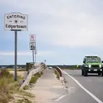
Martha's Vineyard Jaws Tour: Walk the Real Amity Island with a Local Guide
Take a guided Jaws tour of Martha's Vineyard with local guide Mike Currid. Walk the real Amity Island in Edgartown and book the "Amity" Walking Tour.


Complete kayak guide to Martha's Vineyard: 10 launch sites, 10 routes, 5 rental operators, shark safety, tidal current warnings & scalloping tips.
⚠️ Safety Warning
Kayaking can be dangerous. Martha's Vineyard waters include great white sharks, strong tidal currents, cold water that can cause hypothermia, and heavy ferry traffic. Always wear a PFD, check conditions before launching, never paddle alone in open water, and dress for the water temperature — not the air. This guide is for informational purposes only and does not replace professional instruction or local knowledge.
Martha's Vineyard is one of the best kayaking destinations on the East Coast — and most visitors never figure that out. While the beaches fill up and the ferries run standing-room-only, the island's network of ponds, harbors, and protected bays sits largely uncrowded, accessible by paddle. Ten significant ponds, hundreds of miles of shoreline, osprey nesting on every other pond, and water so clear you can watch horseshoe crabs crossing the sandy bottom. This guide covers every launch site, every route from beginner to expert, every rental operator on the island, and the safety information you absolutely need before you get on the water.
Already have a sense of when you want to come? See the best time to visit guide for seasonal context — September is the single best month for kayaking on the island.
Table of contents [Show]
| Launch Site | Town | Type | Skill Level | Rental On Site | Best For |
|---|---|---|---|---|---|
| Sengekontacket Pond | Oak Bluffs / Edgartown | Pond | Beginner | Yes (Island Spirit Kayak) | Families, first-timers, wildlife |
| Lagoon Pond | Vineyard Haven / Oak Bluffs | Pond | Beginner | Yes (Wind's Up) | Beginners, windsurfers, calm water |
| Lake Tashmoo | Vineyard Haven | Pond / inlet | Beginner–Intermediate | Nearby (Wind's Up) | Sunset paddles, circumnavigation |
| Felix Neck Wildlife Sanctuary | Edgartown | Pond / estuary | Beginner | Yes (Felix Neck) | Naturalist tours, birding |
| Poucha Pond, Chappaquiddick | Edgartown / Chappaquiddick | Pond | Intermediate | Yes (Trustees) | Solitude, Cape Poge wildlife |
| Edgartown Great Pond | Edgartown | Pond | Intermediate | No | Long-distance, hidden beaches |
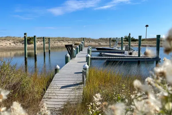
| Katama Bay | Edgartown | Bay / coastal | Intermediate | No | Tidal flats, ocean connection |
| Tisbury Great Pond | West Tisbury | Pond | Intermediate | No | Expedition, barrier beach access |
| Menemsha Pond chain | Chilmark | Pond chain | Beginner–Intermediate | Yes (Book-A-Boat) | Scenic, fishing villages, connected ponds |
| Chilmark Pond | Chilmark | Pond | Beginner | No | Hidden gem, remote beach access |
Martha's Vineyard is not a forgiving environment for unprepared paddlers. The hazards are real, specific, and worth understanding before you get in a boat. This section is not filler — read it.
Since 2018, confirmed great white shark sightings near Martha's Vineyard and the Cape & Islands have increased significantly, driven by the recovering gray seal population. Seals are the primary prey. Avoid paddling in areas with visible seal haul-outs or large seal concentrations — particularly around Vineyard Sound, the south shore, and areas near Chappaquiddick in fall months. Download the Sharktivity app (free, by Atlantic White Shark Conservancy) before your trip and check it the morning of any paddle. Shark sightings are reported in real time. If you see a seal near your kayak, it's not a Kodak moment — move away calmly and quickly. Kayaks can be mistaken for seals from below.
The island's geography creates some punishing tidal currents in specific locations. Devil's Bridge (off the Aquinnah cliffs) runs up to 3.5 knots during peak ebb or flood — strong enough to make paddling impossible and capsizing likely. Muskeget Channel (between Chappaquiddick and Nantucket) reaches 5 knots and is expert-only, period. Edgartown Harbor runs up to 3 knots during tidal exchange and is complicated by heavy ferry and motorboat traffic. The protected ponds covered in this guide are largely current-free, but any outlet to the ocean or a harbor requires checking tide charts first. Free tide charts: NOAA Tides & Currents.
The real swimming season on Martha's Vineyard runs July through September only, when ocean water reaches 67–70°F. Outside those months, water temperatures are cold enough to incapacitate a swimmer within minutes. Apply the 1-10-1 rule: 1 minute of cold shock upon immersion (gasping, panic), 10 minutes of meaningful swimming ability before muscles fail, and 1 hour before unconsciousness from hypothermia. Always dress for the water temperature, not the air temperature. If you're paddling in May, June, or October, wear a wetsuit regardless of how warm the air feels. A 65°F air temperature with 50°F water is a life-safety situation if you capsize.
Martha's Vineyard is exposed to the Atlantic, and afternoon southwest winds are a predictable pattern from late spring through early fall. Winds that start at 5–8 knots in the morning routinely build to 15–20 knots by early afternoon. Paddle mornings whenever possible — launch by 8 or 9AM and be off the exposed water by noon. Open bays like Katama and the exposed ponds on the south shore are significantly affected. Wind forecasts: check Windy.com or the National Weather Service marine forecast.
Ferries operate continuously in Vineyard Haven and Oak Bluffs harbors, and in Edgartown during summer. A kayak is nearly invisible to a ferry or large powerboat captain. Never cross a ferry lane without confirming the channel is clear. Wear bright colors. Use a signal flag if you have one. In general, avoid Vineyard Haven Harbor inner approaches and the Oak Bluffs ferry slip area during peak hours.
The single best beginner kayaking destination on Martha's Vineyard. At 745 acres with an average depth of just 3 feet, Sengekontacket is calm, warm in summer, and ringed with osprey nests, egrets, and diamondback terrapins. The pond sits between the Oak Bluffs and Edgartown town lines, separated from Nantucket Sound by a narrow barrier beach (Joseph Sylvia State Beach, also called the Beach Road). Island Spirit Kayak operates directly on the pond — you can rent and launch in minutes. The bridge on Beach Road is a good landmark and natural turnaround point. Look for osprey nests on channel markers and the remains of cedar fish weirs along the shore. The pond is shallow enough that wading is possible almost everywhere if you tip over.
Mass Audubon's Felix Neck sanctuary sits on a peninsula between Sengekontacket and Edgartown Great Pond, with kayak access to protected coves and naturalist-led tours. Guided kayak tours run $50–60 per boat and are led by Audubon naturalists who can identify every bird, fish, and plant along the route. Solo rentals are also available. The guided experience is genuinely worth the price — you'll leave knowing far more about the pond's ecology than you came with. Book ahead in July and August.
The ferry to Chappaquiddick runs continuously from Edgartown (4 minutes, $5 for a kayak) and drops you at the edge of one of the island's least-crowded paddling environments. Poucha Pond connects to Cape Poge Bay, and the Trustees of Reservations offer rentals at $25/hour — the most affordable option on the island. The route to Cape Poge Lighthouse takes intermediate paddlers through a tidal gut that requires tide awareness but rewards with total solitude. Osprey, terns, and harbor seals are regular sights. Avoid the outer Cape Poge area when the wind is up — the open water exposure increases quickly once you leave the pond.
At 544 to 840 acres (the surface area varies with seasonal cuts to the ocean), Edgartown Great Pond is the largest of the island's great ponds and one of the finest long-distance kayak destinations in New England. Fifteen miles of shoreline, multiple coves and arms to explore, and a hidden Land Bank beach accessible only by water. The put-in is off Meetinghouse Road (look for the Land Bank access point). A full exploration takes 4–6 hours. Bring lunch. The south end of the pond occasionally opens to the ocean through a temporary cut, creating tidal current — check locally before paddling near the south shore. Scalloping season (October–March) brings additional boat traffic on the pond.
At 1,695 acres, Katama Bay is the largest coastal embayment on the island. It's wind-exposed and subject to tidal flushing through the South Beach barrier, making it an intermediate destination. The pay-off is spectacular views, tern colonies, and the sense of genuine open water. Launch from the public ramp at Katama Landing (off Katama Road). Paddle the western shoreline, which is more sheltered than the south and east sides. Avoid the inlet at South Beach entirely — the current there is dangerous and the surf can be significant. See the beach guide for South Beach parking and access logistics.
Wind's Up sits right on Lagoon Pond in Vineyard Haven, making this the most convenient rental operation on the island. The pond covers 544 acres and is almost entirely protected from wind, with calm, warm water that's ideal for beginners. One important detail: the Lagoon Pond drawbridge (on Beach Road) opens on schedule — check the bridge schedule before planning a crossing if you want to paddle the full pond from north to south. The south end connects toward Oak Bluffs, offering an interesting exploration if you time the bridge. Osprey and cormorants are common. Lagoon Pond is the island's hub for windsurfing and kiteboarding, so watch for those craft, especially on windy afternoons.
Locals' favorite, and for good reason. At 269 acres, Lake Tashmoo is small enough to circumnavigate in about 2 hours at a relaxed pace — perfect for an evening sunset paddle. The lake connects to Vineyard Sound through a narrow inlet at its north end, giving it a slight tidal influence but no dangerous current. Launch from the town landing at the end of Lake Tashmoo Road. The western shore is undeveloped and quiet. Evening paddles here, with the sun dropping over the sound and ospreys returning to their nests, are among the best experiences on Martha's Vineyard. Wind's Up in Vineyard Haven rents kayaks with delivery available — call ahead to arrange drop-off at the town landing.
At 800 acres, Tisbury Great Pond is the island's most rewarding all-day kayak expedition. The pond sits in West Tisbury, separated from the Atlantic by a narrow barrier beach accessible only by kayak or foot. No road access means the south shore is among the most remote and undisturbed landscapes on Martha's Vineyard. Launch from the public access at the end of Old County Road. Budget 5–8 hours for a full exploration, and bring everything you need — there are no facilities. The pond occasionally connects to the ocean through a seasonal cut. When the cut is open, tidal flow creates current — don't paddle near it. Check with locals before launching during cut season (typically late spring or summer).
The connected ponds of Chilmark — Menemsha Pond, Nashaquitsa Pond, and Stonewall Pond — form a 3–4 mile chain of connected water with character unlike anywhere else on the island. Menemsha village (the island's working fishing harbor) sits at the pond's western end, and Book-A-Boat offers rentals from $49 (singles half-day) to $69 (doubles). The narrows between Menemsha and Nashaquitsa require a short portage or a careful squeeze at high tide. Nashaquitsa is quieter and wilder. Stonewall Pond, the innermost, is almost completely undisturbed. The whole chain rewards an early-morning start — fishing boats, egrets on the flats, and the cliffs of Aquinnah visible to the west. See the fishing guide for context on Menemsha Harbor's fishing scene.
The hidden beginner gem of the west side. Chilmark Pond is small, protected, and rarely visited by tourists. No rental operation on site means you need to bring your own boat or arrange delivery from Book-A-Boat or Wind's Up. The reward is complete quiet and a paddle to a remote barrier beach that sees almost no foot traffic. Access is limited — use the public right-of-way off South Road and confirm access conditions locally before hauling a boat in. Best in early morning when the water is flat and the light is extraordinary. Check the sunset guide for the best evening light locations on the west side.
| Operator | Location | Hourly Rate | Half-Day / Full-Day | Guided Tours | Special Offerings |
|---|---|---|---|---|---|
| Island Spirit Kayak | Sengekontacket Pond (Oak Bluffs) | ~$35/hr | Half-day available | $75–$175 | Glow-in-the-dark / bioluminescence tours $120; sunset tours |
| Wind's Up | Lagoon Pond (Vineyard Haven) | ~$35/hr | $85/full day | No | Delivery to other ponds $80; also rents SUPs, windsurfers |
| Book-A-Boat | Menemsha / Chilmark | N/A | Singles $49 half-day, Doubles $69 half-day | No | West side focus; covers Menemsha Pond chain |
| Felix Neck (Mass Audubon) | Felix Neck Sanctuary (Edgartown) | $50–$60/boat | Session-based | Yes — naturalist-led $50–$60 | Wildlife and ecology focus; advance booking required |
| Trustees (Chappaquiddick) | Poucha Pond (Chappaquiddick) | $25/hr | Half-day available | No | Adaptive kayaking at Long Point; most affordable rates on island |
Booking tip: In July and August, all operators book out days or weeks in advance. Call or book online as soon as your trip is confirmed. Shoulder season (May–June, September–October) has same-day availability most days. Island Spirit Kayak's bioluminescence tours sell out weeks ahead — book those immediately once you have dates.
Skill: Beginner | Time: 1–1.5 hours | Launch: Island Spirit Kayak on Beach Road
The classic introduction to MV kayaking. Paddle north from the Island Spirit dock along the western shore, passing osprey nesting platforms and shallow eel grass beds, then loop back along the eastern shore near the Beach Road causeway. The water is rarely more than 4 feet deep. This is the right route to build confidence, learn to read wind and wake, and simply enjoy the pond's extraordinary wildlife. Diamondback terrapins sun themselves on logs in June and July. Harbor seals occasionally appear in fall.
Skill: Beginner | Time: 1.5–2 hours | Launch: Wind's Up, Beach Road, Vineyard Haven
Paddle north toward the drawbridge, then south toward the Oak Bluffs end of the pond. The pond narrows toward the south, creating interesting channels and coves. The east shore is largely undeveloped. Wind's Up has paddleboards and windsurfers on the water simultaneously — stay to the right of the channel if wind sport traffic is heavy. Good for families with children who want predictable, flat water.
Skill: Beginner–Intermediate | Time: 1.5–2 hours | Launch: Lake Tashmoo Town Landing
Put in at the town landing and paddle counter-clockwise. The western shore is undeveloped oak and scrub forest. The north end has a narrow inlet to Vineyard Sound — paddle in to see it but don't exit into the Sound unless you're experienced with tidal currents. The eastern shore has private homes and docks but the water access is public. Tashmoo's clarity is remarkable in clear weather — you can watch stripers and bluefish working the eel grass from your kayak. A sunset circumnavigation starting around 6PM in summer is one of the best kayak experiences on the island.
Skill: Beginner–Intermediate | Time: 2–3 hours | Launch: Menemsha village, Book-A-Boat
Launch from the Menemsha area and paddle east through the narrow connection to Nashaquitsa Pond, then continue to Stonewall Pond if tides allow. The narrows between Menemsha and Nashaquitsa require care — it's shallow at low tide and the passage is narrow. Time your launch for mid-tide to make the passage comfortably. Stonewall is the quietest, most remote of the three ponds. Reverse course and return to Menemsha for a post-paddle sunset — the fishing village light over the harbor is outstanding. See the Chilmark guide for Menemsha village details.
Skill: Intermediate | Time: 2–4 hours | Launch: Trustees landing, Chappaquiddick
Take the Chappaquiddick ferry from Edgartown with your kayak or rent from the Trustees. Launch into Poucha Pond and paddle east toward the Cape Poge tidal gut. At mid-to-high tide, the gut allows passage into Cape Poge Bay — a remote, pristine embayment with the Cape Poge Lighthouse visible in the distance. Harbor seals haul out on sandbars in fall and winter. Shorebirds, including piping plovers, nest on the outer beach in spring. Return through the gut on a rising or high tide. Don't attempt the gut at low tide or on a strong ebb. Full details on Chappaquiddick access and logistics.
Skill: Intermediate | Time: 3–5 hours | Launch: Land Bank access, Meetinghouse Road
Launch from the north end of the pond and paddle south, exploring the arms and coves as you go. The western arm holds the hidden Land Bank beach — accessible only by water, with no facilities, and usually empty. The south end of the pond (approaching the barrier beach) has the potential for tidal current if the seasonal cut to the ocean is open — stay north of the middle section if you're unsure. Plan for a 4–5 hour outing minimum to do the pond justice. Bring lunch and plan for the return paddle against afternoon wind if you start late. The pond is excellent for scalloping in season (October–March with town license).
Skill: Intermediate | Time: 4–6 hours | Launch: Old County Road public access, West Tisbury
The most remote paddling experience on Martha's Vineyard. Launch at first light, paddle south across the main pond, and follow the arms toward the barrier beach. The beach itself — which you reach by landing your kayak and walking over the dune — is one of the most isolated spots on the island. No roads reach it. In summer, you may have company from a few other paddlers. In May, September, or October, you may be completely alone. Bring water, food, sun protection, and a dry bag for everything. Check the weather carefully: afternoon wind across 800 acres of open water creates conditions that are tiring even for experienced paddlers.
Skill: Intermediate | Time: 2–3 hours | Launch: Katama Landing, Katama Road
Launch from Katama Landing and paddle the western shoreline of the bay, staying away from the South Beach inlet. The bay's tidal flats are exposed at low tide, creating extensive shallow areas where you can watch horseshoe crabs, wading birds, and schools of baitfish. The blue crab population here is significant — worth watching carefully in warm water months. Wind exposure is the key variable: morning launches in calm conditions are excellent. Afternoon launches with any south or southwest wind are ill-advised. Check the weather guide before any open-water paddle here.
Skill: Advanced | Time: 2.5–3.5 hours | Launch: Oak Bluffs Harbor or State Beach
A coastal paddle along the northeast shore of the island, exposed to Nantucket Sound. The route passes State Beach, the barrier beach at Sengekontacket, and arrives in Edgartown Harbor. Conditions matter enormously — this is an open-water paddle with no shelter in northerly or easterly wind. Check forecasts carefully and have a clear plan for where to land if conditions deteriorate. Heavy powerboat traffic in summer. Requires solid bracing skills and the ability to handle 1–2 foot wind chop. Not a first-time open-water paddle. Know the Edgartown harbor approach and be aware of ferry traffic at the harbor entrance.
Skill: Expert only | Time: 2.5–4 hours | Launch: West Chop or Vineyard Haven Harbor
The crossing of Vineyard Sound to the Elizabeth Islands is a serious open-water undertaking. Tidal currents running up to 2–3 knots across the Sound, heavy commercial and recreational boat traffic, ferry wakes, and exposure to all wind directions make this route appropriate only for experienced sea kayakers with proper equipment (sea kayak, spray skirt, pump, paddle float, VHF radio). The crossing to Naushon Island (the largest Elizabeth Island) is achievable in calm conditions at slack tide, but the Elizabeth Islands are mostly private land with limited legal access points. This route requires local knowledge and ideally a partner with experience. File a float plan before departing.
| Period | Water Temp | Wind Pattern | Crowds | Wetsuit? | Verdict |
|---|---|---|---|---|---|
| May–June | 50–61°F (cold) | Variable, strong | Low | Required | Experienced paddlers only; beautiful and uncrowded |
| July–August | 68–70°F (warm) | SW builds afternoons | Very high | No | Peak season; rentals book out; paddle early mornings |
| September | 67°F (warm) | Calmer than summer | Moderate | No | Best month of the year — warm water, less wind, fewer crowds |
| October | 62°F (cool) | Northerlies increase | Low | Recommended | Excellent if dressed right; scalloping season begins; dramatic light |
| November–April | 38–47°F (very cold) | Strong, unpredictable | Very low | Drysuit required | Expert only; most rentals closed; remote and beautiful |
The single most important timing rule: paddle before 10AM. Regardless of the month, mornings on Martha's Vineyard tend to be calmer, clearer, and more wildlife-active than afternoons. The southwest sea breeze that makes summer beaches pleasant is the same wind that makes afternoon kayaking on exposed water genuinely tiring. Plan your launch for 7–9AM and be back on shore by noon on any day with predicted afternoon wind above 10 knots.
For a full breakdown of island conditions by month, the Martha's Vineyard weather by month guide covers ocean temperatures, wind patterns, and rainfall for every month of the year.
Kayaking is the single best way to encounter Martha's Vineyard's wildlife. At water level, silent and slow, you enter the pond ecosystems rather than observing them from a distance. Here's what you'll find on the water by season:
Martha's Vineyard supports 60–70 breeding pairs of osprey — one of the densest osprey populations in New England. They nest on channel markers, utility poles, and dedicated nesting platforms throughout all the major ponds. Nesting season runs April through August. Osprey begin hunting actively as soon as the water warms in late May — you'll see them hovering 30–50 feet over the water, then diving feet-first to catch fish. Sengekontacket, Lagoon Pond, and Lake Tashmoo all have reliable osprey sightings from May through October.
The horseshoe crab spawning run happens on spring high tides in late May and June — a prehistoric spectacle that draws birders from across the country for the shorebirds it supports. Kayaks allow quiet observation from close range that would be impossible on foot. Look for the pale-green egg masses along sandy pond margins. Handle nothing — the crabs are protected and stressed by handling.
Harbor seals return to Martha's Vineyard in late September and stay through April, hauling out on sandbars and rocky ledges near tidal inlets. They're most visible near Cape Poge, the Edgartown Great Pond outlet, and Katama Bay. From a kayak, you can approach within viewing distance while the seals are in the water — they're naturally curious. If a seal approaches your boat, stay still and enjoy the encounter, but don't encourage it. Remember that where seals are concentrated, great white sharks may not be far away — consult Sharktivity before paddling any seal haul-out area.
The island's ponds support a healthy population of diamondback terrapins, a protected coastal turtle species. They're most visible from kayaks in June and July, basking on logs, rocks, and floating debris in the warm shallows of Sengekontacket and Lagoon Pond. Females come ashore to nest in June — give any turtle you encounter on shore a wide berth. Never approach, touch, or pick up nesting turtles.
On warm, calm, moonless summer nights (typically July and August, sometimes into September), certain ponds on Martha's Vineyard exhibit bioluminescence — dinoflagellates in the water glow blue-green when agitated by paddle strokes. Island Spirit Kayak's glow tours ($120) run on appropriate nights — the guide selects the pond and timing based on current conditions. It's not guaranteed every tour, but when it happens, it's genuinely magical. The bioluminescence is most intense in protected, brackish ponds with warm water and specific plankton blooms. Book the tour rather than attempting to find it independently — local knowledge on which ponds are active on a given night makes all the difference.
Martha's Vineyard bay scallops are among the finest in the world — small, sweet, and harvested from the same ponds you paddle. The season runs October through March with specific dates varying by town and year. Each town issues its own shellfish licenses for recreational harvesting:
| Town | License Cost (approx.) | Daily Limit | Best Ponds | License Office |
|---|---|---|---|---|
| Edgartown | $50–$75 (resident/non-resident) | 1 bushel | Edgartown Great Pond, Katama Bay | Edgartown Town Hall |
| Oak Bluffs | $50–$100 | 1 bushel | Sengekontacket Pond (shared with Edgartown) | Oak Bluffs Town Hall |
| Tisbury (Vineyard Haven) | $50–$100 | 1 bushel | Lake Tashmoo, Lagoon Pond | Tisbury Town Hall |
| Chilmark | $100–$250 | 1 bushel | Menemsha Pond, Nashaquitsa | Chilmark Town Hall |
| West Tisbury | $50–$100 | 1 bushel | Tisbury Great Pond | West Tisbury Town Hall |
Kayak scalloping is extraordinarily efficient: you can move quietly across eel grass beds, spot scallops through polarized sunglasses in clear shallows, and work areas that motorboat scallopers can't reach due to depth. You need a mesh bag that can hang over the side of your kayak, a pair of neoprene gloves, and a pair of polarized sunglasses. The scallop season overlaps with the fall foliage and late-season paddling window — October mornings on Edgartown Great Pond or Tisbury Great Pond, scalloping and watching the mist burn off, are among the quietest pleasures Martha's Vineyard offers. See the fishing and Derby guide for more on island shellfish and fishing traditions.
Also note: if you're bringing your dog on your kayaking trip, most ponds allow dogs in kayaks — but keep them leashed near nesting birds and terrapin areas, and always bring a water bottle for them on warm days.
⚠️ Safety Warning
Kayaking can be dangerous. Martha's Vineyard waters include great white sharks, strong tidal currents, cold water that can cause hypothermia, and heavy ferry traffic. Always wear a PFD, check conditions before launching, never paddle alone in open water, and dress for the water temperature — not the air. This guide is for informational purposes only and does not replace professional instruction or local knowledge.
Plan Your Martha's Vineyard Kayaking Adventure
Book guided kayak tours, sunset paddles, and bioluminescence experiences with local operators. Browse all Martha's Vineyard outdoor tours →
🚌 Island Tip of the Day — Transport
Bike rental options: Anderson's (Oak Bluffs, since 1971), Martha's Bike Rentals (Oak Bluffs Ave), MVeBike (e-bikes $60–85/day), and R.W. Cutler. Most offer island-wide delivery.
Take a guided Jaws tour of Martha's Vineyard with local guide Mike Currid. Walk the real Amity Island in Edgartown and book the "Amity" Walking Tour.
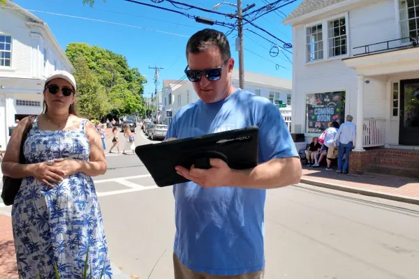
A first-hand look at the Edgartown Historic Walking Tour and "Amity" Jaws Tour with Mike Currid of the Edgartown Tour Company — what to expect, what you'll learn, and how to book.
Saturday-to-Saturday Martha's Vineyard itinerary: rental logistics, day-by-day plan from Edgartown and Chappy to Aquinnah and Menemsha sunset, farmers markets, food experiences, and sunset sail. Everything verified for 2026.
Complete 2-day car-free Martha's Vineyard weekend itinerary: Friday ferry timing, where to stay, walk-in dining, Saturday beach + Aquinnah, Sunday departure. Three budget tiers. Verified for 2026.
Complete parking guide to Martha's Vineyard: free lots, time limits, beach stickers, ferry lots, park-and-ride strategy, EV charging, and how to avoid the 4,500+ tickets written every summer.
50 genuinely free things to do on Martha's Vineyard: beaches, hikes, concerts, lighthouses, lantern festivals, and more. Every location verified, every price double-checked for 2026.
Get exclusive Martha’s Vineyard travel tips, hidden gems, and local guides delivered to your inbox. Stay connected like a true island insider.
Subscribe Now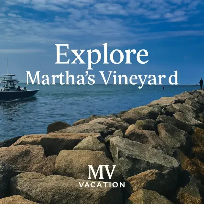
Please note: Content on MV Vacation is compiled from publicly available sources and personal experience. Prices, hours, access rules, and business details change frequently — we do our best to keep information current but cannot guarantee it is accurate or complete at any given time. This site provides general travel guidance only, not professional advice. Always verify details directly with the business, official website, or local authorities, and use your own judgment and due diligence before acting on any information. See our full disclaimer for details.